
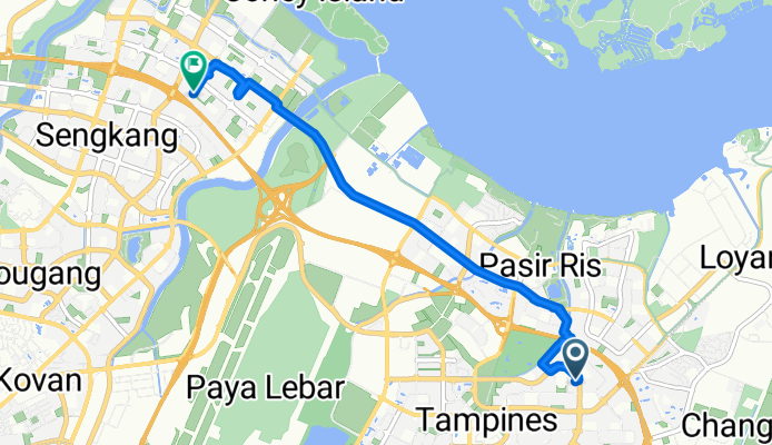
Tampines to Punggol
Eine Fahrradroute, die in Singapur, Central Singapore Community Development Council, Singapur beginnt.
Übersicht
Über diese Route
- 58 min
- Dauer
- 9,5 km
- Distanz
- 144 m
- Aufstieg
- 154 m
- Abstieg
- 9,9 km/h
- Ø-Tempo
- ---
- Max. Höhe

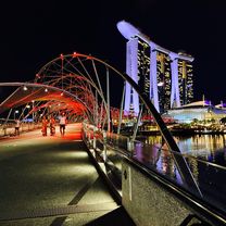
Fotos von der Route

Weiter mit Bikemap
Diese Radroute verwenden, bearbeiten oder herunterladen
Du möchtest Tampines to Punggol fahren oder sie für deine eigene Reise anpassen? Folgendes kannst du mit dieser Bikemap-Route machen:
Gratis Funktionen
- Speichere diese Route als Favorit oder in einer Sammlung
- Kopiere & plane deine eigene Version dieser Route
- Synchronisiere deine Route mit Garmin oder Wahoo
Premium-Funktionen
Kostenlose Testversion für 3 Tage oder einmalige Zahlung. Mehr über Bikemap Premium.
- Navigiere diese Route auf iOS & Android
- Exportiere eine GPX / KML-Datei dieser Route
- Erstelle deinen individuellen Ausdruck (Jetzt kostenlos ausprobieren)
- Lade diese Route für die Offline-Navigation herunter
Entdecke weitere Premium-Funktionen.
Bikemap Premium aktivierenVon unserer Community
Singapur: Andere beliebte Routen, die hier beginnen
 Junction 10 - Pang Sua - Bollywood - Lim Chu Kang - Old Chua Chu Kang
- Distanz
- 31,3 km
- Aufstieg
- 246 m
- Abstieg
- 246 m
- Standort
- Singapur, Central Singapore Community Development Council, Singapur
 Half of SG
- Distanz
- 89,8 km
- Aufstieg
- 169 m
- Abstieg
- 173 m
- Standort
- Singapur, Central Singapore Community Development Council, Singapur
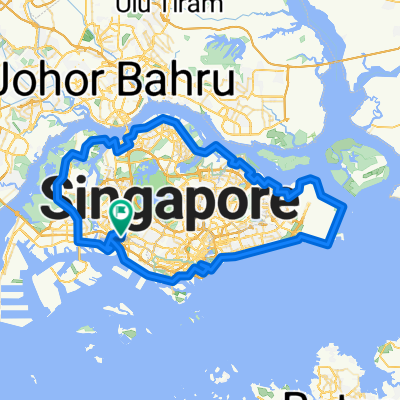 Singapore PCN Cycle Loop
- Distanz
- 143,4 km
- Aufstieg
- 556 m
- Abstieg
- 538 m
- Standort
- Singapur, Central Singapore Community Development Council, Singapur
 Round the Island
- Distanz
- 130,5 km
- Aufstieg
- 171 m
- Abstieg
- 174 m
- Standort
- Singapur, Central Singapore Community Development Council, Singapur
 Punggol Rd, Singapore to Helix Bridge, Singapore
- Distanz
- 17,8 km
- Aufstieg
- 245 m
- Abstieg
- 251 m
- Standort
- Singapur, Central Singapore Community Development Council, Singapur
 NINTENDO ISLAND TOUR - AMENDED 2
- Distanz
- 75,3 km
- Aufstieg
- 129 m
- Abstieg
- 135 m
- Standort
- Singapur, Central Singapore Community Development Council, Singapur
 Round Island (126km)
- Distanz
- 126 km
- Aufstieg
- 190 m
- Abstieg
- 190 m
- Standort
- Singapur, Central Singapore Community Development Council, Singapur
 MY FIRST CIRCLE
- Distanz
- 134,5 km
- Aufstieg
- 210 m
- Abstieg
- 215 m
- Standort
- Singapur, Central Singapore Community Development Council, Singapur
In der App öffnen