

Armidale Tourist Information Centre to Dangars Gorge return
Eine Fahrradroute, die in Armidale, New South Wales, Australien beginnt.
Übersicht
Über diese Route
Starting at Armidale's Tourist Information Centre, this part bitumen, part gravel ride will take you out to the beautiful Dangars Gorge.
The gravel road on Dangars Falls Road can be quite rutted and can be busy on weekends.
Places of Interest:
-
View from Knobs Road overlooking Armidale and Mount Duval.
-
Dangarsleigh War Memorial built in the 1920s by a local family who lost their son in WWI.
-Petersons Winery - it's worth checking if they're open and ducking in for a wine and meal or to check out the historic buildings and view of the winery.
- Dangars Gorge - Picnic tables and basic toilet facilities available. Both beginner and intermediate hiking/walking trails (maps are provided there). Camping is also allowed (best to check park's website beforehand).
- 2 h 7 min
- Dauer
- 47 km
- Distanz
- 355 m
- Aufstieg
- 353 m
- Abstieg
- 22,3 km/h
- Ø-Tempo
- ---
- Max. Höhe

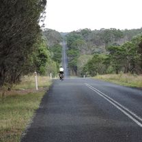
Fotos von der Route


Routenqualität
Wegtypen und Untergründe entlang der Route
Wegtypen
Ruhige Straße
27,9 km
(59 %)
Straße
14,9 km
(32 %)
Untergründe
Befestigt
25,1 km
(53 %)
Unbefestigt
22 km
(47 %)
Asphalt
23,5 km
(50 %)
Unbefestigt (undefiniert)
22 km
(47 %)
Weiter mit Bikemap
Diese Radroute verwenden, bearbeiten oder herunterladen
Du möchtest Armidale Tourist Information Centre to Dangars Gorge return fahren oder sie für deine eigene Reise anpassen? Folgendes kannst du mit dieser Bikemap-Route machen:
Gratis Funktionen
- Speichere diese Route als Favorit oder in einer Sammlung
- Kopiere & plane deine eigene Version dieser Route
- Synchronisiere deine Route mit Garmin oder Wahoo
Premium-Funktionen
Kostenlose Testversion für 3 Tage oder einmalige Zahlung. Mehr über Bikemap Premium.
- Navigiere diese Route auf iOS & Android
- Exportiere eine GPX / KML-Datei dieser Route
- Erstelle deinen individuellen Ausdruck (Jetzt kostenlos ausprobieren)
- Lade diese Route für die Offline-Navigation herunter
Entdecke weitere Premium-Funktionen.
Bikemap Premium aktivierenVon unserer Community
Armidale: Andere beliebte Routen, die hier beginnen
 Avoiding the Waterfall Way from Armidale
- Distanz
- 92,5 km
- Aufstieg
- 708 m
- Abstieg
- 708 m
- Standort
- Armidale, New South Wales, Australien
 Armidale to Point Lookout loop
- Distanz
- 226,3 km
- Aufstieg
- 4.225 m
- Abstieg
- 4.225 m
- Standort
- Armidale, New South Wales, Australien
 Armidale, Toms Gully, Puddledock loop
- Distanz
- 71,6 km
- Aufstieg
- 607 m
- Abstieg
- 607 m
- Standort
- Armidale, New South Wales, Australien
 Apple tree drive loop for kids
- Distanz
- 7,8 km
- Aufstieg
- 92 m
- Abstieg
- 93 m
- Standort
- Armidale, New South Wales, Australien
 Armidale to Gara river crossing along Herbert Park Rd
- Distanz
- 48,3 km
- Aufstieg
- 516 m
- Abstieg
- 515 m
- Standort
- Armidale, New South Wales, Australien
 Armidale Tourist Information Centre to Dangars Gorge return
- Distanz
- 47 km
- Aufstieg
- 355 m
- Abstieg
- 353 m
- Standort
- Armidale, New South Wales, Australien
 Armidale to Uralla via Hawthorne Dr
- Distanz
- 72,4 km
- Aufstieg
- 463 m
- Abstieg
- 464 m
- Standort
- Armidale, New South Wales, Australien
 New England Cycle Trail South
- Distanz
- 353,4 km
- Aufstieg
- 999 m
- Abstieg
- 1.577 m
- Standort
- Armidale, New South Wales, Australien
In der App öffnen