

Michael's Rosy Way from Morecambe to Bridlington
Eine Fahrradroute, die in Morecambe, England, Vereinigtes Königreich beginnt.
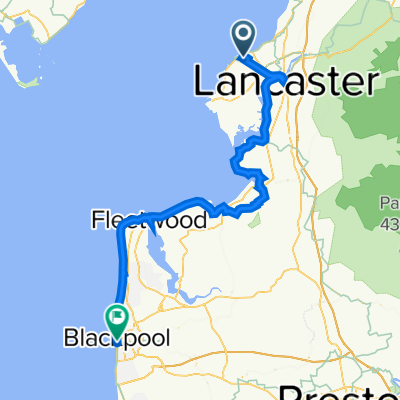
Übersicht
Über diese Route
This route is of my trip this summer based on my variation of the Sustrans Way of the Roses route. I wanted to stay overnight in Crayke, others will probably have other priorities. I will make corrections if I find any errors.
September 2011
<span style="font-family: Arial,sans-serif;"><font size="4">Morecambe to Bridlington in 3 days<br /></font></span>
<span style="font-family: Arial,sans-serif;"><font size="3">Morecambe</font></span>
<span style="font-family: Arial,sans-serif;"><font size="3">The start is on promenade near Midland Hotel and at rdbt cross Marine Rd then down Central Dr to <span style="font-weight: normal;">d</span><span style="font-weight: normal;">ismount </span><span style="font-weight: normal;">in</span> 250yds for R <span style="font-weight: normal;">at </span>crossings before rdbt.</font></span>
<span style="font-family: Arial,sans-serif;"><font size="3">Bear right at Frankie and Benny's to access cyclepath on right of rly line.</font></span>
<span style="font-family: Arial,sans-serif;"><font size="3"><span style="font-weight: normal;">In 0.4m</span> L across rly line and cont over Winsfell View and Out Moss Ln</font></span>
<span style="font-family: Arial,sans-serif;"><font size="3">In 2.6m cross Millennium Bridge over River Lune and fork L <span style="font-weight: normal;">to </span><span style="font-weight: normal;">cont on</span><span style="font-weight: normal;"> </span><span style="font-weight: normal;">cyclepath.</span></font></span>
<span style="font-family: Arial,sans-serif;"><font size="3"><span style="font-weight: normal;">Cont </span><span style="font-weight: normal;">for </span><span style="font-weight: normal;">5</span><span style="font-weight: normal;">m </span><span style="font-weight: normal;">(</span><span style="font-weight: normal;">passing </span><span style="font-weight: normal;">under M6, </span><span style="font-weight: normal;">over</span><span style="font-weight: normal;"> loop of River Lune and thru Caton) </span><span style="font-weight: normal;">to</span></font></span>
<span style="font-family: Arial,sans-serif;"><font size="3">R <span style="font-weight: normal;"> </span><span style="font-weight: normal;">leaving cyclepath to </span><span style="font-weight: normal;">cross A683 </span><span style="font-weight: normal;">and up</span><span style="font-weight: normal;"> Holme Ln to</span></font></span>
<span style="font-family: Arial,sans-serif;"><font size="4">Brookhouse</font></span>
<span style="font-family: Arial,sans-serif;"><font size="3">In 0.28m L across small bridge to L on Brookhouse Rd for 1.4m then R on A683 for 1.6m.</font></span>
<span style="font-family: Arial,sans-serif;"><font size="3">Turn R on B6480 for 1.6m to</font></span>
<span style="font-family: Arial,sans-serif;"><font size="4">Wray</font></span>
<span style="font-family: Arial,sans-serif;"><font size="3">In centre R onto Main Street (sp Lowgill/High Tathham) for 2.5m to</font></span>
<span style="font-family: Arial,sans-serif;"><font size="3">R (sp Lowgill/High Tathham) then in 200yds L (sp Settle 12m)</font></span>
<span style="font-family: Arial,sans-serif;"><font size="3">In 2m SO across High Bentham-Slaidburn road</font></span>
<span style="font-family: Arial,sans-serif;"><font size="3">In 3.8m SO passing Keasden Church and across Clapham-Slaidburn road</font></span>
<span style="font-family: Arial,sans-serif;"><font size="3">In1.3m SO under Settle-Carlisle rly then bear right</font></span>
<span style="font-family: Arial,sans-serif;"><font size="3">SO for 1.5m passing Eldroth to re-cross rly bridge</font></span>
<span style="font-family: Arial,sans-serif;"><font size="3">SO for 1.5m to cross over rly bridge near Armidstead Hall</font></span>
<span style="font-family: Arial,sans-serif;"><font size="3">In 460yds at x-rds R (sp Settle) then SO for 1.6m to pass under rly by </font></span>
<span style="font-family: Arial,sans-serif;"><font size="4">Giggleswick Station</font></span>
<span style="font-family: Arial,sans-serif;"><font size="3">R on A65 for 0.3m then next R to pass under rly for 1.7m to</font></span>
<span style="font-family: Arial,sans-serif;"><font size="4">Rathmell</font></span>
<span style="font-family: Arial,sans-serif;"><font size="3">SO<span style="font-weight: normal;"> for 2m to </span>Wigglesworth <span style="font-weight: normal;">where </span><span style="font-weight: normal;">sharp </span>L <span style="font-weight: normal;">on B6478 (SP Long Preston) </span></font></span>
<span style="font-family: Arial,sans-serif;"><font size="3"><span style="font-weight: normal;">In abt 1m cross River Ribble then </span><span style="font-weight: normal;">next </span>R <span style="font-weight: normal;">(sp Hellifield </span><span style="font-weight: normal;">but </span><span style="font-weight: normal;">sign </span><span style="font-weight: normal;">might be </span><span style="font-weight: normal;">rotated)</span></font></span>
<span style="font-family: Arial,sans-serif;"><font size="3"><span style="font-weight: normal;">In 0.8m</span><span style="font-weight: normal;"> </span>R<span style="font-weight: normal;"> on A682 </span><span style="font-weight: normal;">for 0.3m t</span><span style="font-weight: normal;">hen</span><span style="font-weight: normal;"> </span><span style="font-weight: normal;">just after caravan park turn </span>L <span style="font-weight: normal;">onto gated rd</span></font></span>
<span style="font-family: Arial,sans-serif;"><font size="3"><span style="font-weight: normal;">In about 0.3m </span>R <span style="font-weight: normal;">on A65 </span><span style="font-weight: normal;">into</span></font></span>
<span style="font-family: Arial,sans-serif;"><font size="4">Hellifield</font></span>
<span style="font-family: Arial,sans-serif;"><font size="3">SO then soon after 30mph sign L (sp Malham/Airton) then 1.8m to</font></span>
<span style="font-family: Arial,sans-serif;"><font size="4">Otterburn</font></span>
<span style="font-family: Arial,sans-serif;"><font size="3">SO<span style="font-weight: normal;"> for 1.6m to </span>Airton <span style="font-weight: normal;">then</span><span style="font-weight: normal;"> </span>SO <span style="font-weight: normal;">(sp Calton/Winterburn/Hetton) </span><span style="font-weight: normal;">for 2.3m to </span>L<span style="font-weight: normal;"> at TJ into </span><font size="4">Winterburn</font></font></span>
<span style="font-family: Arial,sans-serif;"><font size="3">Cont for 2m to</font></span>
<span style="font-family: Arial,sans-serif;"><font size="3"><font size="4">Hetton</font><font size="4"> </font></font></span>
<span style="font-family: Arial,sans-serif;"><font size="3">L to join rd from Flasby then SO thru <font size="4">Cracoe </font><font size="4">to</font><font size="4"> </font>L onto B6265</font></span>
<span style="font-family: Arial,sans-serif;"><font size="3"><span style="font-weight: normal;">In 0.5m as road bends left </span>R <span style="font-weight: normal;">(eff SO) to climb and 2.5m </span><span style="font-weight: normal;">bear right </span>R <span style="font-weight: normal;">to</span></font></span>
<span style="font-family: Arial,sans-serif;"><font size="4">Thorpe</font></span>
<span style="font-family: Arial,sans-serif;"><font size="3">bear left thru village then in 0.45m R onto B6160 to</font></span>
<span style="font-family: Arial,sans-serif;"><font size="4">Burnsell</font></span>
<span style="font-family: Arial,sans-serif;"><font size="3">R to cross bridge over River Wharfe to</font></span>
<span style="font-family: Arial,sans-serif;"><font size="4">Appletreewick </font></span>
<span style="font-family: Arial,sans-serif;"><font size="3">In 0.3m after village R (sp Bardon/Bolton Abbey/Skipton)</font></span>
<span style="font-family: Arial,sans-serif;"><font size="3">After 1.6m at Bardon L (sp Hazelwood/Storiths)</font></span>
<span style="font-family: Arial,sans-serif;"><font size="3">In 2.25m R across wooden bridge over River Wharfe by Cavendish Pavilion</font></span>
<span style="font-family: Arial,sans-serif;"><font size="3">Thru car park to L on B6160 for 1m passing Bolton Abbey to</font></span>
<span style="font-family: Arial,sans-serif;"><font size="4">Bolton Abbey</font></span>
<span style="font-family: Arial,sans-serif;"><font size="4"><font size="3"><span style="font-weight: normal;">Soon after </span></font><font size="3"><span style="font-weight: normal;">Devonshire Arms </span></font><font size="3"><span style="font-weight: normal;">turn </span></font><font size="3">L</font><font size="3"><span style="font-weight: normal;"> at rdbt onto busy A59 for 650yds to </span></font><font size="3">R</font><font size="3"><span style="font-weight: normal;"> to</span></font></font></span>
<span style="font-family: Arial,sans-serif;"><font size="4">Beamsley</font></span>
<span style="font-family: Arial,sans-serif;"><font size="3">Cont for 4m thru Nesfield and past Ilkley Golf Course to R at TJ and into </font></span>
<span style="font-family: Arial,sans-serif;"><font size="4">Ilkley</font></span>
<span style="font-family: Arial,sans-serif;"><font size="3">SO <span style="font-weight: normal;">(L&R) at x-rds </span><span style="font-weight: normal;">for 3.4m </span><span style="font-weight: normal;">past sports grounds </span><span style="font-weight: normal;">and </span><span style="font-weight: normal;">by River Wharfe </span><span style="font-weight: normal;">initially then climb to</span></font></span>
<span style="font-family: Arial,sans-serif;"><font size="4">Askwith</font></span>
<span style="font-family: Arial,sans-serif;"><font size="3">L (sp Askwith Village Hall) up hill for 1.4m to L at x-rds for 2m to R (sp Timble) then SO in 360yds thru</font></span>
<span style="font-family: Arial,sans-serif;"><font size="4">Timble</font></span>
<span style="font-family: Arial,sans-serif;"><font size="3">Cont down hill to R at TJ and across top of Fewston Dam to next L </font></span>
<span style="font-family: Arial,sans-serif;"><font size="3">SO up hill sp Pately Bridge (not sharp left sp Skipton) to SO at x-rds (sp Harrogate)</font></span>
<span style="font-family: Arial,sans-serif;"><font size="3">In 0.5m sharp L on B6451 then R in 355yds on Penny Pot Ln (sp Harrogate)</font></span>
<span style="font-family: Arial,sans-serif;"><font size="3">L in 0.8m then after 0.6m L then R across busy A59 sp Kettlesing/Birstwith to</font></span>
<span style="font-family: Arial,sans-serif;"><font size="4">Kettlesing</font></span>
<span style="font-family: Arial,sans-serif;"><font size="3"><span style="font-weight: normal;">Bear </span><span style="font-weight: normal;">left</span><span style="font-weight: normal;"> </span><span style="font-weight: normal;">to </span>L <span style="font-weight: normal;">at TJ </span><span style="font-weight: normal;">(</span><span style="font-weight: normal;">by War Memorial</span><span style="font-weight: normal;">)</span><span style="font-weight: normal;"> </span><span style="font-weight: normal;">sp Birstwith.</span></font></span>
<span style="font-family: Arial,sans-serif;"><font size="3"><span style="font-weight: normal;">Bear left</span><span style="font-weight: normal;"> </span><span style="font-weight: normal;">in</span><span style="font-weight: normal;"> 1m </span><span style="font-weight: normal;">then after short climb</span><span style="font-weight: normal;"> </span>R<span style="font-weight: normal;"> at TJ then imm </span>R<span style="font-weight: normal;"> </span><span style="font-weight: normal;">to</span></font></span>
<span style="font-family: Arial,sans-serif;"><font size="4">Hampsthwaite</font></span>
<span style="font-family: Arial,sans-serif;"><font size="3">L<span style="font-weight: normal;"> </span><span style="font-weight: normal;">in village </span><span style="font-weight: normal;">to</span><span style="font-weight: normal;"> </span><span style="font-weight: normal;">bridge </span><span style="font-weight: normal;">over</span><span style="font-weight: normal;"> River Nidd </span><span style="font-weight: normal;">and up the hill</span></font></span>
<span style="font-family: Arial,sans-serif;"><font size="3"><span style="font-weight: normal;">After </span><span style="font-weight: normal;">0.</span><span style="font-weight: normal;">6</span><span style="font-weight: normal;">m </span><span style="font-weight: normal;">sharp </span>R <span style="font-weight: normal;">on</span><span style="font-weight: normal;">to </span><span style="font-weight: normal;">narrow </span><span style="font-weight: normal;">lane </span><span style="font-weight: normal;">(</span><span style="font-weight: normal;">turn</span><span style="font-weight: normal;"> </span><span style="font-weight: normal;">is just </span><span style="font-weight: normal;">after triple garage of large white house</span><span style="font-weight: normal;">)</span></font></span>
<span style="font-family: Arial,sans-serif;"><font size="3"><span style="font-weight: normal;">I</span><span style="font-weight: normal;">n</span><span style="font-weight: normal;"> 0.5m </span><span style="font-weight: normal;">thru gate </span><span style="font-weight: normal;">on</span><span style="font-weight: normal;"> path </span><span style="font-weight: normal;">through wood past Ripley Castle </span><span style="font-weight: normal;">( </span><span style="font-weight: normal;">a bit </span><span style="font-weight: normal;">less </span><span style="font-weight: normal;">stony</span><span style="font-weight: normal;"> after 100yds)</span><span style="font-weight: normal;"> </span></font></span>
<span style="font-family: Arial,sans-serif;"><font size="4">Ripley</font></span>
<span style="font-family: Arial,sans-serif;"><font size="3">L <span style="font-weight: normal;">by Boar's Head Hotel</span> <span style="font-weight: normal;">to </span>L<span style="font-weight: normal;"> at rdbt on B6165 (sp Pately Bridge)</span></font></span>
<span style="font-family: Arial,sans-serif;"><font size="3">R<span style="font-weight: normal;"> in 0.6m (sp Fountains Abbey and Bishop Thornton) up hill.</span></font></span>
<span style="font-family: Arial,sans-serif;"><font size="3"><span style="font-weight: normal;">After 1.7m turn </span>R<span style="font-weight: normal;"> by derelict inn. Cont for 2.7m </span><span style="font-weight: normal;">and</span><span style="font-weight: normal;"> thru </span>Markington<span style="font-weight: normal;"> </span><span style="font-weight: normal;">to </span>L <span style="font-weight: normal;">at </span><span style="font-weight: normal;">TJ </span><span style="font-weight: normal;">on</span><span style="font-weight: normal;"> A65 </span><span style="font-weight: normal;">at</span></font></span>
<span style="font-family: Arial,sans-serif;"><font size="4">Wormald Green</font></span>
<span style="font-family: Arial,sans-serif;"><font size="3"><span style="font-weight: normal;">I</span><span style="font-weight: normal;">n 400yds </span><span style="font-weight: normal;">at top of hill </span>R <span style="font-weight: normal;">(sp Burton Leonard) </span><span style="font-weight: normal;">for 1.5m to </span></font></span>
<span style="font-family: Arial,sans-serif;"><font size="4">Burton Leonard</font></span>
<span style="font-family: Arial,sans-serif;"><font size="3">Fork R in village and past Royal Oak pub. In 1.4m bear right in Copgrove then in 1m L to</font></span>
<span style="font-family: Arial,sans-serif;"><font size="4">Staveley</font></span>
<span style="font-family: Arial,sans-serif;"><font size="3">Bear right (sp Arkendale) then 1m to SO across A6055 to</font></span>
<span style="font-family: Arial,sans-serif;"><font size="4">Arkendale</font></span>
<span style="font-family: Arial,sans-serif;"><font size="3">L<span style="font-weight: normal;"> at TJ then 1m to bridge over A1(M) to </span>L<span style="font-weight: normal;"> on A168 then next </span>R <span style="font-weight: normal;">(sp Marton cum Grafton)</span></font></span>
<span style="font-family: Arial,sans-serif;"><font size="3"><span style="font-weight: normal;">In 1.8m </span>R<span style="font-weight: normal;"> at TJ on B6265 then next </span>L <span style="font-weight: normal;">(sp Upper Dunsforth/ Greater Ouseburn) to</span></font></span>
<span style="font-family: Arial,sans-serif;"><font size="4">Greater Ouseburn</font></span>
<span style="font-family: Arial,sans-serif;"><font size="3">SO thru village then L (sp Aldwark via toll bridge). In 1m cross River Ouse then 1.8m to </font></span>
<span style="font-family: Arial,sans-serif;"><font size="4">Youlton</font></span>
<span style="font-family: Arial,sans-serif;"><font size="3">Bear left then in 1m SO at x-rds (sp Alne/ Easingwold) for 0.38m to</font></span>
<span style="font-family: Arial,sans-serif;"><font size="4">Alne</font></span>
<span style="font-family: Arial,sans-serif;"><font size="3">Bear right then SO for 3.7m then R into </font></span>
<span style="font-family: Arial,sans-serif;"><font size="4">Easingwold</font></span>
<span style="font-family: Arial,sans-serif;"><font size="3">SO at mini-rdb (sp Brandsby/Crayke). After 0.38m L then 2m to</font></span>
<span style="font-family: Arial,sans-serif;"><font size="4">Crayke</font></span>
<span style="font-family: Arial,sans-serif;"><font size="3">At TJ either bear left to Durham Ox PH</font></span>
<span style="font-family: Arial,sans-serif;"><font size="3"><span style="font-weight: normal;">or b</span><span style="font-weight: normal;">ear </span><span style="font-weight: normal;">right at TJ</span><span style="font-weight: normal;"> (sp Stillington/Huby) </span><span style="font-weight: normal;">then </span><span style="font-weight: normal;">1.2m </span><span style="font-weight: normal;">to </span>L<span style="font-weight: normal;"> at TJ </span><span style="font-weight: normal;">then </span><span style="font-weight: normal;">1.4m </span><span style="font-weight: normal;">in</span><span style="font-weight: normal;">to</span></font></span>
<span style="font-family: Arial,sans-serif;"><font size="4">Stillington</font></span>
<span style="font-family: Arial,sans-serif;"><font size="3">R on B1363 for 1m then L (sp Sheriff Hutton/Strensall) for 3.2m to L at TJ</font></span>
<span style="font-family: Arial,sans-serif;"><font size="3">In 0.87m R then 0.3m to </font></span>
<span style="font-family: Arial,sans-serif;"><font size="4">West Lilling</font></span>
<span style="font-family: Arial,sans-serif;"><font size="3">R at TJ then SO for 2.8m, thru rly crossing then thru</font></span>
<span style="font-family: Arial,sans-serif;"><font size="4">Flaxton</font></span>
<span style="font-family: Arial,sans-serif;"><font size="3">SO for abt 1m to L at TJ with busy A64. (dismount and use footpath opposite)</font></span>
<span style="font-family: Arial,sans-serif;"><font size="3">Walk to next R in 450yds sp Claxton/Stamford Bridge) then SO for 1.63m thru Claxton to</font></span>
<span style="font-family: Arial,sans-serif;"><font size="4">Sand Sutton</font></span>
<span style="font-family: Arial,sans-serif;"><font size="3"><font size="4">Enter village and just after 30mph sign</font> L sp Stamford Bridge</font></span>
<span style="font-family: Arial,sans-serif;"><font size="3">SO for1.6m to R at TJ then in 430yds next L to</font></span>
<span style="font-family: Arial,sans-serif;"><font size="4">Stamford Bridge</font></span>
<span style="font-family: Arial,sans-serif;"><font size="3">L across River Derwent use footbridge rather than the road</font></span>
<span style="font-family: Arial,sans-serif;"><font size="3">Bear left then R just after Stamford Free House (sp Fangfosse/High Catton/Low Catton)</font></span>
<span style="font-family: Arial,sans-serif;"><font size="3"><span style="font-weight: normal;">After 120yds </span>L <span style="font-weight: normal;">by church (sp Full Sutton/Fangfoss)</span></font></span>
<span style="font-family: Arial,sans-serif;"><font size="3">SO for 2.7m to L at TJ (sp Fangfoss) then next R by caravan site. In 1.67m L (sp Yapham)</font></span>
<span style="font-family: Arial,sans-serif;"><font size="3">In 1.24m R then, next L (sp Yapham/Bishop Wilton) to by-pass Pocklington and leave WofR signed route. After 0.54m L at TJ then SO thru</font></span>
<span style="font-family: Arial,sans-serif;"><font size="4">Yapham</font></span>
<span style="font-family: Arial,sans-serif;"><font size="3">Cont for 0.75m to </font></span>
<span style="font-family: Arial,sans-serif;"><font size="4">Meltonby</font></span>
<span style="font-family: Arial,sans-serif;"><font size="3">R<span style="font-weight: normal;"> (sp Pocklington) then after 0.78m</span> L <span style="font-weight: normal;">(no sp) </span><span style="font-weight: normal;">for 0.64m </span><span style="font-weight: normal;">to</span><span style="font-weight: normal;"> </span>L<span style="font-weight: normal;"> </span><span style="font-weight: normal;">(eff </span>SO<span style="font-weight: normal;">) re-joining WofR route</span></font></span>
<span style="font-family: Arial,sans-serif;"><font size="3"><span style="font-weight: normal;">In 0.4m </span>R<span style="font-weight: normal;"> sp </span>Millington Wood <span style="font-weight: normal;">then </span>SO<span style="font-weight: normal;"> </span><span style="font-weight: normal;">up Swineridge Hill</span></font></span>
<span style="font-family: Arial,sans-serif;"><font size="3"><span style="font-weight: normal;">Follow narrow road for</span><span style="font-weight: normal;"> </span><span style="font-weight: normal;">4.</span><span style="font-weight: normal;">3</span><span style="font-weight: normal;">m </span><span style="font-weight: normal;">thru </span><font size="4">Millingto</font><font size="4">n </font><font size="4">Dale</font><font size="4"><span style="font-weight: normal;">, </span></font><font size="4"><span style="font-weight: normal;">climb</span></font><span style="font-weight: normal;"> </span><span style="font-weight: normal;">to </span>L <span style="font-weight: normal;">(sp Huggate) for 1m t</span><span style="font-weight: normal;">hru</span></font></span>
<span style="font-family: Arial,sans-serif;"><font size="4">Huggate</font></span>
<span style="font-family: Arial,sans-serif;"><font size="3"><span style="font-weight: normal;">Cont for 0.75m </span><span style="font-weight: normal;">to </span><span style="font-weight: normal;">bear left then in 450yds</span> <span style="font-weight: normal;">fork</span> R <span style="font-weight: normal;">(sp Tib</span><span style="font-weight: normal;">thorpe</span><span style="font-weight: normal;">/Dr</span><span style="font-weight: normal;">i</span><span style="font-weight: normal;">ffield) </span><span style="font-weight: normal;">then</span><span style="font-weight: normal;"> 4m to</span></font></span>
<span style="font-family: Arial,sans-serif;"><font size="4">Tibthorpe</font></span>
<span style="font-family: Arial,sans-serif;"><font size="3">SO across B1248. Then 1.1m to Kirkburn stay SO (leaving WofR) to bear left to cross A614. At TJ R and next L (to leave WofR) thru Southburn then in 2m SO across A164 to</font></span>
<span style="font-family: Arial,sans-serif;"><font size="4">Hutton</font></span>
<span style="font-family: Arial,sans-serif;"><font size="3">L at TJ for 0.8m going thru rly crossing to L at x-rds (sp Skerne) to rejoin WofR for 1.6m to</font></span>
<span style="font-family: Arial,sans-serif;"><font size="4">Skerne</font></span>
<span style="font-family: Arial,sans-serif;"><font size="3">R <span style="font-weight: normal;">sp Wansford </span><span style="font-weight: normal;">(to leave WofR and by-pass Driffeld). </span><span style="font-weight: normal;">In </span><span style="font-weight: normal;">1.4m to </span>L <span style="font-weight: normal;">on B1249 to</span></font></span>
<span style="font-family: Arial,sans-serif;"><font size="4">Wansford</font></span>
<span style="font-family: Arial,sans-serif;"><font size="3">R<span style="font-weight: normal;"> at mini-rdb (sp Nafferton) then </span>R<span style="font-weight: normal;"> after 0.3m (sp Millingdale/Outgates/Cattleholmes)</span></font></span>
<span style="font-family: Arial,sans-serif;"><font size="3"><span style="font-weight: normal;">In 0.7m </span>L<span style="font-weight: normal;"> at TJ </span><span style="font-weight: normal;">then </span>R<span style="font-weight: normal;"> in 0.6m (sp Carr House/ </span><span style="font-weight: normal;">Cattleholmes/ Millingdale</span><span style="font-weight: normal;">) </span><span style="font-weight: normal;">to </span><span style="font-weight: normal;">rejoin Wo</span><span style="font-weight: normal;">fR</span></font></span>
<span style="font-family: Arial,sans-serif;"><font size="3"><span style="font-weight: normal;">In 0.6m</span> fork left <span style="font-weight: normal;">(sp Millingdale/Outgates) </span><span style="font-weight: normal;">for </span><span style="font-weight: normal;">1.</span><span style="font-weight: normal;">4</span><span style="font-weight: normal;">m </span><span style="font-weight: normal;">thru </span><span style="font-weight: normal;"> Outgate Farm </span><span style="font-weight: normal;">and</span><span style="font-weight: normal;"> gated rly crossing to </span>R<span style="font-weight: normal;"> in 0.26m. In 250yds </span>R<span style="font-weight: normal;"> at TJ t</span><span style="font-weight: normal;">hen over </span><span style="font-weight: normal;">Kelk Beck t</span><span style="font-weight: normal;">o</span><span style="font-weight: normal;"> next </span>L <span style="font-weight: normal;">at bend</span> <span style="font-weight: normal;">for 1m to</span></font></span>
<span style="font-family: Arial,sans-serif;"><font size="4">Harpham</font></span>
<span style="font-family: Arial,sans-serif;"><font size="3">R<span style="font-weight: normal;"> at TJ </span><span style="font-weight: normal;">(ignore sign indicating left to Bridlington). Cont </span><span style="font-weight: normal;">for 0.9m </span><span style="font-weight: normal;">thru</span><span style="font-weight: normal;"> gated rly crossing then in 0.4m </span>L <span style="font-weight: normal;">at TJ then thru rly crossing to</span></font></span>
<span style="font-family: Arial,sans-serif;"><font size="4">Burton Agnes</font></span>
<span style="font-family: Arial,sans-serif;"><font size="3">L<span style="font-weight: normal;"> </span><span style="font-weight: normal;">onto shared path by </span><span style="font-weight: normal;">A614 </span><span style="font-weight: normal;">for 160yds then</span><span style="font-weight: normal;"> </span>R <span style="font-weight: normal;">(sp Rudston)</span></font></span>
<span style="font-family: Arial,sans-serif;"><font size="3"><span style="font-weight: normal;">A</span><span style="font-weight: normal;">fter 0.5m </span>fork L <span style="font-weight: normal;">then </span><span style="font-weight: normal;">in </span><span style="font-weight: normal;">1.1m </span>R<span style="font-weight: normal;"> at TJ. </span><span style="font-weight: normal;">Cont </span>SO<span style="font-weight: normal;"> </span><span style="font-weight: normal;">for </span><span style="font-weight: normal;">4.8m </span><span style="font-weight: normal;">along ridge then descend into</span></font></span>
<span style="font-family: Arial,sans-serif;"><font size="4">Bridlington</font></span>
<span style="font-family: Arial,sans-serif;"><font size="3">L <span style="font-weight: normal;">at TJ with </span><span style="font-weight: normal;">A165 </span><span style="font-weight: normal;">(cross and </span><span style="font-weight: normal;">cycle on</span><span style="font-weight: normal;"> shared path opposite)</span></font></span>
<span style="font-family: Arial,sans-serif;"><font size="3"><span style="font-weight: normal;">In abt </span><span style="font-weight: normal;">0.4m </span>R<span style="font-weight: normal;"> on </span><span style="font-weight: normal;">path thru trees </span><span style="font-weight: normal;">then </span>SO<span style="font-weight: normal;"> down</span><span style="font-weight: normal;"> Easton Rd </span></font></span>
<span style="font-family: Arial,sans-serif;"><font size="3"><span style="font-weight: normal;">Cont </span>SO <span style="font-weight: normal;">to Westgate then High Street to </span>R<span style="font-weight: normal;"> at </span><span style="font-weight: normal;">traffic </span><span style="font-weight: normal;">lights on A1038</span></font></span>
<span style="font-family: Arial,sans-serif;"><font size="3"><span style="font-weight: normal;">In 70yds dismount </span><span style="font-weight: normal;">by bus stop and go through gap in brick wall onto </span><span style="font-weight: normal;">Baptist Pl </span></font></span>
<span style="font-family: Arial,sans-serif;"><font size="3">R <span style="font-weight: normal;">at TJ </span><span style="font-weight: normal;">onto</span><span style="font-weight: normal;"> Apple Garth Ln </span><span style="font-weight: normal;">to </span>R<span style="font-weight: normal;"> at TJ onto St Mary's Walk</span></font></span>
<span style="font-family: Arial,sans-serif;"><font size="3"><span style="font-weight: normal;">In </span><span style="font-weight: normal;">300yds </span>L <span style="font-weight: normal;">on</span><span style="font-weight: normal;"> Queensgate, </span>SO<span style="font-weight: normal;"> at</span><span style="font-weight: normal;"> rdbt to </span>R<span style="font-weight: normal;"> at lights (sp North Beech/Town Centre)</span></font></span>
<span style="font-family: Arial,sans-serif;"><font size="3">L <span style="font-weight: normal;">after rly bridge onto First Av </span><span style="font-weight: normal;">and </span>SO<span style="font-weight: normal;"> t</span><span style="font-weight: normal;">o seafront.</span></font></span>
<span style="font-family: Arial,sans-serif;"><font size="3"><span style="font-weight: normal;">The </span><span style="font-weight: normal;">start/</span><span style="font-weight: normal;">finish </span><span style="font-weight: normal;">is abt </span><span style="font-weight: normal;">200yds on the right.</span></font></span>
- -:--
- Dauer
- 268,6 km
- Distanz
- 912 m
- Aufstieg
- 908 m
- Abstieg
- ---
- Ø-Tempo
- ---
- Max. Höhe
Weiter mit Bikemap
Diese Radroute verwenden, bearbeiten oder herunterladen
Du möchtest Michael's Rosy Way from Morecambe to Bridlington fahren oder sie für deine eigene Reise anpassen? Folgendes kannst du mit dieser Bikemap-Route machen:
Gratis Funktionen
- Speichere diese Route als Favorit oder in einer Sammlung
- Kopiere & plane deine eigene Version dieser Route
- Teile sie in Etappen ein, um eine mehrtägige Tour zu erstellen
- Synchronisiere deine Route mit Garmin oder Wahoo
Premium-Funktionen
Kostenlose Testversion für 3 Tage oder einmalige Zahlung. Mehr über Bikemap Premium.
- Navigiere diese Route auf iOS & Android
- Exportiere eine GPX / KML-Datei dieser Route
- Erstelle deinen individuellen Ausdruck (Jetzt kostenlos ausprobieren)
- Lade diese Route für die Offline-Navigation herunter
Entdecke weitere Premium-Funktionen.
Bikemap Premium aktivierenVon unserer Community
Morecambe: Andere beliebte Routen, die hier beginnen
 New Route Trail
- Distanz
- 30,8 km
- Aufstieg
- 110 m
- Abstieg
- 110 m
- Standort
- Morecambe, England, Vereinigtes Königreich
 Way of Roses
- Distanz
- 314,5 km
- Aufstieg
- 2.464 m
- Abstieg
- 2.459 m
- Standort
- Morecambe, England, Vereinigtes Königreich
 Condor Green -Crosgill - Lune Valley - Morecambe Prom
- Distanz
- 53,4 km
- Aufstieg
- 266 m
- Abstieg
- 267 m
- Standort
- Morecambe, England, Vereinigtes Königreich
 Michael's Rosy Way from Morecambe to Bridlington
- Distanz
- 268,6 km
- Aufstieg
- 912 m
- Abstieg
- 908 m
- Standort
- Morecambe, England, Vereinigtes Königreich
 Bare, Glasson, Gressingham Kellet Circular v2
- Distanz
- 66,3 km
- Aufstieg
- 439 m
- Abstieg
- 440 m
- Standort
- Morecambe, England, Vereinigtes Königreich
 Halton Promenade Circular
- Distanz
- 19,7 km
- Aufstieg
- 101 m
- Abstieg
- 101 m
- Standort
- Morecambe, England, Vereinigtes Königreich
 Morecambe to Knott End
- Distanz
- 53,4 km
- Aufstieg
- 115 m
- Abstieg
- 113 m
- Standort
- Morecambe, England, Vereinigtes Königreich
 Silverdale Circuit V3
- Distanz
- 52,2 km
- Aufstieg
- 312 m
- Abstieg
- 313 m
- Standort
- Morecambe, England, Vereinigtes Königreich
In der App öffnen