

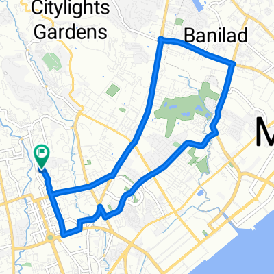
Visitacion Street 2, Cebu City to Antonio Y De Pio National Highway, Tuburan
Eine Fahrradroute, die in Cebu City, Central Visayas, Philippinen beginnt.
Übersicht
Über diese Route
- 5 h 27 min
- Dauer
- 82,5 km
- Distanz
- 2.111 m
- Aufstieg
- 2.131 m
- Abstieg
- 15,1 km/h
- Ø-Tempo
- ---
- Max. Höhe

Routenqualität
Wegtypen und Untergründe entlang der Route
Wegtypen
Ruhige Straße
33 km
(40 %)
Straße
7,4 km
(9 %)
Untergründe
Befestigt
14 km
(17 %)
Unbefestigt
16,5 km
(20 %)
Unbefestigt (undefiniert)
13,2 km
(16 %)
Asphalt
9,1 km
(11 %)
Weiter mit Bikemap
Diese Radroute verwenden, bearbeiten oder herunterladen
Du möchtest Visitacion Street 2, Cebu City to Antonio Y De Pio National Highway, Tuburan fahren oder sie für deine eigene Reise anpassen? Folgendes kannst du mit dieser Bikemap-Route machen:
Gratis Funktionen
- Speichere diese Route als Favorit oder in einer Sammlung
- Kopiere & plane deine eigene Version dieser Route
- Teile sie in Etappen ein, um eine mehrtägige Tour zu erstellen
- Synchronisiere deine Route mit Garmin oder Wahoo
Premium-Funktionen
Kostenlose Testversion für 3 Tage oder einmalige Zahlung. Mehr über Bikemap Premium.
- Navigiere diese Route auf iOS & Android
- Exportiere eine GPX / KML-Datei dieser Route
- Erstelle deinen individuellen Ausdruck (Jetzt kostenlos ausprobieren)
- Lade diese Route für die Offline-Navigation herunter
Entdecke weitere Premium-Funktionen.
Bikemap Premium aktivierenVon unserer Community
Cebu City: Andere beliebte Routen, die hier beginnen
 Route from Gorordo Avenue, Cebu City
- Distanz
- 39,7 km
- Aufstieg
- 927 m
- Abstieg
- 944 m
- Standort
- Cebu City, Central Visayas, Philippinen
 next week's challenge
- Distanz
- 46,1 km
- Aufstieg
- 328 m
- Abstieg
- 393 m
- Standort
- Cebu City, Central Visayas, Philippinen
 Sunday Route
- Distanz
- 13,2 km
- Aufstieg
- 98 m
- Abstieg
- 98 m
- Standort
- Cebu City, Central Visayas, Philippinen
 2nd 1891, Cebu City to Lungsod ng Cebu
- Distanz
- 6,3 km
- Aufstieg
- 285 m
- Abstieg
- 96 m
- Standort
- Cebu City, Central Visayas, Philippinen
 G. Garcia Street, Cebu to G. Garcia Street, Cebu
- Distanz
- 0,5 km
- Aufstieg
- 5 m
- Abstieg
- 6 m
- Standort
- Cebu City, Central Visayas, Philippinen
 Relaxed route in Lungsod ng Cebu
- Distanz
- 3,3 km
- Aufstieg
- 14 m
- Abstieg
- 23 m
- Standort
- Cebu City, Central Visayas, Philippinen
 Restful route
- Distanz
- 2,7 km
- Aufstieg
- 3 m
- Abstieg
- 48 m
- Standort
- Cebu City, Central Visayas, Philippinen
 Route from N. Escario, Cebu City
- Distanz
- 11,7 km
- Aufstieg
- 66 m
- Abstieg
- 62 m
- Standort
- Cebu City, Central Visayas, Philippinen
In der App öffnen