

Bormio - Passo del Mortirolo
Eine Fahrradroute, die in Bormio, Lombardei, Italien beginnt.
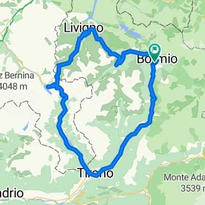
Übersicht
Über diese Route
The Mortirolo Pass is opened to traffic only in summertime, from May to September. It connects the two provinces Sondrio and Brescia and is a particular challenge to bikers, who prove their power on this steep Alpine pass.
In order to reach Mazzo di Valtellina (the starting point of this pass) follow the route SS38; south direction (follow the signs for Sondrio. Please pay attention just outside Bormio; the SS38 enters long & dark tunnels very dangerous for bikers. Keep the right side please and follow the signs for Cepina. This is the old SS38 and will gently conduct you to Mazzo di Tirano (near Tirano).
Since the old SS38 and Mortirolo are secondary roads, traffic is not too bad. Right passed Mazzo you find soon a very steep uphill stretch. After that, the road will lead constantly uphill through the woods, untill you reach a tiny village. Passed that, the road gets steeper again and you drive uphill again surrounded by trees. Only a few parts of the road are not in the wood, which you leave just before getting to the top. On the Mortirolo Pass you find a wonderful panorama of the surrounding valleys and mountains
- -:--
- Dauer
- 43,7 km
- Distanz
- 1.407 m
- Aufstieg
- 782 m
- Abstieg
- ---
- Ø-Tempo
- ---
- Max. Höhe

Routenqualität
Wegtypen und Untergründe entlang der Route
Wegtypen
Straße
12,7 km
(29 %)
Ruhige Straße
4,4 km
(10 %)
Untergründe
Befestigt
38,9 km
(89 %)
Unbefestigt
0,4 km
(1 %)
Asphalt
38,9 km
(89 %)
Schotter
0,4 km
(1 %)
Undefiniert
4,4 km
(10 %)
Weiter mit Bikemap
Diese Radroute verwenden, bearbeiten oder herunterladen
Du möchtest Bormio - Passo del Mortirolo fahren oder sie für deine eigene Reise anpassen? Folgendes kannst du mit dieser Bikemap-Route machen:
Gratis Funktionen
- Speichere diese Route als Favorit oder in einer Sammlung
- Kopiere & plane deine eigene Version dieser Route
- Synchronisiere deine Route mit Garmin oder Wahoo
Premium-Funktionen
Kostenlose Testversion für 3 Tage oder einmalige Zahlung. Mehr über Bikemap Premium.
- Navigiere diese Route auf iOS & Android
- Exportiere eine GPX / KML-Datei dieser Route
- Erstelle deinen individuellen Ausdruck (Jetzt kostenlos ausprobieren)
- Lade diese Route für die Offline-Navigation herunter
Entdecke weitere Premium-Funktionen.
Bikemap Premium aktivierenVon unserer Community
Bormio: Andere beliebte Routen, die hier beginnen
 AXS Tour de Alps 2009 - Stage 9°
- Distanz
- 130,2 km
- Aufstieg
- 3.139 m
- Abstieg
- 3.138 m
- Standort
- Bormio, Lombardei, Italien
 Bormio - Bormio
- Distanz
- 106,3 km
- Aufstieg
- 2.711 m
- Abstieg
- 2.713 m
- Standort
- Bormio, Lombardei, Italien
 p06 Passo dello Stelvio & Umbrailpass
- Distanz
- 38,1 km
- Aufstieg
- 1.584 m
- Abstieg
- 1.404 m
- Standort
- Bormio, Lombardei, Italien
 Stelvio sterrato
- Distanz
- 62,4 km
- Aufstieg
- 1.896 m
- Abstieg
- 1.892 m
- Standort
- Bormio, Lombardei, Italien
 p12 Passo dello Stelvio
- Distanz
- 46,7 km
- Aufstieg
- 1.547 m
- Abstieg
- 1.824 m
- Standort
- Bormio, Lombardei, Italien
 2 - BORMIO>Mazzo>P.so Mortirolo>Ponte di Legno>P.so Gavia>BORMIO
- Distanz
- 113 km
- Aufstieg
- 3.142 m
- Abstieg
- 3.142 m
- Standort
- Bormio, Lombardei, Italien
 4- BORMIO-Tirano-Poschiavo-Forcola di livigno- Livigno-BORMIO
- Distanz
- 122,2 km
- Aufstieg
- 2.301 m
- Abstieg
- 2.309 m
- Standort
- Bormio, Lombardei, Italien
 Bormio - Mortirolo - Gavia - Bormio
- Distanz
- 111,9 km
- Aufstieg
- 3.110 m
- Abstieg
- 3.110 m
- Standort
- Bormio, Lombardei, Italien
In der App öffnen