

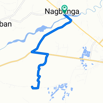
National Highway 3, Castillejos to National Road 97, Castillejos City
Eine Fahrradroute, die in Castillejos, Central Luzon, Philippinen beginnt.
Übersicht
Über diese Route
- 2 h 38 min
- Dauer
- 36,1 km
- Distanz
- 54 m
- Aufstieg
- 57 m
- Abstieg
- 13,7 km/h
- Ø-Tempo
- ---
- Max. Höhe

Routenqualität
Wegtypen und Untergründe entlang der Route
Wegtypen
Straße
1,8 km
(5 %)
Ruhige Straße
0,7 km
(2 %)
Undefiniert
33,6 km
(93 %)
Untergründe
Befestigt
16,3 km
(45 %)
Asphalt
15,5 km
(43 %)
Beton
0,7 km
(2 %)
Undefiniert
19,9 km
(55 %)
Weiter mit Bikemap
Diese Radroute verwenden, bearbeiten oder herunterladen
Du möchtest National Highway 3, Castillejos to National Road 97, Castillejos City fahren oder sie für deine eigene Reise anpassen? Folgendes kannst du mit dieser Bikemap-Route machen:
Gratis Funktionen
- Speichere diese Route als Favorit oder in einer Sammlung
- Kopiere & plane deine eigene Version dieser Route
- Synchronisiere deine Route mit Garmin oder Wahoo
Premium-Funktionen
Kostenlose Testversion für 3 Tage oder einmalige Zahlung. Mehr über Bikemap Premium.
- Navigiere diese Route auf iOS & Android
- Exportiere eine GPX / KML-Datei dieser Route
- Erstelle deinen individuellen Ausdruck (Jetzt kostenlos ausprobieren)
- Lade diese Route für die Offline-Navigation herunter
Entdecke weitere Premium-Funktionen.
Bikemap Premium aktivierenVon unserer Community
Castillejos: Andere beliebte Routen, die hier beginnen
 Nagbayan, Castillejos to National Highway 306, Castillejos
- Distanz
- 9,6 km
- Aufstieg
- 27 m
- Abstieg
- 27 m
- Standort
- Castillejos, Central Luzon, Philippinen
 National Road 107, Castillejos to GOVIC Highway, Castillejos
- Distanz
- 19,2 km
- Aufstieg
- 81 m
- Abstieg
- 88 m
- Standort
- Castillejos, Central Luzon, Philippinen
 National Highway 3, Castillejos to National Road 97, Castillejos City
- Distanz
- 36,1 km
- Aufstieg
- 54 m
- Abstieg
- 57 m
- Standort
- Castillejos, Central Luzon, Philippinen
 Easy ride in
- Distanz
- 10,5 km
- Aufstieg
- 0 m
- Abstieg
- 10 m
- Standort
- Castillejos, Central Luzon, Philippinen
 rides
rides- Distanz
- 25 km
- Aufstieg
- 58 m
- Abstieg
- 113 m
- Standort
- Castillejos, Central Luzon, Philippinen
 1st ride
- Distanz
- 19,3 km
- Aufstieg
- 328 m
- Abstieg
- 376 m
- Standort
- Castillejos, Central Luzon, Philippinen
 pauwi
pauwi- Distanz
- 19,1 km
- Aufstieg
- 169 m
- Abstieg
- 173 m
- Standort
- Castillejos, Central Luzon, Philippinen
 Moderate route in Castillejos
- Distanz
- 12,9 km
- Aufstieg
- 12 m
- Abstieg
- 32 m
- Standort
- Castillejos, Central Luzon, Philippinen
In der App öffnen