

z) Da Todi a Ponte San Giovanni (from Todi to Ponte San Giovanni)
Eine Fahrradroute, die in Todi, Umbria, Italy beginnt.
Übersicht
Über diese Route
Il percorso descritto ha come corridoio di riferimento la valle del fiume Tevere nel tratto da Todi a Perugia Ponte san Giovanni. La ciclovia è interessante e relativamente facile sul piano delle salite, ma possiamo dire che si tratta di una infrastruttrazione ancora acerba con alcuni punti critici.
1 il percorso è segnalato, ma con segnaletica poco frequente e diversi bivi critici sono scoperti. La stessa segnaletica peraltro è posata solo per il ciclista che discende il fiume e per chi dovesse invece risalirlo è necessario ricorrere tutta l'esperienza e le astuzie del cicloturista esperto. La segnaletica appare bisognosa di manutenzione e auspicabilmente anche di dotazione di segnali (frecce) con destinazione e distanza
2 Il percorso è per lunghi tratti esposto e non asfaltato (in particolare da Marsciano a Deruta) con conseguente caldo e polvere in estate e pioggia e vento se capita.
3 Alcuni tratti con traffico in particolare in uscita da Todi con relativa assenza di segnaletica in direzione nord e in entrata a Ponte San Giovanni
English
The route described has as its reference corridor the valley of the Tiber river in the stretch from Todi to Perugia Ponte San Giovanni. The cycle path is interesting and relatively easy in terms of climbs, but we can say that it is still immature infrastructure with some critical points. 1 the route is signposted, but with infrequent signs and several critical crossroads are uncovered. Moreover, the same signs are placed only for the cyclist who descends the river and for those who should instead go up it it is necessary to use all the experience and tricks of the expert cyclist. The signs appear in need of maintenance and hopefully also of signs (arrows) with destination and distance 2 The route is exposed and unpaved for long stretches (in particular from Marsciano to Deruta) resulting in heat and dust in summer and rain and wind if it happens. 3 Some stretches with traffic in particular exiting from Todi with relative absence of signs towards the north and entering Ponte San Giovanni
- -:--
- Dauer
- 53,5 km
- Distanz
- 205 m
- Aufstieg
- 404 m
- Abstieg
- ---
- Ø-Tempo
- 399 m
- Ø-Tempo

Fotos von der Route
 Da Todi a Ponte San Giovanni (from Todi to Ponte San Giovanni)\"")
 Da Todi a Ponte San Giovanni (from Todi to Ponte San Giovanni)\"")
 Da Todi a Ponte San Giovanni (from Todi to Ponte San Giovanni)\"")
 Da Todi a Ponte San Giovanni (from Todi to Ponte San Giovanni)\"")
Routenqualität
Wegtypen und Untergründe entlang der Route
Wegtypen
Ruhige Straße
20,2 km
(38 %)
Vielbefahrene Straße
12,9 km
(24 %)
Untergründe
Befestigt
7,1 km
(13 %)
Unbefestigt
11 km
(21 %)
Schotter
8,1 km
(15 %)
Asphalt
5 km
(9 %)
Weiter mit Bikemap
Diese Radroute verwenden, bearbeiten oder herunterladen
Du möchtest z) Da Todi a Ponte San Giovanni (from Todi to Ponte San Giovanni) fahren oder sie für deine eigene Reise anpassen? Folgendes kannst du mit dieser Bikemap-Route machen:
Gratis Funktionen
- Speichere diese Route als Favorit oder in einer Sammlung
- Kopiere & plane deine eigene Version dieser Route
- Synchronisiere deine Route mit Garmin oder Wahoo
Premium-Funktionen
Kostenlose Testversion für 3 Tage oder einmalige Zahlung. Mehr über Bikemap Premium.
- Navigiere diese Route auf iOS & Android
- Exportiere eine GPX / KML-Datei dieser Route
- Erstelle deinen individuellen Ausdruck (Jetzt kostenlos ausprobieren)
- Lade diese Route für die Offline-Navigation herunter
Entdecke weitere Premium-Funktionen.
Bikemap Premium aktivierenVon unserer Community
Todi: Andere beliebte Routen, die hier beginnen
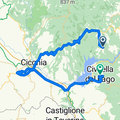 Titignano Orvieto Civitella del Lavo
- Distanz
- 52,9 km
- Aufstieg
- 979 m
- Abstieg
- 1.024 m
- Standort
- Todi, Umbrien, Italien
 Anelli di Todi - Monte Castello di Vibio
- Distanz
- 40,2 km
- Aufstieg
- 761 m
- Abstieg
- 761 m
- Standort
- Todi, Umbrien, Italien
 TODI 2 (ADV+) - Avigliano Umbro
- Distanz
- 56,6 km
- Aufstieg
- 1.008 m
- Abstieg
- 1.002 m
- Standort
- Todi, Umbrien, Italien
 3.Todi - Val di Ranco
- Distanz
- 169,7 km
- Aufstieg
- 3.285 m
- Abstieg
- 2.586 m
- Standort
- Todi, Umbrien, Italien
 Todi to Perugia
- Distanz
- 53,7 km
- Aufstieg
- 801 m
- Abstieg
- 1.005 m
- Standort
- Todi, Umbrien, Italien
 La Roccaccia
- Distanz
- 10 km
- Aufstieg
- 484 m
- Abstieg
- 485 m
- Standort
- Todi, Umbrien, Italien
 TODI 1 (ADV) - Avigliano Umbro
- Distanz
- 45,9 km
- Aufstieg
- 892 m
- Abstieg
- 872 m
- Standort
- Todi, Umbrien, Italien
 Todi-Marsciano-Ponte S.Giovanni-Umbertide
- Distanz
- 96,5 km
- Aufstieg
- 285 m
- Abstieg
- 449 m
- Standort
- Todi, Umbrien, Italien
In der App öffnen