![[Trek] V 52 - La véloroute de la Marne](/_next/static/media/contour-lines-light-small.cafd5e5d.avif)
![[Trek] V 52 - La véloroute de la Marne](https://media.bikemap.net/routes/9771421/staticmaps/in_317a5de9-720f-4c03-bc70-65e5e17f67de_694x400_bikemap-2021-3D-static.png)
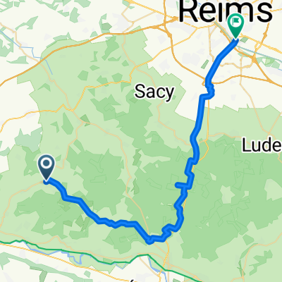
[Trek] V 52 - La véloroute de la Marne
Eine Fahrradroute, die in Châtillon-sur-Marne, Grand Est, Frankreich beginnt.
Übersicht
Über diese Route
From Dormans to Epernay, Marne flows between the foothills of the Montagne de Reims and the Côte des Blancs, which marks the eastern border of the Paris basin. in the wait of a new greenway to be developed, the route follows a section on preliminary automobile roads. The surrounding land fades gradually as we approach Chalons-en-Champagne. From the boat cruise you can see the "Venise Pétillante" before arriving to Vitry-le-François to follow a temporary route on a low traffic road.
Modified: 23 weeks ago
- -:--
- Dauer
- 19,5 km
- Distanz
- 22 m
- Aufstieg
- 18 m
- Abstieg
- ---
- Ø-Tempo
- 75 m
- Max. Höhe

Routenqualität
Wegtypen und Untergründe entlang der Route
Wegtypen
Ruhige Straße
9,8 km
(50 %)
Pfad
7,9 km
(40 %)
Untergründe
Befestigt
17,9 km
(92 %)
Unbefestigt
0,2 km
(1 %)
Asphalt
16,6 km
(85 %)
Beton
1,4 km
(7 %)
Weiter mit Bikemap
Diese Radroute verwenden, bearbeiten oder herunterladen
Du möchtest [Trek] V 52 - La véloroute de la Marne fahren oder sie für deine eigene Reise anpassen? Folgendes kannst du mit dieser Bikemap-Route machen:
Gratis Funktionen
- Speichere diese Route als Favorit oder in einer Sammlung
- Kopiere & plane deine eigene Version dieser Route
- Synchronisiere deine Route mit Garmin oder Wahoo
Premium-Funktionen
Kostenlose Testversion für 3 Tage oder einmalige Zahlung. Mehr über Bikemap Premium.
- Navigiere diese Route auf iOS & Android
- Exportiere eine GPX / KML-Datei dieser Route
- Erstelle deinen individuellen Ausdruck (Jetzt kostenlos ausprobieren)
- Lade diese Route für die Offline-Navigation herunter
Entdecke weitere Premium-Funktionen.
Bikemap Premium aktivierenVon unserer Community
Châtillon-sur-Marne: Andere beliebte Routen, die hier beginnen
![[Trek] V 52 - La véloroute de la Marne](https://media.bikemap.net/routes/9771421/staticmaps/in_317a5de9-720f-4c03-bc70-65e5e17f67de_400x400_bikemap-2021-3D-static.png) [Trek] V 52 - La véloroute de la Marne
[Trek] V 52 - La véloroute de la Marne- Distanz
- 19,5 km
- Aufstieg
- 22 m
- Abstieg
- 18 m
- Standort
- Châtillon-sur-Marne, Grand Est, Frankreich
 Recovered Route
- Distanz
- 49,4 km
- Aufstieg
- 882 m
- Abstieg
- 897 m
- Standort
- Châtillon-sur-Marne, Grand Est, Frankreich
 Etappe 7_ Vandières - Jouarre
- Distanz
- 69,5 km
- Aufstieg
- 324 m
- Abstieg
- 266 m
- Standort
- Châtillon-sur-Marne, Grand Est, Frankreich
 Circuit du Chatillonais
- Distanz
- 25 km
- Aufstieg
- 370 m
- Abstieg
- 368 m
- Standort
- Châtillon-sur-Marne, Grand Est, Frankreich
 Binson-et-Orquigny
- Distanz
- 54,2 km
- Aufstieg
- 522 m
- Abstieg
- 521 m
- Standort
- Châtillon-sur-Marne, Grand Est, Frankreich
 Autour de Châtillon-sur-Marne
- Distanz
- 26,1 km
- Aufstieg
- 438 m
- Abstieg
- 439 m
- Standort
- Châtillon-sur-Marne, Grand Est, Frankreich
 vrijgezellenfeest Reims
- Distanz
- 37,4 km
- Aufstieg
- 611 m
- Abstieg
- 637 m
- Standort
- Châtillon-sur-Marne, Grand Est, Frankreich
 Steady Donnerstag Course In Vandières
- Distanz
- 29,3 km
- Aufstieg
- 175 m
- Abstieg
- 175 m
- Standort
- Châtillon-sur-Marne, Grand Est, Frankreich
In der App öffnen