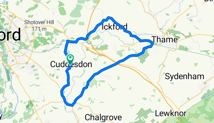
Cómo podría ser el ciclismo en Wheatley.

Wheatley en bici

Descubre un mapa con 72 rutas y senderos en bici cerca de Wheatley, creados por nuestra comunidad.

Retrato de la región

Conoce Wheatley

Encuentra la ruta en bicicleta ideal para ti en Wheatley, donde tenemos 72 rutas ciclistas para explorar. La mayoría de la gente sale en bicicleta por aquí en los meses de julio y agosto.

2319 km

Distancia registrada

72

Rutas ciclistas

5574

Población

Comunidad

Usuarios más activos en Wheatley

Rutas seleccionadas a mano

Descubre Wheatley a través de estas colecciones

Laura Southern
Recorrido

Home

8 rutas

De nuestra comunidad

Las mejores rutas en bici en y alrededor de Wheatley

Wheatley to John Radcliffe Hospitals (via Shotover)
Bici de ciudadAsfaltadaGrava
0

Wheatley to John Radcliffe Hospitals (via Shotover)

Ruta ciclista en Wheatley, England, United Kingdom

From Wheatley to the John Radcliffe Hospital.  Uses the Old Road across Shotover.  Long, steady climb from Wheatley.  Very steep climb from Oxford if doing the route in the opposite direction.  Over Shotover the route is gravel, often pot-holed, difficult in wet weather and unlit (so probably only a daytime route for most people).  On the other hand this is definitely the most beautiful way to enter Oxford from the east, and one that has very little traffic across most of its route.
6,5 km
Distancia
101 m
Ascenso
72 m
Descenso
longer  work route with  training hill
Bici de carrerasAsfaltadaSin asfaltar
Krisjohnsx
0

longer work route with training hill

Ruta ciclista en Wheatley, England, United Kingdom

25,2 km
Distancia
92 m
Ascenso
136 m
Descenso
Thornhill-Brookes-quiet-a
Bici de ciudadAsfaltada
0

Thornhill-Brookes-quiet-a

Ruta ciclista en Wheatley, England, United Kingdom

Quiet route from Thornhill Park and Ride to Oxford Brookes through Old Headington, John Radcliffe Hospital grounds, and bridleway behind Headington School, Pullens Lane and then to Darcy.
4,4 km
Distancia
24 m
Ascenso
25 m
Descenso
0

Home 2

Ruta ciclista en Wheatley, England, United Kingdom

28 km
Distancia
107 m
Ascenso
107 m
Descenso

Descubre más rutas