
Salernes en bici
Descubre un mapa con 95 rutas y senderos en bici cerca de Salernes, creados por nuestra comunidad.
Retrato de la región
Conoce Salernes
Encuentra la ruta en bicicleta ideal para ti en Salernes, donde tenemos 95 rutas ciclistas para explorar. La mayoría de la gente sale en bicicleta por aquí en los meses de junio y julio.
6209 km
Distancia registrada
95
Rutas ciclistas
3673
Población
Comunidad
Usuarios más activos en Salernes


De nuestra comunidad
Las mejores rutas en bici en y alrededor de Salernes
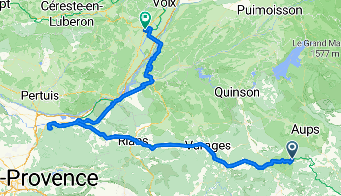
Sillans La Cascade - Manosque
Ruta ciclista en Salernes, Provenza-Alpes-Costa Azul, Francia
- 117,2 km
- Distancia
- 1419 m
- Ascenso
- 1458 m
- Descenso

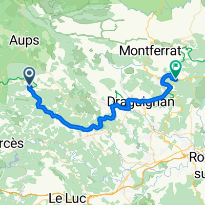
Tour of Central Var
Ruta ciclista en Salernes, Provenza-Alpes-Costa Azul, Francia
- 67,7 km
- Distancia
- 688 m
- Ascenso
- 679 m
- Descenso

Beauty in the Valley
Ruta ciclista en Salernes, Provenza-Alpes-Costa Azul, Francia
- 43 km
- Distancia
- 366 m
- Ascenso
- 366 m
- Descenso

Fun & Quick
Ruta ciclista en Salernes, Provenza-Alpes-Costa Azul, Francia
- 40,9 km
- Distancia
- 388 m
- Ascenso
- 388 m
- Descenso
Descubre más rutas
 70km,1200hm
- Distancia
- 69,2 km
- Ascenso
- 1080 m
- Descenso
- 1081 m
- Ubicación
- Salernes, Provenza-Alpes-Costa Azul, Francia
 30km,400hm
- Distancia
- 29,2 km
- Ascenso
- 469 m
- Descenso
- 475 m
- Ubicación
- Salernes, Provenza-Alpes-Costa Azul, Francia
 Cours Théodore Bouge, Salernes à Route Departementale, Callas
- Distancia
- 42,7 km
- Ascenso
- 840 m
- Descenso
- 766 m
- Ubicación
- Salernes, Provenza-Alpes-Costa Azul, Francia
 Seillans/Seillans
- Distancia
- 58 km
- Ascenso
- 487 m
- Descenso
- 471 m
- Ubicación
- Salernes, Provenza-Alpes-Costa Azul, Francia
 Salernes-La Roque-d'Anthéron
- Distancia
- 86,6 km
- Ascenso
- 769 m
- Descenso
- 834 m
- Ubicación
- Salernes, Provenza-Alpes-Costa Azul, Francia
 WE LORGUES 83KM 1400D+
- Distancia
- 83 km
- Ascenso
- 1162 m
- Descenso
- 1164 m
- Ubicación
- Salernes, Provenza-Alpes-Costa Azul, Francia
 Tour of Central Var CLONED FROM ROUTE 127751
- Distancia
- 67,8 km
- Ascenso
- 428 m
- Descenso
- 428 m
- Ubicación
- Salernes, Provenza-Alpes-Costa Azul, Francia
 Tour of Central Var
- Distancia
- 67,8 km
- Ascenso
- 382 m
- Descenso
- 382 m
- Ubicación
- Salernes, Provenza-Alpes-Costa Azul, Francia