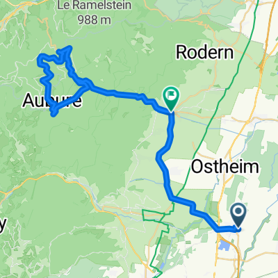
Houssen en bici
Descubre un mapa con 57 rutas y senderos en bici cerca de Houssen, creados por nuestra comunidad.
Retrato de la región
Conoce Houssen
Encuentra la ruta en bicicleta ideal para ti en Houssen, donde tenemos 57 rutas ciclistas para explorar. La mayoría de la gente sale en bicicleta por aquí en los meses de agosto y septiembre.
3581 km
Distancia registrada
57
Rutas ciclistas
1650
Población
De nuestra comunidad
Las mejores rutas en bici en y alrededor de Houssen
Colmar - Německo, okruh
Ruta ciclista en Houssen, Gran Este, Francia
- 72,1 km
- Distancia
- 89 m
- Ascenso
- 88 m
- Descenso
Elsass Rundfahrt Etappe 1 B
Ruta ciclista en Houssen, Gran Este, Francia
- 67,4 km
- Distancia
- 651 m
- Ascenso
- 652 m
- Descenso
2009 Euro Tour -- Ride Day 34 — 2 August 2009 — 68125 Houssen (Colmar)— Circle
Ruta ciclista en Houssen, Gran Este, Francia
<div style="color: #000000; font-family: Helvetica; font-size: medium;">
<div class="MsoNormal"><span style="font-family: Arial;">
<div class="MsoNormal">
<div class="MsoNormal"><span style="font-family: Arial;">Fantastic ride today.<span> </span>The roads and the countryside were very nice and rate a return visit.<span> </span>We saw two nice-looking Logis de France hotels in a particularly nice town called Thannenkirch, which is on D42.</span></div>
<div class="MsoNormal"><span style="font-family: Arial;"> </span></div>
<div class="MsoNormal"><span style="font-family: Arial;">Starting off, we found our way out of town on some flat roads that gradually approached mountains with vineyards growing halfway up their slopes.<span> </span>Just beautiful.</span></div>
<div class="MsoNormal"><span style="font-family: Arial;"> </span></div>
<div class="MsoNormal"><span style="font-family: Arial;">We got into Ribeauvillé and found that a stage of the Tour d’Alsace was getting organized.<span> </span>So, we hustled on hoping to be at the tête de la course.<span> </span>As the riders never passed us, either we’re faster than we think or...more likely...they took another route.</span></div>
<div class="MsoNormal"><span style="font-family: Arial;"> </span></div>
<div class="MsoNormal"><span style="font-family: Arial;">We had a nice picnic lunch in a traffic circle in Lièpvre.<span> </span>As there were many cars, this being N59, we were constantly waving to amused drivers and passengers.</span></div>
<div class="MsoNormal"><span style="font-family: Arial;"> </span></div>
<div class="MsoNormal"><span style="font-family: Arial;">We’d set out today despite the heavy cloud cover and the forecasts of rain.<span> </span>On the last climb of the day (about 550 M to the Col du Haut de Ribeauvillé at 742 M), it started to rain heavily, so we initially took shelter under some trees at a convenient picnic table while putting on our rain gear.<span> </span>After it lightened some, we set out and arrived at the Col.<span> </span>Immediately after taking a picture, it started pouring and we started the descent.<span> </span>Stopping after a kilometer or so, we stopped to put on our rain pants and then coasted carefully the remaining 11 km into Ribeauvillé in relative comfort despite the rain.</span></div>
<div class="MsoNormal"><span style="font-family: Arial;"> </span></div>
<div class="MsoNormal"><span style="font-family: Arial;">Arriving in Ribeauvillé and thereafter, the enormous sky was marvelous to see: heavy clouds of deep grey, some white, and some blue sky.<span> </span>And with the mountains on both sides of the flat valley, we wished we could have captured it on the camera.<span> </span>Unfortunately, the camera stopped working at this point, likely due to the humidity.</span></div>
<div class="MsoNormal"><span style="font-family: Arial;"> </span></div>
</div>
</div>
</div>
</span><span style="font-family: Arial;">Route:</span></div>
<div class="MsoNormal">
<div class="MsoNormal" style="font-family: Arial;"><span style="font-family: Arial;"> </span></div>
<span style="font-family: Arial;">D4 into Houssen Centre-ville</span>
<span style="font-family: Arial;">Unnumbered road North to</span>
<span style="font-family: Arial;">D3 Northeast into Ostheim</span>
<span style="font-family: Arial;">D416 Northwest into Ribeauvillé</span>
<span style="font-family: Arial;">D1<sup>B</sup> Northeast to Bergheim</span>
<span style="font-family: Arial;">D42/D48<sup>1</sup> Northwest through Thannenkirch to Lièpvre</span>
<span style="font-family: Arial;">D459 Southwest to Fertrupt</span>
<span style="font-family: Arial;">D416 Southeast through Col du Haut de Ribeauvillé (742 M) and Ribeauvillé to Ostheim</span>
<span style="font-family: Arial;">D3/unnumbered road/D4 South to Fasthôtel in Houssen</span>
</div>
<div class="MsoNormal">Background:<span style="font-family: Arial;">
<div class="MsoNormal" style="font-size: 16px;"><span style="font-family: Arial;"> </span></div>
</span></div>
My wife and I have been doing self-supported tours in Western Europe (a majority in France) since 1993. This series of rides covers our 2009 4.5 month route through parts of France, Germany, Austria, Switzerland, and then back to France. Our beginning and ending point is near Chadurie (south of Angouleme) where our friends have a farm with Gites and Chambres d'Hotes.
We rode our Dawes touring bicycles purchased in 1993 heavily loaded with 700Cx32 tires. All of our riding was on paved roads, mostly with very little traffic. Pretty much the only unpaved sections were some bicycle paths in Germany and Austria. Sadly, that wasn't so great as Helen fell a number of times on the unpaved paths. Fortunately, though, no serious injury.
If any questions, feel free to email me at jeffkadet@netdiving.com
Jeff
<div><br /></div>
</div>
- 65,8 km
- Distancia
- 917 m
- Ascenso
- 916 m
- Descenso
2009 Euro Tour -- Ride Day 35 — 3 August 2009 — 68125 Houssen (Colmar) to 67118 Geispolsheim (Strasbourg)
Ruta ciclista en Houssen, Gran Este, Francia
<div class="MsoNormal" style="color: #000000; font-family: Helvetica; font-size: medium;">
<div class="MsoNormal"><span style="font-family: Arial;">Over the past several days as we’ve pedaled east, we’ve seen increasing German influence in the place names, signage and architecture.<span> </span>In Orbey was the first “zimmer” sign.<span> </span>Today there were plenty of German-style buildings along the route and particularly with all the flowers, we found it pleasant indeed.</span></div>
<div class="MsoNormal"><span style="font-family: Arial;"> </span></div>
<div class="MsoNormal"><span style="font-family: Arial;">Alsace has been a very friendly place.<span> </span>First, as we had stopped along D468, a farmer in a tractor stopped to help us since we were looking at a map.<span> </span>He suggested the cycling path along the Canal du Rhône au Rhin, which we then used for some ten miles or so.<span> </span>He also gave us a bag full of some sweet small fruits (maybe a type of plum).<span> </span>He said that his son is in Boston playing basketball, we think for the NBA.<span> </span>Very nice chat.<span> </span>We met this tractor driver just south of Diebolsheim.</span></div>
<div class="MsoNormal"><span style="font-family: Arial;"> </span></div>
<div class="MsoNormal"><span style="font-family: Arial;">Second, again when looking at a map trying to find the Etap, a bicycle rider stopped to help, and then led us out of his way to show us how to find it.<span> </span>A third very friendly and helpful person was the fellow working at the hotel who checked us in and answered some questions.</span></div>
<div class="MsoNormal"><span style="font-family: Arial;"> </span></div>
<div class="MsoNormal"><span style="font-family: Arial;">Today’s ride was very flat and easy along excellent roads.<span> </span>A number of the villages were very colorful and sweet.<span> </span>We saw quite a few cycling tourists like us, likely attracted by the canal.<span> </span>Speaking of the canal, it was great to ride along and very pleasant with zero cars, but it would become very boring to ride on it for too long a time.<span> </span>The canal path, with a few minor exceptions, was well paved.</span></div>
<div class="MsoNormal"><br /></div>
<div class="MsoNormal">We passed from the Haut-Rhin Department to the Basa-Rhin Department, both of which are in the Alsace Region.</div>
<div class="MsoNormal"><span style="font-family: Arial;"><br /></span></div>
<div class="MsoNormal"><span style="font-family: Arial;">Route:</span></div>
<div class="MsoNormal"><span style="font-family: Arial;"> </span></div>
<span style="font-family: Arial;">D4 East from hotel to Centre-ville</span>
<span style="font-family: Arial;">Unnumbered road north to</span>
<span style="font-family: Arial;">D3 East to Jebsheim</span>
<span style="font-family: Arial;">D9/D208/D10/D468 </span>
<span style="font-family: Arial;">Northeast through Marckolsheim, Artolsheim and Diebolsheim to Friesenheim</span>
<span style="font-family: Arial;">D203 West to</span>
<span style="font-family: Arial;">Canal du Rhône au Rhin North to D222 at Plobsheim</span>
<span style="font-family: Arial;">D222 North to</span>
<span style="font-family: Arial;">N83 South to hotel</span>
</div>
<div class="MsoNormal" style="color: #000000; font-family: Helvetica; font-size: medium;">Background:<span style="font-family: Arial;">
<div class="MsoNormal" style="font-size: 16px;"><span style="font-family: Arial;"> </span></div>
</span></div>
My wife and I have been doing self-supported tours in Western Europe (a majority in France) since 1993. This series of rides covers our 2009 4.5 month route through parts of France, Germany, Austria, Switzerland, and then back to France. Our beginning and ending point is near Chadurie (south of Angouleme) where our friends have a farm with Gites and Chambres d'Hotes.
We rode our Dawes touring bicycles purchased in 1993 heavily loaded with 700Cx32 tires. All of our riding was on paved roads, mostly with very little traffic. Pretty much the only unpaved sections were some bicycle paths in Germany and Austria. Sadly, that wasn't so great as Helen fell a number of times on the unpaved paths. Fortunately, though, no serious injury.
If any questions, feel free to email me at jeffkadet@netdiving.com
Jeff
- 72,9 km
- Distancia
- 25 m
- Ascenso
- 62 m
- Descenso
Descubre más rutas
- Elsass-Durch die Obstgärten um Colmar
- Distancia
- 24 km
- Ascenso
- 47 m
- Descenso
- 46 m
- Ubicación
- Houssen, Gran Este, Francia
- Colmar-Ballon d'Alsace (Auberge du Langenberg)
- Distancia
- 104,9 km
- Ascenso
- 2209 m
- Descenso
- 1329 m
- Ubicación
- Houssen, Gran Este, Francia
- Itinéraire modéré en Turckheim
- Distancia
- 14 km
- Ascenso
- 60 m
- Descenso
- 8 m
- Ubicación
- Houssen, Gran Este, Francia
- Elsass Rundfahrt Etappe 3 A
- Distancia
- 136 km
- Ascenso
- 1836 m
- Descenso
- 1833 m
- Ubicación
- Houssen, Gran Este, Francia
- PRIMA TAPPA 66 km
- Distancia
- 66 km
- Ascenso
- 719 m
- Descenso
- 719 m
- Ubicación
- Houssen, Gran Este, Francia
- kolem Colmaru CLONED FROM ROUTE 552603 CLONED FROM ROUTE 692003
- Distancia
- 52,7 km
- Ascenso
- 587 m
- Descenso
- 587 m
- Ubicación
- Houssen, Gran Este, Francia
- intersport
- Distancia
- 6,6 km
- Ascenso
- 48 m
- Descenso
- 17 m
- Ubicación
- Houssen, Gran Este, Francia
- kolem Colmaru
- Distancia
- 75,6 km
- Ascenso
- 600 m
- Descenso
- 599 m
- Ubicación
- Houssen, Gran Este, Francia