
Châtellerault en bici
Descubre un mapa con 96 rutas y senderos en bici cerca de Châtellerault, creados por nuestra comunidad.
Retrato de la región
Conoce Châtellerault
Encuentra la ruta en bicicleta ideal para ti en Châtellerault, donde tenemos 96 rutas ciclistas para explorar. La mayoría de la gente sale en bicicleta por aquí en los meses de julio y agosto.
7574 km
Distancia registrada
96
Rutas ciclistas
37.210
Población
Comunidad
Usuarios más activos en Châtellerault


De nuestra comunidad
Las mejores rutas en bici en y alrededor de Châtellerault

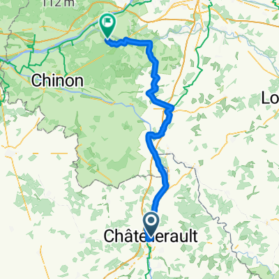
DAY ONE Châtellerault - Savigny-sous-Faye
Ruta ciclista en Châtellerault, Nouvelle-Aquitaine, Francia
Day One
Gare Châtellerault - Camping Municipal Les Iris, Savigny-sous-Faye
The route starts in Châtellerault in the Vienne Department of Nouvelle-Aquitaine. After an early morning TER train, Châtellerault will provide time for breakfast and a brief look around the town before seeking out the start of La Ligne Verte. Châtellerault has links with Scotland, namely, that in return for services offered to the Crowns of Scotland and France, the title of Duc de Châtellerault(1548) was presented to James Hamilton, 2nd Earl of Arran, Chief of the Name, and regent of Scotland during the infancy of Mary, Queen of Scots, and of France. However, he turned against the Queen in 1559, and his French estates and title were confiscated. This period in Scots history can be recalled to this day in the name of the village of Chatelherault in North Lanarkshire, Scotland - close to where the Duke of Hamilton once had a very grand palace and close to where I live. The spelling, for reasons unknown, (perhaps in writing or in error) is not exactly that of the town in France. La Ligne Verte is an old railway line converted into a cycle path and walking trails that runs from Châtellerault to Loudun, through the Lencloître area. This cycle route is known locally as Voie Sylvain Chavane. Sylvain Chavane, born in Châtellerault, was a French professional road cycling racer between 2000 and 2018. The start of the ligne verte is reached from the east side of Pont Henri IV, then crossing the River Vienne and taking a short cycle through some city streets.
This first day stage of the route ends at a campsite in Savigny-sous-Faye.
Camping Municipal Les Iris
4 rue du Lavior,
86140 Savigny-sous-Faye
FRANCE
Tel: +33 5 49 90 70 59
Mobile: +33 7 71 87 04 09
E-mail: savigny-sous-faye@departement86.fr
- 24,5 km
- Distancia
- 138 m
- Ascenso
- 79 m
- Descenso

SityTrail - 001C Chatellerault St Jacques to St Savin via Angles and En Lo
Ruta ciclista en Châtellerault, Nouvelle-Aquitaine, Francia
A reasonable route that uses minor roads. Has accomodation at En Lo, Le Bas Premilly but avoids Paizay. Accomodation and campsite in Chatellerault, Campsite St Pierre de Maillé and St Savin. The detour via the railway line after En Lo could be omitted but it's the most pleasant route. It really isn't necessary to go via Angles sur l'Anglin unless you want to visit the castle ruins, just follow the signs from Pleumartin to St Pierre de Maillé. - A reasonable route that uses minor roads. Has accomodation at En Lo, Le Bas Premilly but avoids Paizay. Accomodation and campsite in Chatellerault, Campsite St Pierre de Maillé and St Savin. The detour via the railway line after En Lo could be omitted but it's the most pleasant route. It really isn't necessary to go via Angles sur l'Anglin unless you want to visit the castle ruins, just follow the signs from Pleumartin to St Pierre de Maillé.
- 61,2 km
- Distancia
- 490 m
- Ascenso
- 462 m
- Descenso

Chatellerault - Lussac Les Châteaux (60 km) - Chabanais (71 km)
Ruta ciclista en Châtellerault, Nouvelle-Aquitaine, Francia
- 131 km
- Distancia
- 1044 m
- Ascenso
- 939 m
- Descenso

(4) Final Chattelerault - Bordeaux, 282km, 990HM (camping)
Ruta ciclista en Châtellerault, Nouvelle-Aquitaine, Francia
Tot net iets onder Bordeaux, kleine camping. Route volgt een 'via verde'.
- 282,2 km
- Distancia
- 574 m
- Ascenso
- 592 m
- Descenso
Descubre más rutas
 tour du clain
- Distancia
- 42 km
- Ascenso
- 231 m
- Descenso
- 231 m
- Ubicación
- Châtellerault, Nouvelle-Aquitaine, Francia
 dag 5 chatelleraut naar nabij Savigne
- Distancia
- 92,5 km
- Ascenso
- 601 m
- Descenso
- 537 m
- Ubicación
- Châtellerault, Nouvelle-Aquitaine, Francia
 11 Tag Châtellerault - Niort
- Distancia
- 112,6 km
- Ascenso
- 350 m
- Descenso
- 379 m
- Ubicación
- Châtellerault, Nouvelle-Aquitaine, Francia
 dangé velleches usseau
- Distancia
- 39,7 km
- Ascenso
- 374 m
- Descenso
- 374 m
- Ubicación
- Châtellerault, Nouvelle-Aquitaine, Francia
 Châtellerault - Lussac-les-châteaux (58km) - Chabanais (130km) - Montbrond (174 km) - Angoulème (220 km)
- Distancia
- 216,9 km
- Ascenso
- 1908 m
- Descenso
- 1856 m
- Ubicación
- Châtellerault, Nouvelle-Aquitaine, Francia
 FR15 Chatelleraut - Cheillé
- Distancia
- 78,3 km
- Ascenso
- 460 m
- Descenso
- 461 m
- Ubicación
- Châtellerault, Nouvelle-Aquitaine, Francia
 France20.5 Chatellerault-Confolens
- Distancia
- 109 km
- Ascenso
- 356 m
- Descenso
- 281 m
- Ubicación
- Châtellerault, Nouvelle-Aquitaine, Francia
 4 Chatellerault - Onder Bordeaux (Camping), 282 km
- Distancia
- 282,4 km
- Ascenso
- 569 m
- Descenso
- 587 m
- Ubicación
- Châtellerault, Nouvelle-Aquitaine, Francia