
Mars Hill en bici
Descubre un mapa con 4 rutas y senderos en bici cerca de Mars Hill, creados por nuestra comunidad.
Sé un pionero
Inspira a otros ciclistas con tu ruta en Mars Hill
Bikemap es una comunidad ciclista global con millones de rutas creadas por ciclistas como tú. Todavía hay pocas rutas en Mars Hill, así que traza tus recorridos favoritos en el mapa para ayudar a otros a descubrir los mejores caminos para pedalear.
De nuestra comunidad
Las mejores rutas en bici en y alrededor de Mars Hill

Hot Doggett Metric Century (2009)
Ruta ciclista en Mars Hill, Carolina del Norte, Estados Unidos
- 103 km
- Distancia
- 2651 m
- Ascenso
- 2482 m
- Descenso

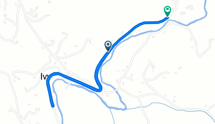
North Main Street 114, Mars Hill to North Main Street 114, Mars Hill
Ruta ciclista en Mars Hill, Carolina del Norte, Estados Unidos
- 34 km
- Distancia
- 462 m
- Ascenso
- 462 m
- Descenso
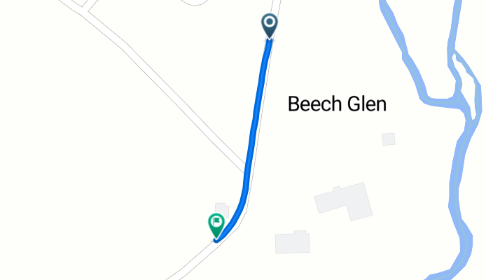
Beech Glen Road to Beech Glen Road
Ruta ciclista en Mars Hill, Carolina del Norte, Estados Unidos
- 2,5 km
- Distancia
- 52 m
- Ascenso
- 12 m
- Descenso
Beech Glen Road to Blue Herron Road
Ruta ciclista en Mars Hill, Carolina del Norte, Estados Unidos
- 0,6 km
- Distancia
- 42 m
- Ascenso
- 0 m
- Descenso