
Beavercreek en bici
Descubre un mapa con 104 rutas y senderos en bici cerca de Beavercreek, creados por nuestra comunidad.
Retrato de la región
Conoce Beavercreek
Encuentra la ruta en bicicleta ideal para ti en Beavercreek, donde tenemos 104 rutas ciclistas para explorar. La mayoría de la gente sale en bicicleta por aquí en los meses de mayo y julio.
2106 km
Distancia registrada
104
Rutas ciclistas
45.193
Población
Comunidad
Usuarios más activos en Beavercreek

De nuestra comunidad
Las mejores rutas en bici en y alrededor de Beavercreek

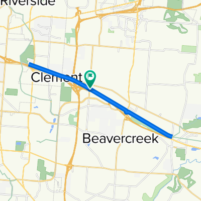
east gate east to Fairborn
Ruta ciclista en Beavercreek, Ohio, Estados Unidos
- 31 km
- Distancia
- 90 m
- Ascenso
- 90 m
- Descenso

RFW - Bellbrook Rolling Hills
Ruta ciclista en Beavercreek, Ohio, Estados Unidos
- 60,1 km
- Distancia
- 268 m
- Ascenso
- 279 m
- Descenso

RFW - Oakwood Hills
Ruta ciclista en Beavercreek, Ohio, Estados Unidos
- 32,1 km
- Distancia
- 168 m
- Ascenso
- 174 m
- Descenso

RFW Flat Bikepath
Ruta ciclista en Beavercreek, Ohio, Estados Unidos
- 46,9 km
- Distancia
- 145 m
- Ascenso
- 161 m
- Descenso
Descubre más rutas
 RFW Flat Bikepath
- Distancia
- 46,8 km
- Ascenso
- 126 m
- Descenso
- 119 m
- Ubicación
- Beavercreek, Ohio, Estados Unidos
 cool route
- Distancia
- 78,8 km
- Ascenso
- 435 m
- Descenso
- 435 m
- Ubicación
- Beavercreek, Ohio, Estados Unidos
 Creekside Trail, Beavercreek to Creekside Trail, Beavercreek
- Distancia
- 18,5 km
- Ascenso
- 59 m
- Descenso
- 58 m
- Ubicación
- Beavercreek, Ohio, Estados Unidos
 Oxford Craziness
- Distancia
- 81,2 km
- Ascenso
- 277 m
- Descenso
- 283 m
- Ubicación
- Beavercreek, Ohio, Estados Unidos
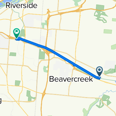 800 Factory Rd, Beavercreek to 3623 Linden Ave, Dayton
- Distancia
- 10,2 km
- Ascenso
- 45 m
- Descenso
- 25 m
- Ubicación
- Beavercreek, Ohio, Estados Unidos
 1854–1898 Spaulding Rd, Kettering to 2001–2157 Wilmington Pike, Kettering
- Distancia
- 18,2 km
- Ascenso
- 123 m
- Descenso
- 97 m
- Ubicación
- Beavercreek, Ohio, Estados Unidos
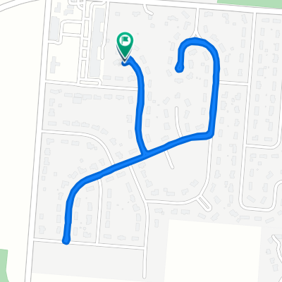 1170 Rosendale Dr, Beavercreek to 1170 Rosendale Dr, Beavercreek
- Distancia
- 2,8 km
- Ascenso
- 0 m
- Descenso
- 0 m
- Ubicación
- Beavercreek, Ohio, Estados Unidos
 Sporty route in Beavercreek
- Distancia
- 39,1 km
- Ascenso
- 152 m
- Descenso
- 154 m
- Ubicación
- Beavercreek, Ohio, Estados Unidos