Crockett en bici
Descubre un mapa ciclista de Crockett, con carriles bici, senderos y puntos de interés destacados.
Sé un pionero
Inspira a otros ciclistas con tu ruta en Crockett
Bikemap es una comunidad ciclista global con millones de rutas creadas por ciclistas como tú. Todavía hay pocas rutas en Crockett, así que traza tus recorridos favoritos en el mapa para ayudar a otros a descubrir los mejores caminos para pedalear.
De nuestra comunidad
Las mejores rutas en bici en y alrededor de Crockett
Crockett to Palestine
Ruta ciclista en Crockett, Texas, United States of America
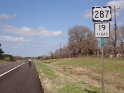
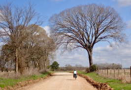
After passing the northern part of the highway ring around Crockett, we were soon on a local road that had a temporary sign saying “Rough Road”. They weren’t kidding since after a short time we lost the pavement and had an unpaved road for a while. Getting into Latexo, we crossed over U.S. 287/Texas 19 onto a local road…that really turned out to be local. It was unpaved often with a sandy base that we had to push the bikes through. This went on for a number of miles until we got close to Grapeland when paving reappeared. Being gun-shy, we decided against the originally planned local roads which would have taken us to Elkhart and Palestine and took U.S. 287/Texas 19 instead. Noisy, but mostly good road shoulder to ride on.
Because of the sandy road conditions, this route was not good for a road bike. You should use US 287/Texas 19 instead of the small local roads.
- 63,1 km
- Distancia
- 512 m
- Ascenso
- 456 m
- Descenso
Crockett, TX - Buffalo, TX
Ruta ciclista en Crockett, Texas, United States of America
Route for tour IcelandAcrossAmerica 2011
- 80,3 km
- Distancia
- 293 m
- Ascenso
- 281 m
- Descenso