
Skyline View en bici
Descubre un mapa con 11 rutas y senderos en bici cerca de Skyline View, creados por nuestra comunidad.
Retrato de la región
Conoce Skyline View
Encuentra la ruta en bicicleta ideal para ti en Skyline View, donde tenemos 11 rutas ciclistas para explorar.
664 km
Distancia registrada
11
Rutas ciclistas
4003
Población
Comunidad
Usuarios más activos en Skyline View


De nuestra comunidad
Las mejores rutas en bici en y alrededor de Skyline View

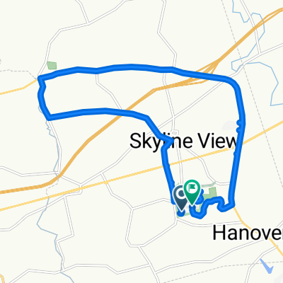
Swatara Gap 40 miler
Ruta ciclista en Skyline View, Pensilvania, Estados Unidos
- 65,3 km
- Distancia
- 311 m
- Ascenso
- 312 m
- Descenso

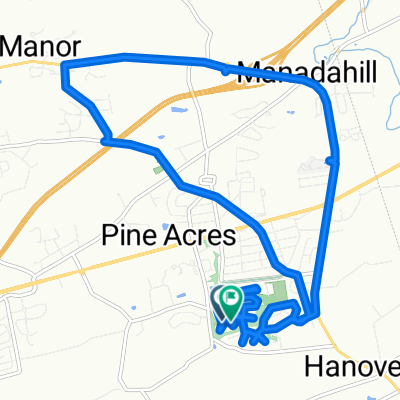
Hummelstown to Marietta
Ruta ciclista en Skyline View, Pensilvania, Estados Unidos
- 42,6 km
- Distancia
- 490 m
- Ascenso
- 533 m
- Descenso

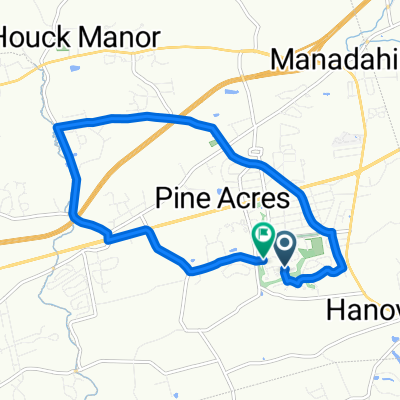
Devonshire Heights Road 8263, Hummelstown to Devonshire Heights Road 8822, Hummelstown
Ruta ciclista en Skyline View, Pensilvania, Estados Unidos
- 25,5 km
- Distancia
- 31 m
- Ascenso
- 42 m
- Descenso

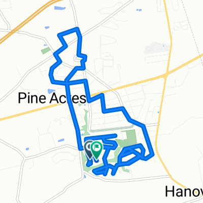
Double Blue Ridge 3Bs
Ruta ciclista en Skyline View, Pensilvania, Estados Unidos
- 26,3 km
- Distancia
- 511 m
- Ascenso
- 498 m
- Descenso
Descubre más rutas
 Piketown Linglestown loop
- Distancia
- 16,7 km
- Ascenso
- 141 m
- Descenso
- 102 m
- Ubicación
- Skyline View, Pensilvania, Estados Unidos
 Neighborhood Linglestown Rd loop
- Distancia
- 17,4 km
- Ascenso
- 184 m
- Descenso
- 149 m
- Ubicación
- Skyline View, Pensilvania, Estados Unidos
 Route in Harrisburg
- Distancia
- 10,8 km
- Ascenso
- 81 m
- Descenso
- 81 m
- Ubicación
- Skyline View, Pensilvania, Estados Unidos
 Chervil Court to Chervil Court
- Distancia
- 14 km
- Ascenso
- 126 m
- Descenso
- 94 m
- Ubicación
- Skyline View, Pensilvania, Estados Unidos
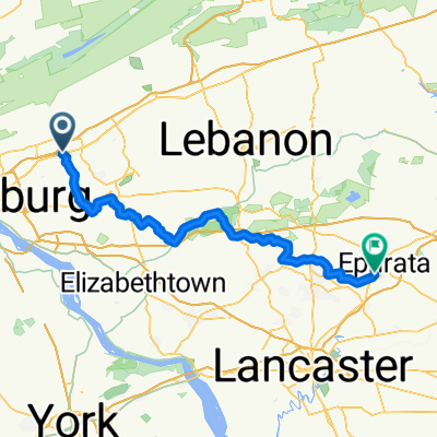 From Harrisburg to Ephrata
- Distancia
- 74,5 km
- Ascenso
- 712 m
- Descenso
- 754 m
- Ubicación
- Skyline View, Pensilvania, Estados Unidos
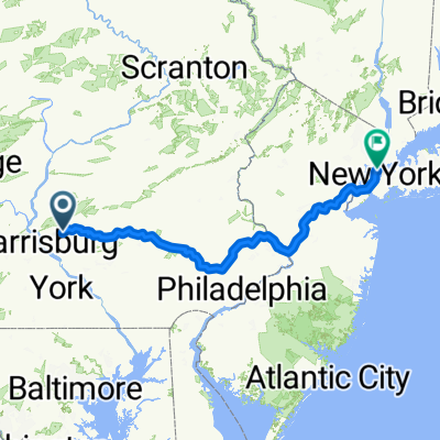 NYC Final
- Distancia
- 357 km
- Ascenso
- 2199 m
- Descenso
- 2328 m
- Ubicación
- Skyline View, Pensilvania, Estados Unidos
 Allentown Boulevard to Chocolate World Way
- Distancia
- 13,8 km
- Ascenso
- 80 m
- Descenso
- 117 m
- Ubicación
- Skyline View, Pensilvania, Estados Unidos