
Ballarat Central en bici
Descubre un mapa con 23 rutas y senderos en bici cerca de Ballarat Central, creados por nuestra comunidad.
Retrato de la región
Conoce Ballarat Central
Encuentra la ruta en bicicleta ideal para ti en Ballarat Central, donde tenemos 23 rutas ciclistas para explorar.
1697 km
Distancia registrada
23
Rutas ciclistas
5645
Población


De nuestra comunidad
Las mejores rutas en bici en y alrededor de Ballarat Central

Ballarat City circuit for windy weather
Ruta ciclista en Ballarat Central, Victoria, Australia
- 50,4 km
- Distancia
- 232 m
- Ascenso
- 222 m
- Descenso

e-MTB Adventure Ride. Ballarat, Creswick.
Ruta ciclista en Ballarat Central, Victoria, Australia
- 29,2 km
- Distancia
- 332 m
- Ascenso
- 331 m
- Descenso

e-MTB Adventure Ride. Ballarat to Melbourne
Ruta ciclista en Ballarat Central, Victoria, Australia
- 135,3 km
- Distancia
- 467 m
- Ascenso
- 871 m
- Descenso

Ballarat to Bacchus Marsh
Ruta ciclista en Ballarat Central, Victoria, Australia
- 69,7 km
- Distancia
- 452 m
- Ascenso
- 778 m
- Descenso
Descubre más rutas
![[Herald Sun Tour 2009 - Etapa 00] Ballarat](https://media.bikemap.net/routes/327032/staticmaps/in_02180b6f-925d-4083-b153-b186a50069ea_400x400_bikemap-2021-3D-static.png) [Herald Sun Tour 2009 - Etapa 00] Ballarat
[Herald Sun Tour 2009 - Etapa 00] Ballarat- Distancia
- 2,3 km
- Ascenso
- 19 m
- Descenso
- 22 m
- Ubicación
- Ballarat Central, Victoria, Australia
 Stay close to Ballarat - including Buninyong
- Distancia
- 70,6 km
- Ascenso
- 580 m
- Descenso
- 580 m
- Ubicación
- Ballarat Central, Victoria, Australia
 Ballarat To Lara Bikepacking
- Distancia
- 103,6 km
- Ascenso
- 606 m
- Descenso
- 1026 m
- Ubicación
- Ballarat Central, Victoria, Australia
 Tour Down Under Stage 3 mock course
- Distancia
- 146,5 km
- Ascenso
- 672 m
- Descenso
- 516 m
- Ubicación
- Ballarat Central, Victoria, Australia
 Ballarat - Windermere Hotel
- Distancia
- 34,9 km
- Ascenso
- 699 m
- Descenso
- 708 m
- Ubicación
- Ballarat Central, Victoria, Australia
 FHB Ballarat to Southern Cross Station, leg 6
- Distancia
- 135,8 km
- Ascenso
- 483 m
- Descenso
- 898 m
- Ubicación
- Ballarat Central, Victoria, Australia
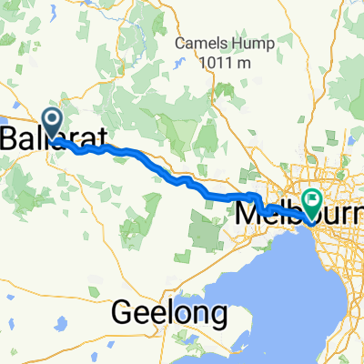 Ballarat to Melbourne
- Distancia
- 124,8 km
- Ascenso
- 268 m
- Descenso
- 683 m
- Ubicación
- Ballarat Central, Victoria, Australia
 Ballarat - Maryborough Trail
- Distancia
- 92,4 km
- Ascenso
- 375 m
- Descenso
- 569 m
- Ubicación
- Ballarat Central, Victoria, Australia