
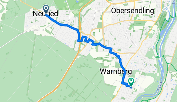
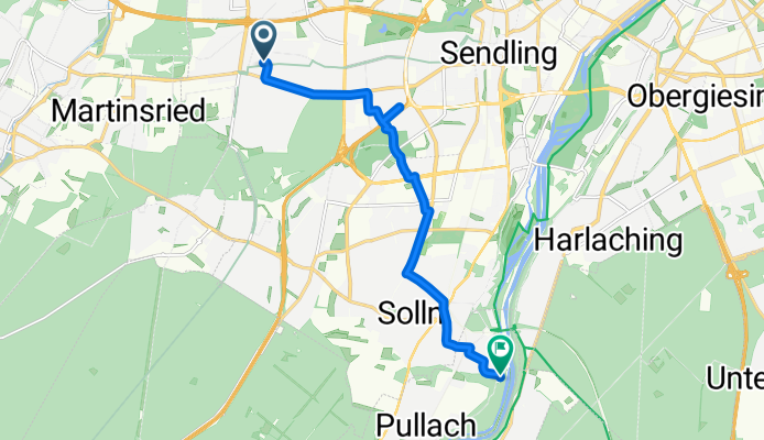
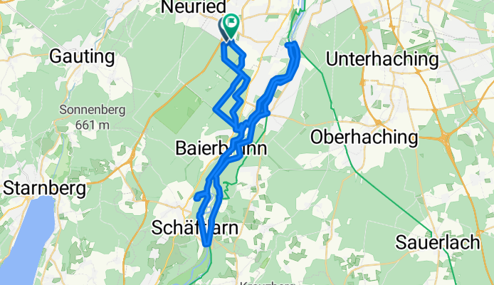
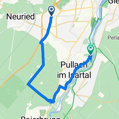
En bici de Neuried a Pullach im Isartal
Personaliza tu propia ruta a partir de nuestra plantilla o descubre cómo prefiere pedalear nuestra comunidad desde Neuried hasta Pullach im Isartal.
Plantilla de ruta
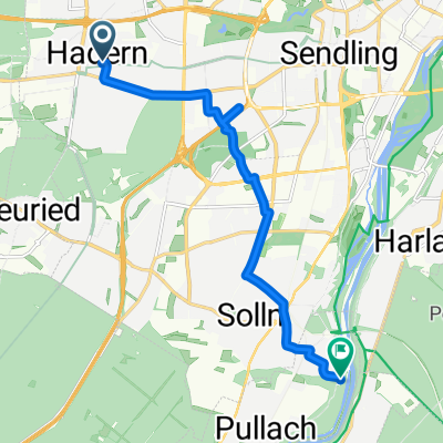
De Neuried a Pullach im Isartal
- 25 min
- Duración
- 7,5 km
- Distancia
- 31 m
- Ascenso
- 6 m
- Descenso
- 18 km/h
- Velocidad Media
- 584 m
- Altitud máxima
Looking to explore the lush southwest of Munich? This gentle cycling route takes you from Neuried, a peaceful suburb known for its green spaces, over to Pullach im Isartal, nestled on the scenic banks of the Isar River. You’ll cruise along mostly smooth asphalt, with about half the ride on dedicated paths and the rest on very quiet roads—perfect for a stress-free spin.
The route covers just under 7.5 kilometers, and with only about 30 meters of elevation gain, it’s an easy journey suitable for most riders. Starting in Neuried, you’ll quickly leave behind residential neighborhoods and pedal towards the leafy edges of the Isartal, soaking up the relaxed vibe. Your destination, Pullach, is famous for its villas and the beautiful Isar valley views—a great spot to enjoy a snack or take a riverside stroll before heading home. So hop on your bike, breathe deep, and enjoy this easy ride through Munich’s greenbelt!
Comunidad
Usuarios destacados en esta región


De nuestra comunidad
Las mejores rutas en bici de Neuried a Pullach im Isartal
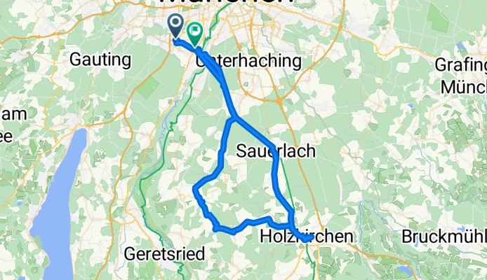
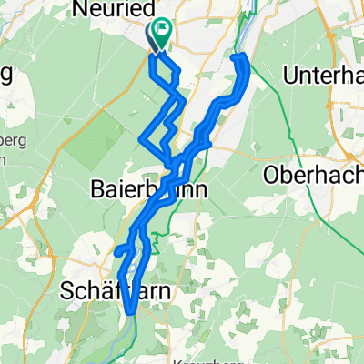
München-Holzkirchen (Test)
Ruta ciclista en Neuried, Baviera, Alemania
- 73,4 km
- Distancia
- 286 m
- Ascenso
- 280 m
- Descenso
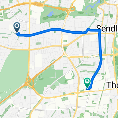
Königswieser Straße, München nach Kreuzeckstraße, Pullach im Isartal
Ruta ciclista en Neuried, Baviera, Alemania
- 4,9 km
- Distancia
- 19 m
- Ascenso
- 16 m
- Descenso
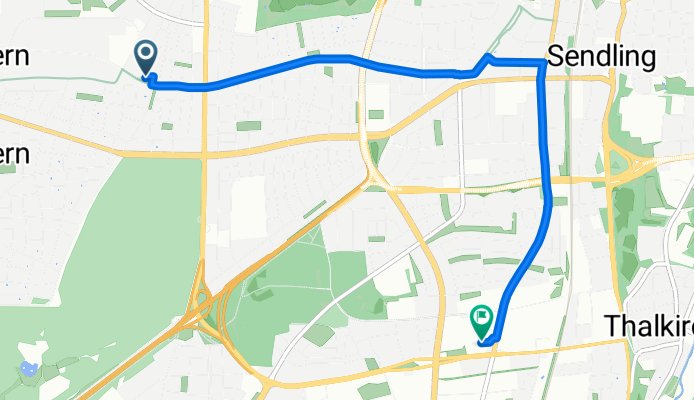
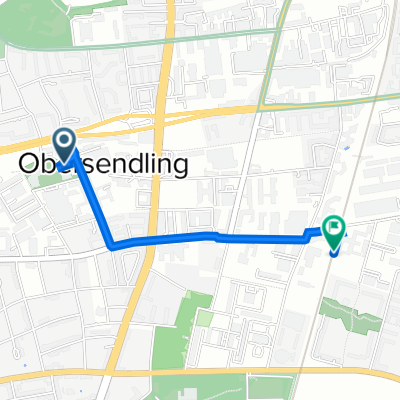
Maxhof-Farchach-Aufhofen-Wörnbrunn-Obersendling
Ruta ciclista en Neuried, Baviera, Alemania
- 61 km
- Distancia
- 333 m
- Ascenso
- 348 m
- Descenso
20150704_194227.gpx
Ruta ciclista en Neuried, Baviera, Alemania
- 9,9 km
- Distancia
- 25 m
- Ascenso
- 13 m
- Descenso
Helfenriederstraße 12, München nach Siemenswerke, München
Ruta ciclista en Neuried, Baviera, Alemania
- 1,7 km
- Distancia
- 3 m
- Ascenso
- 0 m
- Descenso
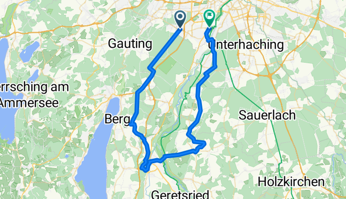
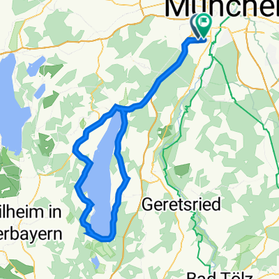
SG2023/Starnberger-See-Runde
Ruta ciclista en Neuried, Baviera, Alemania
- 89,1 km
- Distancia
- 752 m
- Ascenso
- 749 m
- Descenso
Crosser-Tour Isar
Ruta ciclista en Neuried, Baviera, Alemania
- 46,3 km
- Distancia
- 312 m
- Ascenso
- 312 m
- Descenso

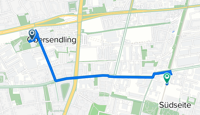
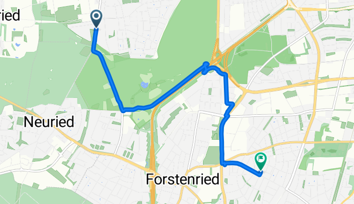
Fürstenrieder Straße 259, München nach Baierbrunner Straße 18, München
Ruta ciclista en Neuried, Baviera, Alemania
- 4,6 km
- Distancia
- 592 m
- Ascenso
- 582 m
- Descenso
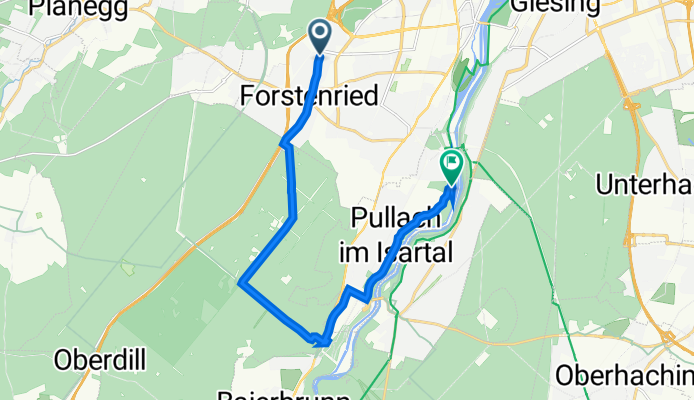
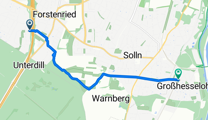
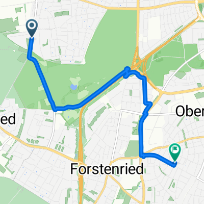
Forstenrieder Allee 67, Munich to Georg-Kalb-Straße 1, Pullach i. Isartal
Ruta ciclista en Neuried, Baviera, Alemania
- 14,3 km
- Distancia
- 446 m
- Ascenso
- 435 m
- Descenso
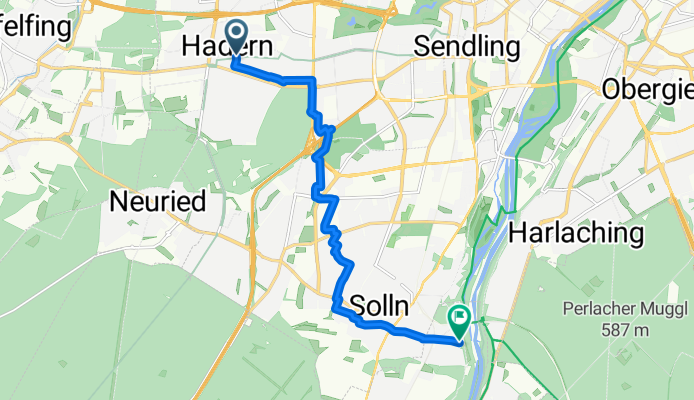
Max-Lebsche-Platz, München nach Muthstraße, München
Ruta ciclista en Neuried, Baviera, Alemania
- 6,5 km
- Distancia
- 36 m
- Ascenso
- 25 m
- Descenso
Descubre más rutas
 Lidl und DM
- Distancia
- 5 km
- Ascenso
- 7 m
- Descenso
- 3 m
- Ubicación
- Neuried, Baviera, Alemania
 20150704_194227.gpx
- Distancia
- 9,9 km
- Ascenso
- 25 m
- Descenso
- 13 m
- Ubicación
- Neuried, Baviera, Alemania
 Helfenriederstraße 12, München nach Siemenswerke, München
- Distancia
- 1,7 km
- Ascenso
- 3 m
- Descenso
- 0 m
- Ubicación
- Neuried, Baviera, Alemania
 SG2023/Starnberger-See-Runde
- Distancia
- 89,1 km
- Ascenso
- 752 m
- Descenso
- 749 m
- Ubicación
- Neuried, Baviera, Alemania
 Crosser-Tour Isar
- Distancia
- 46,3 km
- Ascenso
- 312 m
- Descenso
- 312 m
- Ubicación
- Neuried, Baviera, Alemania
 Fürstenrieder Straße 259, München nach Baierbrunner Straße 18, München
- Distancia
- 4,6 km
- Ascenso
- 592 m
- Descenso
- 582 m
- Ubicación
- Neuried, Baviera, Alemania
 Forstenrieder Allee 67, Munich to Georg-Kalb-Straße 1, Pullach i. Isartal
- Distancia
- 14,3 km
- Ascenso
- 446 m
- Descenso
- 435 m
- Ubicación
- Neuried, Baviera, Alemania
 Max-Lebsche-Platz, München nach Muthstraße, München
- Distancia
- 6,5 km
- Ascenso
- 36 m
- Descenso
- 25 m
- Ubicación
- Neuried, Baviera, Alemania
Rutas desde Neuried
Excursión ciclista de un día de
De Neuried a Unterföhring
En bici de
De Neuried a Múnich
En bici de
De Neuried a Starnberg
Rutas hacia Pullach im Isartal
En bici de
De Bogenhausen a Pullach im Isartal
En bici de
De Pasing a Pullach im Isartal