

Day 5, 42 wet and windy miles from Newtonmore to Pitlockry
Una ruta en bici que comienza en Kingussie, Escocia, Reino Unido.
Visión General
Sobre esta ruta
September 5, 2006. This was our first really wet day. We left Newtonmore in light drizzle at 11 degrees to climb the 1513 foot Drummochter Pass into a SW wind. After a few hours in heavy rain and persistent wind with the temperature dropping to 8 degrees, those of us without rain booties had less than warm feet. Much of the ride was on the not terribly well maintained cycle path that follows the old highway beside the A9 and the rail lines. We stopped for coffee at the New Inn in Dalwhinney and reluctantly passed on the opportinity to visit "Scotland's highest distillery" because it was obvious that we were going to be making poor time in these conditions. Although we could not enjoy the distant views of the mountains and heather, we were impressed with the variety of road kill - several pheasants, hares, and frogs, a mink and a sheep. There were many grand houses as we got farther south and at Blair Athol we marvelled at the 4-miles of 5-foot stone wall along the road on one side of Blair Castle. After 5 hours and 42 miles of this, we arrived at the very pretty town of Pitlochry near 2 pm in time to get our bikes tuned up by the very competent Kevin at the Escape Route cycle shop and repaired to the Moulin Inn (est. 1695) for their real ale brewed on the premises (we all had the 5.2 percent "The Remediator") and excellent lunch (our selections included venison platter, steak and ale pie, game pudding, scotchman's hat - a large Yorkshire pudding with meat and mushroom filling).
- -:--
- Duración
- 67,9 km
- Distancia
- 423 m
- Ascenso
- 570 m
- Descenso
- ---
- Velocidad Media
- 458 m
- Altitud máxima

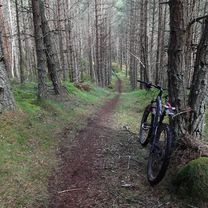
Fotos de la ruta


Calidad de la ruta
Tipos de vía y superficies a lo largo de la ruta
Tipos de vía
Carril bici
25,1 km
(37 %)
Carretera tranquila
12,2 km
(18 %)
Superficies
Pavimentado
38,7 km
(57 %)
Sin pavimentar
0,7 km
(1 %)
Asfalto
38,7 km
(57 %)
Grava
0,7 km
(1 %)
Sin definir
28,5 km
(42 %)
Continuar con Bikemap
Usa, edita o descarga esta ruta en bici
¿Te gustaría recorrer Day 5, 42 wet and windy miles from Newtonmore to Pitlockry o personalizarla para tu propio viaje? Esto es lo que puedes hacer con esta ruta de Bikemap:
Funciones gratuitas
- Guarda esta ruta como favorita o en una colección
- Copia y planifica tu propia versión de esta ruta
- Sincroniza tu ruta con Garmin o Wahoo
Funciones Premium
Prueba gratuita de 3 días o pago único. Más información sobre Bikemap Premium.
- Navega esta ruta en iOS y Android
- Exporta un archivo GPX / KML de esta ruta
- Crea tu impresión personalizada (pruébala gratis)
- Descarga esta ruta para la navegación sin conexión
Descubre más funciones Premium.
Consigue Bikemap PremiumDe nuestra comunidad
Kingussie: Otras rutas populares que empiezan aquí
 Kingussie, Newtonmore Wild Cat trail and Loch Gynack
- Distancia
- 16 km
- Ascenso
- 219 m
- Descenso
- 219 m
- Ubicación
- Kingussie, Escocia, Reino Unido
 Inshriachs Best 3 Descents
- Distancia
- 19,6 km
- Ascenso
- 419 m
- Descenso
- 421 m
- Ubicación
- Kingussie, Escocia, Reino Unido
 May 16th Scotland
- Distancia
- 87,7 km
- Ascenso
- 629 m
- Descenso
- 546 m
- Ubicación
- Kingussie, Escocia, Reino Unido
 KOS Skye and Wester Ross 2021 Day 6
- Distancia
- 47,5 km
- Ascenso
- 248 m
- Descenso
- 280 m
- Ubicación
- Kingussie, Escocia, Reino Unido
 Day 2 Copathlon
- Distancia
- 340,8 km
- Ascenso
- 870 m
- Descenso
- 1102 m
- Ubicación
- Kingussie, Escocia, Reino Unido
 KOS Speyside 2019 Day 1
- Distancia
- 66,7 km
- Ascenso
- 243 m
- Descenso
- 273 m
- Ubicación
- Kingussie, Escocia, Reino Unido
 Inshriach Singletrack 2
- Distancia
- 25,8 km
- Ascenso
- 405 m
- Descenso
- 405 m
- Ubicación
- Kingussie, Escocia, Reino Unido
 Spey 2
- Distancia
- 35,7 km
- Ascenso
- 23 m
- Descenso
- 48 m
- Ubicación
- Kingussie, Escocia, Reino Unido
Ábrela en la app