

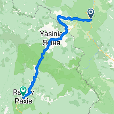
Сarpathian peaks. Route 2.
Una ruta en bici que comienza en Tatariv, Óblast de Ivano-Frankivsk, Ucrania.
Visión General
Sobre esta ruta
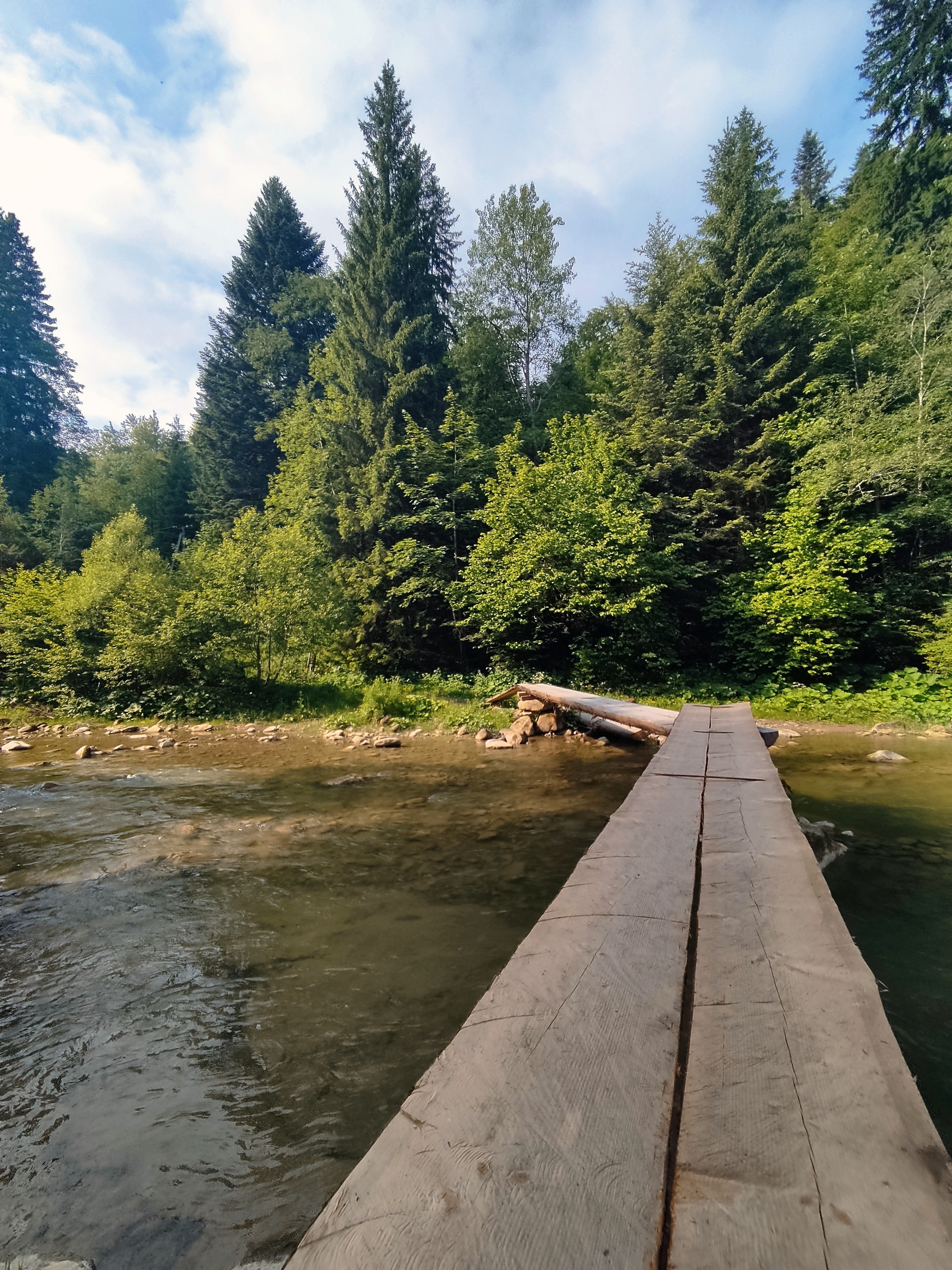
· Cascada Huk. Casi cada tercera cascada en los Cárpatos se llama Huk (puede traducirse como "ruidosa"). Así que llamaremos a esta en particular, situada a varios kilómetros de Mykulychyn, Huk Zhenetskyi, ya que esta turbulenta cascada de 15 m de altura se encuentra en el río Zhenets.
· Puente ferroviario arqueado (viaducto). Uno de los puentes de piedra arqueados más antiguos y largos de Europa está situado en Vorokhta (130 m) y la longitud de uno de sus arcos es de 65 m. Este famoso puente ferroviario fue construido en 1894 y estuvo en funcionamiento hasta 2000. También hay una de las iglesias de madera más antiguas del siglo XVII: la iglesia del Nacimiento de la Virgen María, preservada en Vorokhta.
· Paso Yablunytskyi (paso Tatarski) – 931 m sobre el nivel del mar. Aquí visitará el mercado de souvenirs conocido no solo en los Cárpatos sino en toda Ucrania. En Tatariv pararemos en el monumento del período de la Primera Guerra Mundial.
- -:--
- Duración
- 60,1 km
- Distancia
- 621 m
- Ascenso
- 621 m
- Descenso
- ---
- Velocidad Media
- ---
- Altitud máxima

Destacados de la ruta
Puntos de interés a lo largo de la ruta

Punto de interés después de 10,4 km
Waterfall Huk (may be translated as “loud”) is turbulent 15m-high waterfall situated on the Zhenets river at an altitude 900 m above sea level. Due to constant moisture and breezes from waterfall, vegetation here is very diverse.

Punto de interés después de 24,6 km
• Railway arched bridge (viaduct). One of the oldest and the longest stone arched bridges of Europe is situated in Vorokhta (130 m) and the length of one of the arches is 65 m. This famous railway bridge was built in 1894 and operated till 2000.

Punto de interés después de 37,5 km
Yablonitsky Pass is a pass through the Carpathian Mountains in Ukraine, located in the south-eastern part of Ivano-Frankivsk Oblast. It is one of several passes connecting Transcarpathia with the rest of the country. The headwaters of the Prut River are in the northern end of this pass, and its southern end is part of the Tisza River valley. Here you can visit the souvenir market known not only in the Carpathians but in the whole Ukraine.
Continuar con Bikemap
Usa, edita o descarga esta ruta en bici
¿Te gustaría recorrer Сarpathian peaks. Route 2. o personalizarla para tu propio viaje? Esto es lo que puedes hacer con esta ruta de Bikemap:
Funciones gratuitas
- Guarda esta ruta como favorita o en una colección
- Copia y planifica tu propia versión de esta ruta
- Sincroniza tu ruta con Garmin o Wahoo
Funciones Premium
Prueba gratuita de 3 días o pago único. Más información sobre Bikemap Premium.
- Navega esta ruta en iOS y Android
- Exporta un archivo GPX / KML de esta ruta
- Crea tu impresión personalizada (pruébala gratis)
- Descarga esta ruta para la navegación sin conexión
Descubre más funciones Premium.
Consigue Bikemap PremiumDe nuestra comunidad
Tatariv: Otras rutas populares que empiezan aquí
 Водопад Жанецкий Гук - Буковель
- Distancia
- 48,2 km
- Ascenso
- 638 m
- Descenso
- 636 m
- Ubicación
- Tatariv, Óblast de Ivano-Frankivsk, Ucrania
 Пшк 2012-08-18 Микулич-Космач 40км
- Distancia
- 39,8 km
- Ascenso
- 1067 m
- Descenso
- 1040 m
- Ubicación
- Tatariv, Óblast de Ivano-Frankivsk, Ucrania
 Татарів - Микуличин - Космач - Шепіт - Білоберізка
- Distancia
- 86,2 km
- Ascenso
- 1640 m
- Descenso
- 1869 m
- Ubicación
- Tatariv, Óblast de Ivano-Frankivsk, Ucrania
 Татарів-Буковель-Рахів
- Distancia
- 68,5 km
- Ascenso
- 508 m
- Descenso
- 749 m
- Ubicación
- Tatariv, Óblast de Ivano-Frankivsk, Ucrania
 Татарів - Буковель - Бистриця - Надвірна
- Distancia
- 74,3 km
- Ascenso
- 1339 m
- Descenso
- 1590 m
- Ubicación
- Tatariv, Óblast de Ivano-Frankivsk, Ucrania
 Carpathian peaks. Mt.Lisniv - Mykulychyn
- Distancia
- 41,7 km
- Ascenso
- 855 m
- Descenso
- 1501 m
- Ubicación
- Tatariv, Óblast de Ivano-Frankivsk, Ucrania
 Микуличин-Манява
- Distancia
- 57,9 km
- Ascenso
- 1675 m
- Descenso
- 1762 m
- Ubicación
- Tatariv, Óblast de Ivano-Frankivsk, Ucrania
 Сarpathian peaks. Route 2.
- Distancia
- 60,1 km
- Ascenso
- 621 m
- Descenso
- 621 m
- Ubicación
- Tatariv, Óblast de Ivano-Frankivsk, Ucrania
Ábrela en la app