

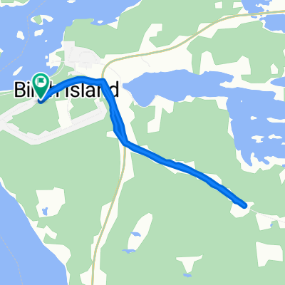
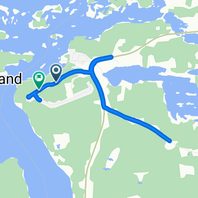
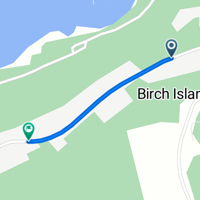
Campbell Street West 90, Little Current to Campbell Street West 90, Little Current
Una ruta en bici que comienza en Little Current, Ontario, Canadá.
Visión General
Sobre esta ruta
- 3 h 43 min
- Duración
- 45,5 km
- Distancia
- 293 m
- Ascenso
- 292 m
- Descenso
- 12,2 km/h
- Velocidad Media
- 324 m
- Altitud máxima

Continuar con Bikemap
Usa, edita o descarga esta ruta en bici
¿Te gustaría recorrer Campbell Street West 90, Little Current to Campbell Street West 90, Little Current o personalizarla para tu propio viaje? Esto es lo que puedes hacer con esta ruta de Bikemap:
Funciones gratuitas
- Guarda esta ruta como favorita o en una colección
- Copia y planifica tu propia versión de esta ruta
- Sincroniza tu ruta con Garmin o Wahoo
Funciones Premium
Prueba gratuita de 3 días o pago único. Más información sobre Bikemap Premium.
- Navega esta ruta en iOS y Android
- Exporta un archivo GPX / KML de esta ruta
- Crea tu impresión personalizada (pruébala gratis)
- Descarga esta ruta para la navegación sin conexión
Descubre más funciones Premium.
Consigue Bikemap PremiumDe nuestra comunidad
Little Current: Otras rutas populares que empiezan aquí
 67–89 Limit St, Northeastern Manitoulin and the Islands to 67–89 Limit St, Northeastern Manitoulin and the Islands
- Distancia
- 20,6 km
- Ascenso
- 300 m
- Descenso
- 300 m
- Ubicación
- Little Current, Ontario, Canadá
 Rainbow Ridge Rd, Whitefish River (Part) 4 to Rainbow Ridge Rd, Whitefish River (Part) 4
- Distancia
- 6,4 km
- Ascenso
- 93 m
- Descenso
- 99 m
- Ubicación
- Little Current, Ontario, Canadá
 Rainbow Ridge Rd, Whitefish River (Part) 4 to Rainbow Ridge Rd, Whitefish River (Part) 4
- Distancia
- 8,4 km
- Ascenso
- 54 m
- Descenso
- 59 m
- Ubicación
- Little Current, Ontario, Canadá
 67–89 Limit St, Northeastern Manitoulin and the Islands to 10944 Highway 6, Northeastern Manitoulin and the Islands
- Distancia
- 20,5 km
- Ascenso
- 284 m
- Descenso
- 284 m
- Ubicación
- Little Current, Ontario, Canadá
 10901–10923 Highway 6, Northeastern Manitoulin and the Islands to 10846–10898 Highway 6, Northeastern Manitoulin and the Islands
- Distancia
- 20,4 km
- Ascenso
- 281 m
- Descenso
- 274 m
- Ubicación
- Little Current, Ontario, Canadá
 13 Blake St W, Northeastern Manitoulin and the Islands to 6 Blake St W, Northeastern Manitoulin and the Islands
- Distancia
- 15,5 km
- Ascenso
- 77 m
- Descenso
- 77 m
- Ubicación
- Little Current, Ontario, Canadá
 13 Blake St W, Northeastern Manitoulin and the Islands to 24 Blake St E, Northeastern Manitoulin and the Islands
- Distancia
- 17,5 km
- Ascenso
- 85 m
- Descenso
- 80 m
- Ubicación
- Little Current, Ontario, Canadá
 Rainbow Ridge Rd, Whitefish River (Part) 4 to Rainbow Ridge Rd, Whitefish River (Part) 4
- Distancia
- 0,8 km
- Ascenso
- 3 m
- Descenso
- 3 m
- Ubicación
- Little Current, Ontario, Canadá
Ábrela en la app