

Arthurs Creek
Una ruta en bici que comienza en Ashwood, Victoria, Australia.
Visión General
Sobre esta ruta
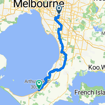
Arthurs Creek is a classic “rouler” ride taking in the hills of north east Melbourne. Consisting of two different loops this ride can be shortened, if needed. The first loop from Warrandyte passes Kangaroo Ground, Hurstbridge, Arthurs Creek & Panton Hill. The second loop around Panton Hill is via Watsons Creek & Smith’s Gully which includes the highest climb of the day; Clintons Rd. Although the climbs are not particular daunting rest assured that by days end you will know you have completed another gruelling 6am-er classic ride.
Ride Founder: Kevin "Murph" Murphy
- -:--
- Duración
- 109,7 km
- Distancia
- 812 m
- Ascenso
- 812 m
- Descenso
- ---
- Velocidad Media
- ---
- Altitud máxima

Continuar con Bikemap
Usa, edita o descarga esta ruta en bici
¿Te gustaría recorrer Arthurs Creek o personalizarla para tu propio viaje? Esto es lo que puedes hacer con esta ruta de Bikemap:
Funciones gratuitas
- Guarda esta ruta como favorita o en una colección
- Copia y planifica tu propia versión de esta ruta
- Divídelo en etapas para crear una excursión de varios días
- Sincroniza tu ruta con Garmin o Wahoo
Funciones Premium
Prueba gratuita de 3 días o pago único. Más información sobre Bikemap Premium.
- Navega esta ruta en iOS y Android
- Exporta un archivo GPX / KML de esta ruta
- Crea tu impresión personalizada (pruébala gratis)
- Descarga esta ruta para la navegación sin conexión
Descubre más funciones Premium.
Consigue Bikemap PremiumDe nuestra comunidad
Ashwood: Otras rutas populares que empiezan aquí
 Arthurs Seat
- Distancia
- 162,3 km
- Ascenso
- 618 m
- Descenso
- 618 m
- Ubicación
- Ashwood, Victoria, Australia
 Flat to Ferns
- Distancia
- 120,9 km
- Ascenso
- 864 m
- Descenso
- 864 m
- Ubicación
- Ashwood, Victoria, Australia
 Giro d'Italia
- Distancia
- 105,7 km
- Ascenso
- 1393 m
- Descenso
- 1393 m
- Ubicación
- Ashwood, Victoria, Australia
 The Drom
- Distancia
- 82,7 km
- Ascenso
- 532 m
- Descenso
- 633 m
- Ubicación
- Ashwood, Victoria, Australia
 Hurtbox Tuesday
- Distancia
- 49,8 km
- Ascenso
- 96 m
- Descenso
- 175 m
- Ubicación
- Ashwood, Victoria, Australia
 Kinglake
- Distancia
- 110,1 km
- Ascenso
- 1007 m
- Descenso
- 1008 m
- Ubicación
- Ashwood, Victoria, Australia
 Strengthies in the Nongs
- Distancia
- 95,2 km
- Ascenso
- 1285 m
- Descenso
- 1285 m
- Ubicación
- Ashwood, Victoria, Australia
 Ashburton, Cranbourne North, Seaford, Ashburton.
- Distancia
- 106,3 km
- Ascenso
- 505 m
- Descenso
- 482 m
- Ubicación
- Ashwood, Victoria, Australia
Ábrela en la app