

Ride Day 16—26 Sept 2005—11500 Quillan - Circle
Una ruta en bici que comienza en Quillan, Occitanie, Francia.
Visión General
Sobre esta ruta
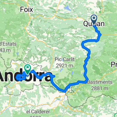
Como decidimos permanecer en Quillan dos noches y teníamos la esperanza de que el clima mejorara, comenzamos este recorrido circular con un cielo amenazante y felizmente sin alforjas.
El día resultó glorioso y la elección de carreteras de mi esposa fue extraordinaria. La D117, aunque tenía demasiado tráfico, estaba dentro de una hermosa garganta llamada Défilé de Pierre-Lys. La D107 subía en pendientes mayormente suaves a lo largo de un arroyo muy bonito y tenía prácticamente ningún tráfico. Los paisajes y vistas mientras subíamos lentamente al Plateau de Sault también eran excepcionales. Y realmente había un área plana que justificaba que se llamara un plateau. El regreso de nuestro punto más alto de 896 m a lo largo de la D613 y la D117 tuvo muchas vistas espectaculares del valle de Quillan y sus montañas circundantes. El descenso por la D117 que hicimos en condiciones relativamente oscuras y lluviosas ayer fue un verdadero placer hoy.
Antecedentes:
Mi esposa y yo hemos realizado tours autoguiados en Europa Occidental (la mayoría en Francia) desde 1993. Esta serie de paseos cubre nuestra ruta de 2 meses en 2005 a través de partes de Francia. Nuestro punto de inicio y final se encuentra cerca de Chaduri (al sur de Angoulême), donde nuestros amigos tienen una granja con Gîtes y Chambres d'Hôtes.
Montamos nuestras bicicletas de turismo Dawes compradas en 1993, cargadas con neumáticos de 700Cx32. Todos nuestros paseos fueron por caminos pavimentados, en su mayoría con muy poco tráfico.
Si hay alguna pregunta, no dude en enviarme un correo electrónico a jeffkadet@netdiving.com.
Jeff
- -:--
- Duración
- 60,1 km
- Distancia
- 747 m
- Ascenso
- 748 m
- Descenso
- ---
- Velocidad Media
- ---
- Altitud máxima

Continuar con Bikemap
Usa, edita o descarga esta ruta en bici
¿Te gustaría recorrer Ride Day 16—26 Sept 2005—11500 Quillan - Circle o personalizarla para tu propio viaje? Esto es lo que puedes hacer con esta ruta de Bikemap:
Funciones gratuitas
- Guarda esta ruta como favorita o en una colección
- Copia y planifica tu propia versión de esta ruta
- Sincroniza tu ruta con Garmin o Wahoo
Funciones Premium
Prueba gratuita de 3 días o pago único. Más información sobre Bikemap Premium.
- Navega esta ruta en iOS y Android
- Exporta un archivo GPX / KML de esta ruta
- Crea tu impresión personalizada (pruébala gratis)
- Descarga esta ruta para la navegación sin conexión
Descubre más funciones Premium.
Consigue Bikemap PremiumDe nuestra comunidad
Quillan: Otras rutas populares que empiezan aquí
 2009 Entre-deux-mers - 2
- Distancia
- 259,7 km
- Ascenso
- 79 m
- Descenso
- 328 m
- Ubicación
- Quillan, Occitanie, Francia
 Quillan - Grandvalira Sector Carrillo
- Distancia
- 191,1 km
- Ascenso
- 4499 m
- Descenso
- 2756 m
- Ubicación
- Quillan, Occitanie, Francia
 Stage 4 - Cent Cols
- Distancia
- 118,6 km
- Ascenso
- 2625 m
- Descenso
- 2439 m
- Ubicación
- Quillan, Occitanie, Francia
 VTT Pyrénées - circuit n°22
- Distancia
- 29,8 km
- Ascenso
- 584 m
- Descenso
- 584 m
- Ubicación
- Quillan, Occitanie, Francia
 Col de Jau
- Distancia
- 100,8 km
- Ascenso
- 2279 m
- Descenso
- 2279 m
- Ubicación
- Quillan, Occitanie, Francia
 etapa 2 - R
- Distancia
- 142,7 km
- Ascenso
- 2047 m
- Descenso
- 1940 m
- Ubicación
- Quillan, Occitanie, Francia
 MBLEspinetQuillan
- Distancia
- 21,1 km
- Ascenso
- 558 m
- Descenso
- 556 m
- Ubicación
- Quillan, Occitanie, Francia
 AAA Pyrenäen 2
- Distancia
- 94 km
- Ascenso
- 2426 m
- Descenso
- 2735 m
- Ubicación
- Quillan, Occitanie, Francia
Ábrela en la app