

Ride Day 30—11 Oct 2005—48210 St-Chely du Tarn/Sainte Énimie — Circle
Una ruta en bici que comienza en Chanac, Occitanie, Francia.
Visión General
Sobre esta ruta
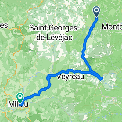
Mi esposa había planeado una gran ruta de más de 100 kilómetros. Sin embargo, con el relativamente oscuro cielo nublado, la ocasional gota de lluvia y el fuerte viento frío que nos mantenía abrigados, incluso en las dos largas subidas de nuestro viaje, ella la redujo considerablemente. Como era de esperar, el sol realmente apareció justo cuando regresamos a St Chély-du-Tarn al final del viaje. ¿Qué más hay de nuevo? Las cosas importantes, sin embargo, son que no nos empapamos y que tuvimos un gran paseo. Desde Ste Énimie, subimos al plateau desde el Tarn y nos dirigimos hacia el noroeste a través del plateau para llegar a Chanac. En el camino hacia el plateau, tuvimos vistas espectaculares que dominaban Ste Énimie. Encontramos que Chanac es un pueblo particularmente bonito que sería un gran lugar para quedarse. También tenía una de las iglesias pequeñas más bonitas que he visto. Debería añadir que Chanac está a orillas del río Lot. Descendimos varios cientos de metros desde el plateau para llegar hasta allí... lo que, por supuesto, significaba que teníamos que volver a subir al plateau para regresar a las Gorges du Tarn y nuestro hotel. En la D998, justo antes del largo descenso a Ste Énimie, había un bonito hotel pequeño en un punto panorámico que era simplemente increíble. La vista se extendía por millas arriba y abajo del desfiladero, mostrando muchas curvas del río y las paredes de roca. A partir de la pintura en la carretera, el Tour de Francia había pasado recientemente por la D32 hacia Chanac. En un momento, vimos declaraciones pintadas contradictorias sobre Armstrong. Una decía aproximadamente que usa drogas y que los oficiales del Tour lo pasan por alto debido al dinero. La otra apoyaba a Armstrong y se refería a sus diez años de arduo trabajo entrenando para el Tour. Antecedentes: Mi esposa y yo hemos estado haciendo recorridos autoguiados en Europa Occidental (la mayoría en Francia) desde 1993. Esta serie de paseos cubre nuestra ruta de dos meses de 2005 a través de partes de Francia. Nuestro punto de inicio y final está cerca de Chaduri (al sur de Angoulême) donde nuestros amigos tienen una granja con Gites y Chambres d'Hotes. Montamos nuestras bicicletas de touring Dawes compradas en 1993, pesadamente cargadas con neumáticos 700Cx32. Todo nuestro recorrido fue por carreteras asfaltadas, principalmente con muy poco tráfico. Si tienes alguna pregunta, no dudes en enviarme un correo electrónico a jeffkadet@netdiving.com. Jeff
- -:--
- Duración
- 58 km
- Distancia
- 951 m
- Ascenso
- 951 m
- Descenso
- ---
- Velocidad Media
- ---
- Altitud máxima

Calidad de la ruta
Tipos de vía y superficies a lo largo de la ruta
Tipos de vía
Carretera tranquila
1,2 km
(2 %)
Sin definir
56,8 km
(98 %)
Superficies
Pavimentado
47 km
(81 %)
Asfalto
47 km
(81 %)
Sin definir
11 km
(19 %)
Continuar con Bikemap
Usa, edita o descarga esta ruta en bici
¿Te gustaría recorrer Ride Day 30—11 Oct 2005—48210 St-Chely du Tarn/Sainte Énimie — Circle o personalizarla para tu propio viaje? Esto es lo que puedes hacer con esta ruta de Bikemap:
Funciones gratuitas
- Guarda esta ruta como favorita o en una colección
- Copia y planifica tu propia versión de esta ruta
- Sincroniza tu ruta con Garmin o Wahoo
Funciones Premium
Prueba gratuita de 3 días o pago único. Más información sobre Bikemap Premium.
- Navega esta ruta en iOS y Android
- Exporta un archivo GPX / KML de esta ruta
- Crea tu impresión personalizada (pruébala gratis)
- Descarga esta ruta para la navegación sin conexión
Descubre más funciones Premium.
Consigue Bikemap PremiumDe nuestra comunidad
Chanac: Otras rutas populares que empiezan aquí
 1999 Radlour am Tarn
- Distancia
- 90,3 km
- Ascenso
- 1143 m
- Descenso
- 1115 m
- Ubicación
- Chanac, Occitanie, Francia
 Ste. Enimie - Millau (Causse Route nr. 159)
- Distancia
- 76,7 km
- Ascenso
- 1119 m
- Descenso
- 1262 m
- Ubicación
- Chanac, Occitanie, Francia
 F120-2024-Chanac-Saint Emine-La Malene-Chanac
- Distancia
- 61,1 km
- Ascenso
- 2248 m
- Descenso
- 2255 m
- Ubicación
- Chanac, Occitanie, Francia
 F122-2024-Chanac-Florac-Les Vignes-La Malene-Chanac
- Distancia
- 118,7 km
- Ascenso
- 3462 m
- Descenso
- 3474 m
- Ubicación
- Chanac, Occitanie, Francia
 F123-2024-Chanac-Correjac-Le Balmes-Chanac
- Distancia
- 42,9 km
- Ascenso
- 1243 m
- Descenso
- 1244 m
- Ubicación
- Chanac, Occitanie, Francia
 F124-2024-Chanac-Einrollen-Trekking
- Distancia
- 58,7 km
- Ascenso
- 1670 m
- Descenso
- 1670 m
- Ubicación
- Chanac, Occitanie, Francia
 Tarnroute (Nr. 160) Ste. Enemie- Millau
- Distancia
- 55,4 km
- Ascenso
- 318 m
- Descenso
- 436 m
- Ubicación
- Chanac, Occitanie, Francia
 F125-2024-Chanac-La Tieule-Chanac
- Distancia
- 65,1 km
- Ascenso
- 1794 m
- Descenso
- 1798 m
- Ubicación
- Chanac, Occitanie, Francia
Ábrela en la app