

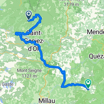
Ride Day 32—13 Oct 2005—48260 Recoules D'Aubrac (Nasbinals) to 15300 Murat
Una ruta en bici que comienza en Laguiole, Occitanie, Francia.
Visión General
Sobre esta ruta
Un poco de lluvia debe caer en cada vida. Poco después de comenzar en la fresca mañana, nos pusimos los pantalones de lluvia y cubrebotas debido a una lluvia ligera. Aunque nunca fue muy fuerte, fue más que ligera y continuó de manera constante durante varias horas. La parte más difícil fue el descenso desde unos 1050 m por la D13 y la D989 hasta Chaudes-Aigues a unos 750 m. Afortunadamente, mientras subíamos de nuevo al nivel de más de 1000 m al norte de Chaudes-Aigues, la lluvia disminuyó ... y hasta pudimos ver nuestras sombras cuando estábamos en la D16. No esperábamos un final tan agradable para el día. Como punto final, dejamos el departamento de Lozère y entramos en el departamento de Cantal justo antes de entrar en St Urcize. Esto también significó que pasamos de la región de Languedoc-Rosellón a la región de Auvernia. Excelentes carreteras con poco tráfico. Antecedentes: Mi esposa y yo hacemos recorridos autoorganizados en Europa Occidental (mayormente en Francia) desde 1993. Esta serie de paseos cubre nuestra ruta de dos meses de 2005 por partes de Francia. Nuestro punto de partida y llegada está cerca de Chaduri (al sur de Angoulême) donde nuestros amigos tienen una granja con gîtes y chambres d'hôtes. Montamos nuestras bicicletas touring Dawes, compradas en 1993, muy cargadas con neumáticos 700Cx32. Todo nuestro recorrido fue por carreteras asfaltadas con muy poco tráfico en su mayoría. Si tienen alguna pregunta, no duden en enviarme un correo electrónico a jeffkadet@netdiving.com Jeff
- -:--
- Duración
- 67,6 km
- Distancia
- 587 m
- Ascenso
- 757 m
- Descenso
- ---
- Velocidad Media
- ---
- Altitud máxima

Continuar con Bikemap
Usa, edita o descarga esta ruta en bici
¿Te gustaría recorrer Ride Day 32—13 Oct 2005—48260 Recoules D'Aubrac (Nasbinals) to 15300 Murat o personalizarla para tu propio viaje? Esto es lo que puedes hacer con esta ruta de Bikemap:
Funciones gratuitas
- Guarda esta ruta como favorita o en una colección
- Copia y planifica tu propia versión de esta ruta
- Sincroniza tu ruta con Garmin o Wahoo
Funciones Premium
Prueba gratuita de 3 días o pago único. Más información sobre Bikemap Premium.
- Navega esta ruta en iOS y Android
- Exporta un archivo GPX / KML de esta ruta
- Crea tu impresión personalizada (pruébala gratis)
- Descarga esta ruta para la navegación sin conexión
Descubre más funciones Premium.
Consigue Bikemap PremiumDe nuestra comunidad
Laguiole: Otras rutas populares que empiezan aquí
 09-MassifCentral
- Distancia
- 60,8 km
- Ascenso
- 509 m
- Descenso
- 1057 m
- Ubicación
- Laguiole, Occitanie, Francia
 JATIENZA2
- Distancia
- 44,1 km
- Ascenso
- 860 m
- Descenso
- 858 m
- Ubicación
- Laguiole, Occitanie, Francia
 Nasbidaniel1
- Distancia
- 53,4 km
- Ascenso
- 964 m
- Descenso
- 964 m
- Ubicación
- Laguiole, Occitanie, Francia
 étape 5
- Distancia
- 105 km
- Ascenso
- 1228 m
- Descenso
- 1265 m
- Ubicación
- Laguiole, Occitanie, Francia
 Aveyron-Tag1--4-0719 Runde angepasst
- Distancia
- 142,3 km
- Ascenso
- 1759 m
- Descenso
- 1875 m
- Ubicación
- Laguiole, Occitanie, Francia
 7.etapa St Chely d Aubrac - Le Malzieu-Ville
- Distancia
- 80,6 km
- Ascenso
- 934 m
- Descenso
- 877 m
- Ubicación
- Laguiole, Occitanie, Francia
 Route de Sainte-Urcize 21, Nasbinals nach Avenue Albert Thomas 23, Capdenac-Gare
- Distancia
- 114 km
- Ascenso
- 2345 m
- Descenso
- 3338 m
- Ubicación
- Laguiole, Occitanie, Francia
 2014 Ride Day 99 - St-Chély-d'Aubrac to Marvejols
- Distancia
- 44,7 km
- Ascenso
- 673 m
- Descenso
- 856 m
- Ubicación
- Laguiole, Occitanie, Francia
Ábrela en la app