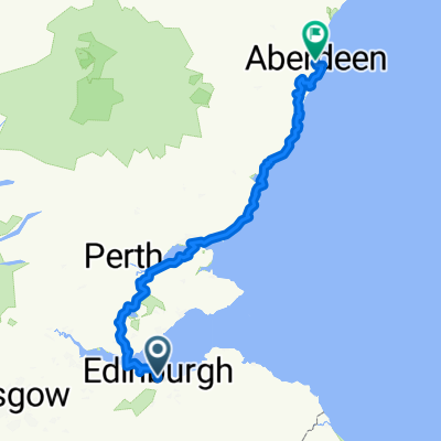
St MargaretsWay-Edinburgh to South Queensferry
Una ruta en bici que comienza en Edinburgh, Scotland, United Kingdom.
Visión General
Sobre esta ruta
Quiet roads and bike tracks out of Edinburgh past famous historical landmarks to the famous Forth Road Bridge.
Starting at Eduardo Paolozzi's giant foot at the top of Leith Walk by St Mary's RC cathedral, then down a street of pubs and along Rocheid Path by the Waters of Leith this Way links up with the former railway line out of Edinburgh,now National Bike Route 1,over the historic Cramond Brig, through Dalmeny Estate to South Queensferry. Great views of the Forth Bridges and Fife coast.
Don't miss the famous secret garden along the Rocheid path.
This is the 1st section of St Margarets Way, the great 100km pilgrimage trail from Edinburgh to St Andrews, part of the revival of the 1000 year old pilgrimage, The Way of St Andrews.(http://www.thewayofstandrews.com)
- -:--
- Duración
- 20,1 km
- Distancia
- 171 m
- Ascenso
- 203 m
- Descenso
- ---
- Velocidad Media
- ---
- Altitud máxima
Destacados de la ruta
Puntos de interés a lo largo de la ruta
Punto de interés después de 10,3 km
Joins John Muir Way
Continuar con Bikemap
Usa, edita o descarga esta ruta en bici
¿Te gustaría recorrer St MargaretsWay-Edinburgh to South Queensferry o personalizarla para tu propio viaje? Esto es lo que puedes hacer con esta ruta de Bikemap:
Funciones gratuitas
- Guarda esta ruta como favorita o en una colección
- Copia y planifica tu propia versión de esta ruta
- Sincroniza tu ruta con Garmin o Wahoo
Funciones Premium
Prueba gratuita de 3 días o pago único. Más información sobre Bikemap Premium.
- Navega esta ruta en iOS y Android
- Exporta un archivo GPX / KML de esta ruta
- Crea tu impresión personalizada (pruébala gratis)
- Descarga esta ruta para la navegación sin conexión
Descubre más funciones Premium.
Consigue Bikemap PremiumDe nuestra comunidad
Edinburgh: Otras rutas populares que empiezan aquí
 Edinburgh-Rosewell Route
- Distancia
- 33,4 km
- Ascenso
- 331 m
- Descenso
- 331 m
- Ubicación
- Edinburgh, Scotland, United Kingdom
 Meadows - Roslin - Gladhouse Reservoir - Crichton - Cousland - NCN1
- Distancia
- 73,7 km
- Ascenso
- 457 m
- Descenso
- 457 m
- Ubicación
- Edinburgh, Scotland, United Kingdom
 training Edinburgh
- Distancia
- 22,7 km
- Ascenso
- 227 m
- Descenso
- 227 m
- Ubicación
- Edinburgh, Scotland, United Kingdom
 Scotland on the road
- Distancia
- 967,8 km
- Ascenso
- 1412 m
- Descenso
- 1472 m
- Ubicación
- Edinburgh, Scotland, United Kingdom
 Bangholm BSi route
- Distancia
- 4,2 km
- Ascenso
- 11 m
- Descenso
- 10 m
- Ubicación
- Edinburgh, Scotland, United Kingdom
 100k april 2025
- Distancia
- 92,8 km
- Ascenso
- 780 m
- Descenso
- 763 m
- Ubicación
- Edinburgh, Scotland, United Kingdom
 Route to Tynecastle High School
- Distancia
- 18 km
- Ascenso
- 138 m
- Descenso
- 138 m
- Ubicación
- Edinburgh, Scotland, United Kingdom
 Sco03 Edinburgh-Aberdeen
- Distancia
- 254,7 km
- Ascenso
- 1169 m
- Descenso
- 1226 m
- Ubicación
- Edinburgh, Scotland, United Kingdom
Ábrela en la app


