Hope to Sunshine Valley
Una ruta en bici que comienza en Hope, Columbia Británica, Canadá.
Visión General
Sobre esta ruta
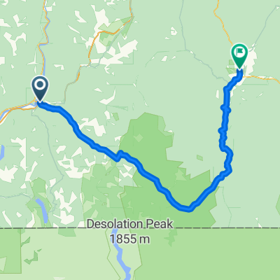
Este fue un paseo muy lento, ya que, aparte de los últimos uno o dos kilómetros, fue casi todo cuesta arriba bajo la lluvia. Salir de Hope fue un ascenso en una carretera muy transitada, que combina las carreteras 5 y 3 de BC (y tal vez también la carretera nacional 1). Finalmente, después de unos kilómetros, salimos de la carretera principal hacia la carretera 3 y nos alegramos mucho de ver un nivel de tráfico mucho más bajo. (Todavía había más tráfico y ruido del que nos hubiera gustado, pero en comparación, fue mucho mejor). A lo largo de todo el recorrido de hoy, había un buen arcén, aunque a veces en la parte final de la subida, el arcén podría haber sido un poco más ancho. Debido a las nubes bajas, no pudimos ver mucho del paisaje, pero lo que pudimos ver fue maravilloso.
- 3 h 39 min
- Duración
- 23,5 km
- Distancia
- 944 m
- Ascenso
- 307 m
- Descenso
- 6,4 km/h
- Velocidad Media
- 731 m
- Altitud máxima
Fotos de la ruta
Continuar con Bikemap
Usa, edita o descarga esta ruta en bici
¿Te gustaría recorrer Hope to Sunshine Valley o personalizarla para tu propio viaje? Esto es lo que puedes hacer con esta ruta de Bikemap:
Funciones gratuitas
- Guarda esta ruta como favorita o en una colección
- Copia y planifica tu propia versión de esta ruta
- Sincroniza tu ruta con Garmin o Wahoo
Funciones Premium
Prueba gratuita de 3 días o pago único. Más información sobre Bikemap Premium.
- Navega esta ruta en iOS y Android
- Exporta un archivo GPX / KML de esta ruta
- Crea tu impresión personalizada (pruébala gratis)
- Descarga esta ruta para la navegación sin conexión
Descubre más funciones Premium.
Consigue Bikemap PremiumDe nuestra comunidad
Hope: Otras rutas populares que empiezan aquí
 Canada by Bike: Hope - Princeton
- Distancia
- 132,8 km
- Ascenso
- 1774 m
- Descenso
- 1196 m
- Ubicación
- Hope, Columbia Británica, Canadá
 TBC day 11. Hope to Vancouver
- Distancia
- 162,7 km
- Ascenso
- 732 m
- Descenso
- 726 m
- Ubicación
- Hope, Columbia Británica, Canadá
 Hope to Manning Park
- Distancia
- 66,5 km
- Ascenso
- 1546 m
- Descenso
- 376 m
- Ubicación
- Hope, Columbia Británica, Canadá
 Hope to Sunshine Valley
- Distancia
- 23,5 km
- Ascenso
- 944 m
- Descenso
- 307 m
- Ubicación
- Hope, Columbia Británica, Canadá
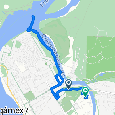
 740 River Parade, Hope to 800 Kawkawa Lake Rd, Hope
- Distancia
- 6,4 km
- Ascenso
- 50 m
- Descenso
- 49 m
- Ubicación
- Hope, Columbia Británica, Canadá
 Hope Manning
- Distancia
- 147,5 km
- Ascenso
- 1942 m
- Descenso
- 1284 m
- Ubicación
- Hope, Columbia Británica, Canadá
 Home to Othello Tunnels
- Distancia
- 18,2 km
- Ascenso
- 226 m
- Descenso
- 226 m
- Ubicación
- Hope, Columbia Británica, Canadá
 Hope Othello Nicola Valley Trail vom 29. September, 10:31
- Distancia
- 6,3 km
- Ascenso
- 343 m
- Descenso
- 343 m
- Ubicación
- Hope, Columbia Británica, Canadá
Ábrela en la app


