

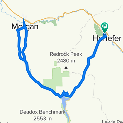
CROYDON DEATH LOOP
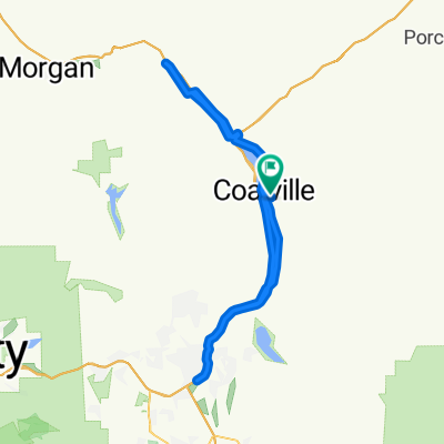
Una ruta en bici que comienza en Coalville, Utah, Estados Unidos.
Visión General
Sobre esta ruta
Una ruta corta pero moderada para ciclismo con diversidad interesante. Aproximadamente 11 millas con una ganancia de elevación de alrededor de 650 pies.
ADVERTENCIA: APROXIMADAMENTE 1.5 MILLAS DE ESTA RUTA ESTÁ EN I-15. ES TU RESPONSABILIDAD INVESTIGAR UNA BUENA EXPLICACIÓN (PARA CUALQUIER POLICÍA DEL ESTADO DE UTAH) SOBRE POR QUÉ ESTO ES LEGAL. Se recomienda realizar esta ruta en sentido horario para que la sección de la autopista sea en descenso.
No hay servicios en la ruta, ni siquiera en Henefer. Podría haber algunos lugares donde puedas encontrar agua de zanjas si es necesario, pero nada seguro para beber.
Tu viaje puede extenderse agregando un tramo de ida y vuelta desde Croydon hacia el embalse de Lost Creek.
- -:--
- Duración
- 17,3 km
- Distancia
- ---
- Ascenso
- ---
- Descenso
- ---
- Velocidad Media
- ---
- Altitud máxima

Continuar con Bikemap
Usa, edita o descarga esta ruta en bici
¿Te gustaría recorrer CROYDON DEATH LOOP o personalizarla para tu propio viaje? Esto es lo que puedes hacer con esta ruta de Bikemap:
Funciones gratuitas
- Guarda esta ruta como favorita o en una colección
- Copia y planifica tu propia versión de esta ruta
- Sincroniza tu ruta con Garmin o Wahoo
Funciones Premium
Prueba gratuita de 3 días o pago único. Más información sobre Bikemap Premium.
- Navega esta ruta en iOS y Android
- Exporta un archivo GPX / KML de esta ruta
- Crea tu impresión personalizada (pruébala gratis)
- Descarga esta ruta para la navegación sin conexión
Descubre más funciones Premium.
Consigue Bikemap PremiumDe nuestra comunidad
Coalville: Otras rutas populares que empiezan aquí
 Pioneer Drive to Pioneer Drive
- Distancia
- 96,6 km
- Ascenso
- 542 m
- Descenso
- 522 m
- Ubicación
- Coalville, Utah, Estados Unidos
 23 S Main St, Coalville to 98 N Main St, Coalville
- Distancia
- 0,3 km
- Ascenso
- 0 m
- Descenso
- 0 m
- Ubicación
- Coalville, Utah, Estados Unidos
 Browns Cyn - Echo Res.
- Distancia
- 88,3 km
- Ascenso
- 788 m
- Descenso
- 709 m
- Ubicación
- Coalville, Utah, Estados Unidos
 North Uinta
- Distancia
- 297,4 km
- Ascenso
- 2692 m
- Descenso
- 2770 m
- Ubicación
- Coalville, Utah, Estados Unidos
 Wanship to Echo
- Distancia
- 19,9 km
- Ascenso
- 110 m
- Descenso
- 24 m
- Ubicación
- Coalville, Utah, Estados Unidos
 Coalville Cycling
- Distancia
- 68,6 km
- Ascenso
- 1395 m
- Descenso
- 1127 m
- Ubicación
- Coalville, Utah, Estados Unidos
 Pioneer Drive to Pioneer Drive
- Distancia
- 34 km
- Ascenso
- 219 m
- Descenso
- 204 m
- Ubicación
- Coalville, Utah, Estados Unidos
 Wanship-Kamas Valley
- Distancia
- 72,6 km
- Ascenso
- 347 m
- Descenso
- 362 m
- Ubicación
- Coalville, Utah, Estados Unidos
Ábrela en la app