

Montpeyroux - Circle through Gorges-de-l'Hérault and St-Jean-de-Buèges
Una ruta en bici que comienza en Montpeyroux, Occitanie, Francia.
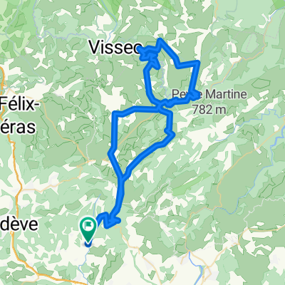
Visión General
Sobre esta ruta
Esta fue una ruta muy desafiante. No por andar a través de las Gorges-de-l'Hérault, sino más bien por los 15 a 20 kilómetros a lo largo de la D122. Tenía algunas subidas muy empinadas, y prácticamente toda la carretera era de un solo carril, ocasionalmente un poco rocosa y en mal estado. Hicimos esta ruta a finales de octubre de 2024; esperemos que eventualmente se repavimente.
Si estás preparado para la D122, disfrutarás del paisaje y el desafío. Gran recorrido en general.
Tuvimos muy poco o ningún tráfico en todas las carreteras. Como era a finales de octubre, había muy pocos visitantes en las Gorges. Probablemente esta parte de la ruta tendría mucho más tráfico durante el verano.
- 4 h 45 min
- Duración
- 51,4 km
- Distancia
- 969 m
- Ascenso
- 979 m
- Descenso
- 10,8 km/h
- Velocidad Media
- 563 m
- Altitud máxima

Fotos de la ruta


Calidad de la ruta
Tipos de vía y superficies a lo largo de la ruta
Tipos de vía
Carretera
30,8 km
(60 %)
Carretera tranquila
0,5 km
(1 %)
Sin definir
20 km
(39 %)
Superficies
Pavimentado
22,1 km
(43 %)
Asfalto
22,1 km
(43 %)
Sin definir
29,3 km
(57 %)
Continuar con Bikemap
Usa, edita o descarga esta ruta en bici
¿Te gustaría recorrer Montpeyroux - Circle through Gorges-de-l'Hérault and St-Jean-de-Buèges o personalizarla para tu propio viaje? Esto es lo que puedes hacer con esta ruta de Bikemap:
Funciones gratuitas
- Guarda esta ruta como favorita o en una colección
- Copia y planifica tu propia versión de esta ruta
- Sincroniza tu ruta con Garmin o Wahoo
Funciones Premium
Prueba gratuita de 3 días o pago único. Más información sobre Bikemap Premium.
- Navega esta ruta en iOS y Android
- Exporta un archivo GPX / KML de esta ruta
- Crea tu impresión personalizada (pruébala gratis)
- Descarga esta ruta para la navegación sin conexión
Descubre más funciones Premium.
Consigue Bikemap PremiumDe nuestra comunidad
Montpeyroux: Otras rutas populares que empiezan aquí
 Mont Saint Baudille 2023
- Distancia
- 60 km
- Ascenso
- 1790 m
- Descenso
- 1790 m
- Ubicación
- Montpeyroux, Occitanie, Francia
 La Bueges
- Distancia
- 54,3 km
- Ascenso
- 783 m
- Descenso
- 783 m
- Ubicación
- Montpeyroux, Occitanie, Francia
 MUC Cyclo-Portée du 4 juin 2014
- Distancia
- 68,1 km
- Ascenso
- 987 m
- Descenso
- 987 m
- Ubicación
- Montpeyroux, Occitanie, Francia
 Montpeyroux to Lodève
- Distancia
- 24,3 km
- Ascenso
- 172 m
- Descenso
- 181 m
- Ubicación
- Montpeyroux, Occitanie, Francia
 GIGNAC CIRQUE VISSEC
- Distancia
- 93,7 km
- Ascenso
- 1472 m
- Descenso
- 1461 m
- Ubicación
- Montpeyroux, Occitanie, Francia
 Cirque Navacelles 2
- Distancia
- 89,5 km
- Ascenso
- 1540 m
- Descenso
- 1543 m
- Ubicación
- Montpeyroux, Occitanie, Francia
![[Terres Rouges] Descenso du Ruffles. ¡Espectacular!](https://media.bikemap.net/routes/11495871/staticmaps/in_3abb83c1-d439-45c9-aa9d-eb66077f5791_400x400_bikemap-2021-3D-static.png) [Terres Rouges] Descenso du Ruffles. ¡Espectacular!
[Terres Rouges] Descenso du Ruffles. ¡Espectacular!- Distancia
- 22,2 km
- Ascenso
- 1136 m
- Descenso
- 1139 m
- Ubicación
- Montpeyroux, Occitanie, Francia
 2014; route 7Abis naar Gignac (alternatief)
- Distancia
- 4,4 km
- Ascenso
- 25 m
- Descenso
- 79 m
- Ubicación
- Montpeyroux, Occitanie, Francia
Ábrela en la app