Day 6 | Side Trip to Ski Jump Planica
Una ruta en bici que comienza en Kranjska Gora, Kranjska Gora, Slovenia.
Visión General
Sobre esta ruta
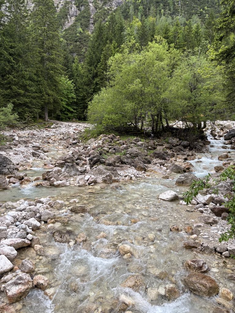
Planica is an alpine valley in northwestern Slovenia, extending south from the border village of Rateče, not far from another well-known ski resort, Kranjska Gora. Further south, the valley extends into the Tamar Valley, a popular hiking destination in Triglav National Park. Planica is famous for ski jumping. The first ski jumping hill was constructed before 1930 at the slope of Mount Ponca. In 1934, Stanko Bloudek built a larger hill, known as the "Bloudek Giant". The first ski jump over 100 m was achieved here in 1936 by the Austrian Sepp Bradl. At the time, this was the biggest jumping hill in the world, sometimes called "the mother of all jumping hills. In 1969, a new K-185 hill, Letalnica bratov Gorišek, was built by Lado and Janez Gorišek. Between 1985, when Matti Nykänen flew 191 m, and 2011, new world records have always been set at Planica rather than any other ski jumping hill (e.g., Kulm in Austria, Harrachov in the Czech Republic, Oberstdorf in Germany, or Vikersundbakken in Norway). After its 2010 rebuilding, Vikersundbakken is the biggest hill in the world, and the current world record is set there. In 1994, Toni Nieminen of Finland was the first ski jumper in history to jump over 200 m. The hill record is 239 m, set by Bjørn Einar Romøren of Norway in March 2005, which at the time was a world record. The ski jumping infrastructure was recently completely renovated and the old K-130 hill was rebuilt. Last year the works on the K-185 hill have been completed, making it the biggest ski jumping hill in the world once again. By now all the hills have been completed.
- -:--
- Duración
- 13,6 km
- Distancia
- 232 m
- Ascenso
- 233 m
- Descenso
- ---
- Velocidad Media
- 941 m
- Altitud máxima
Continuar con Bikemap
Usa, edita o descarga esta ruta en bici
¿Te gustaría recorrer Day 6 | Side Trip to Ski Jump Planica o personalizarla para tu propio viaje? Esto es lo que puedes hacer con esta ruta de Bikemap:
Funciones gratuitas
- Guarda esta ruta como favorita o en una colección
- Copia y planifica tu propia versión de esta ruta
- Sincroniza tu ruta con Garmin o Wahoo
Funciones Premium
Prueba gratuita de 3 días o pago único. Más información sobre Bikemap Premium.
- Navega esta ruta en iOS y Android
- Exporta un archivo GPX / KML de esta ruta
- Crea tu impresión personalizada (pruébala gratis)
- Descarga esta ruta para la navegación sin conexión
Descubre más funciones Premium.
Consigue Bikemap PremiumDe nuestra comunidad
Kranjska Gora: Otras rutas populares que empiezan aquí
 Vitranška ulica 10b nach Via Laghi
- Distancia
- 10,8 km
- Ascenso
- 274 m
- Descenso
- 149 m
- Ubicación
- Kranjska Gora, Kranjska Gora, Slovenia
 Day 6 | Side Trip to Ski Jump Planica
- Distancia
- 13,6 km
- Ascenso
- 232 m
- Descenso
- 233 m
- Ubicación
- Kranjska Gora, Kranjska Gora, Slovenia
 Sella Nevea
- Distancia
- 97,2 km
- Ascenso
- 2361 m
- Descenso
- 2360 m
- Ubicación
- Kranjska Gora, Kranjska Gora, Slovenia
 Kranjska Gora - Bovec Etappe 1
- Distancia
- 13,9 km
- Ascenso
- 1137 m
- Descenso
- 368 m
- Ubicación
- Kranjska Gora, Kranjska Gora, Slovenia
 KrGora-Mangrt-Vršič-KrGora
- Distancia
- 109,6 km
- Ascenso
- 2673 m
- Descenso
- 2673 m
- Ubicación
- Kranjska Gora, Kranjska Gora, Slovenia
 Okruh z Trenty
- Distancia
- 111 km
- Ascenso
- 3684 m
- Descenso
- 3339 m
- Ubicación
- Kranjska Gora, Kranjska Gora, Slovenia
 Zoza 3.Tag VM Kranjska Gora - Dom na Vrsicu - Bohinj-
- Distancia
- 12,8 km
- Ascenso
- 1035 m
- Descenso
- 349 m
- Ubicación
- Kranjska Gora, Kranjska Gora, Slovenia
 TDL 2009 Tag 2 Var x
- Distancia
- 34,7 km
- Ascenso
- 1887 m
- Descenso
- 1961 m
- Ubicación
- Kranjska Gora, Kranjska Gora, Slovenia
Ábrela en la app


