
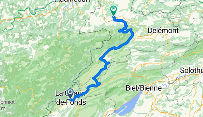
La Chaux-de-Fonds to Porrentruy
Una ruta en bici que comienza en La Chaux-de-Fonds, Neuchâtel, Suiza.
Visión General
Sobre esta ruta
- 4 h 55 min
- Duración
- 81,2 km
- Distancia
- 1431 m
- Ascenso
- 1997 m
- Descenso
- 16,5 km/h
- Velocidad Media
- 1248 m
- Altitud máxima

Fotos de la ruta

Calidad de la ruta
Tipos de vía y superficies a lo largo de la ruta
Tipos de vía
Carretera tranquila
52 km
(64 %)
Carretera
8,1 km
(10 %)
Superficies
Pavimentado
48,7 km
(60 %)
Sin pavimentar
3,2 km
(4 %)
Asfalto
41,4 km
(51 %)
Pavimentado (sin definir)
7,3 km
(9 %)
Destacados de la ruta
Puntos de interés a lo largo de la ruta
Punto de interés después de 19,7 km
Observatoire Astronomique de Mont-Soleil
Punto de interés después de 33,2 km
Etang de la Gruère
Punto de interés después de 35,8 km
Etang des Royes
Punto de interés después de 62,4 km
St-Ursanne
Punto de interés después de 62,4 km
Cloître
Punto de interés después de 62,5 km
Pont Saint-Jean The small town of St-Ursanne, which annually welcomes far more tourists than it has inhabitants, can be entered through three town gates. The entrance from the south over the bridge and through the Porte St-Jean is very impressive. A statue of St. John of Nepomuk, patron saint of all bridges, stands on one of the abutments. His many other «commitments» as patron saint of confessors, rafters, millers, priests and mariners may have led to the fact that not all bridges could be saved from destruction. A first bridge must have stood around 1440. It can be assumed that it was also built of wood, as was one known from an earlier 16th century depiction of the town. Chroniclers reported that the winter in 1670 was so cold that even the wine in the cellars froze. At that time the wooden bridge was destroyed by ice flowing down the Doubs. The bridge subsequently built in 1728/29 by master builder Brunet to plans by Advocate Humbert, was adorned by the figure of Nepomuk, who appears to gaze up river to the site of the former bridge.
Punto de interés después de 62,6 km
Viewpoint
Punto de interés después de 70,8 km
Col de la Croix
Continuar con Bikemap
Usa, edita o descarga esta ruta en bici
¿Te gustaría recorrer La Chaux-de-Fonds to Porrentruy o personalizarla para tu propio viaje? Esto es lo que puedes hacer con esta ruta de Bikemap:
Funciones gratuitas
- Guarda esta ruta como favorita o en una colección
- Copia y planifica tu propia versión de esta ruta
- Divídelo en etapas para crear una excursión de varios días
- Sincroniza tu ruta con Garmin o Wahoo
Funciones Premium
Prueba gratuita de 3 días o pago único. Más información sobre Bikemap Premium.
- Navega esta ruta en iOS y Android
- Exporta un archivo GPX / KML de esta ruta
- Crea tu impresión personalizada (pruébala gratis)
- Descarga esta ruta para la navegación sin conexión
Descubre más funciones Premium.
Consigue Bikemap PremiumDe nuestra comunidad
La Chaux-de-Fonds: Otras rutas populares que empiezan aquí
- La Chaux-de-Fonds to Porrentruy
- Distancia
- 81,2 km
- Ascenso
- 1431 m
- Descenso
- 1997 m
- Ubicación
- La Chaux-de-Fonds, Neuchâtel, Suiza
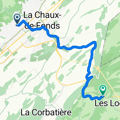 De Rue Combe-Grieurin à Route de la Vue-des-Alpes
- Distancia
- 9 km
- Ascenso
- 348 m
- Descenso
- 116 m
- Ubicación
- La Chaux-de-Fonds, Neuchâtel, Suiza
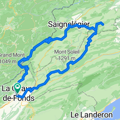
 La Chaux-de-Fonds - St Croix
- Distancia
- 111,5 km
- Ascenso
- 1316 m
- Descenso
- 1316 m
- Ubicación
- La Chaux-de-Fonds, Neuchâtel, Suiza
 2021 La Chaux-de-Fonds - Porrentruy
- Distancia
- 312 km
- Ascenso
- 495 m
- Descenso
- 1070 m
- Ubicación
- La Chaux-de-Fonds, Neuchâtel, Suiza
 Route in La Chaux-de-Fonds
- Distancia
- 90,8 km
- Ascenso
- 2563 m
- Descenso
- 2565 m
- Ubicación
- La Chaux-de-Fonds, Neuchâtel, Suiza
 La Chaux-de-Fonds - Tête-de-Ran
- Distancia
- 19,5 km
- Ascenso
- 597 m
- Descenso
- 597 m
- Ubicación
- La Chaux-de-Fonds, Neuchâtel, Suiza
 petite tour du matin
- Distancia
- 30,7 km
- Ascenso
- 1163 m
- Descenso
- 1156 m
- Ubicación
- La Chaux-de-Fonds, Neuchâtel, Suiza
 la Ferrière
- Distancia
- 28,7 km
- Ascenso
- 519 m
- Descenso
- 515 m
- Ubicación
- La Chaux-de-Fonds, Neuchâtel, Suiza
Ábrela en la app