
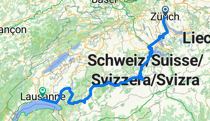
Lakes Route - Zurich to Lausanne
Una ruta en bici que comienza en Zürich (Kreis 6) / Oberstrass, Zúrich, Suiza.
Visión General
Sobre esta ruta
Más sobre la Lakes Route: https://www.cyclingthread.com/exploring-swiss-alps-cycling-lakes-route-in-switzerland La Lakes Route es una ruta ciclista de unos 500 kilómetros a través de una Suiza de postal, que conecta diez lagos y regiones pintorescas como Werdenberg, Lucerna al pie del monte Pilatus, Iseltwald en el lago Brienz, Gruyères y los viñedos de Lavaux sobre el lago de Ginebra. La versión descrita comienza en Zúrich y termina en Lausana, pasando por Zug, Lucerna, Meiringen, Interlaken, Spiez y Gstaad. Según Switzerland Mobility, la ruta mide aproximadamente 510 km y tiene un desnivel total de alrededor de 5900 m. Ofrece vistas espectaculares de lagos alpinos, pueblos encantadores y valles, por lo que es perfecta para un viaje de varios días. Muchos ciclistas planifican de 6 a 8 días para completarla, según el ritmo y las paradas. Su perfil exigente con subidas y bajadas la hace a la vez desafiante y gratificante. En definitiva, la Lakes Route es una aventura ciclista bien organizada y pintoresca que captura la variedad de paisajes suizos.
- 23 h 31 min
- Duración
- 341,3 km
- Distancia
- 5957 m
- Ascenso
- 5992 m
- Descenso
- 14,5 km/h
- Velocidad Media
- 1285 m
- Altitud máxima

Fotos de la ruta


Continuar con Bikemap
Usa, edita o descarga esta ruta en bici
¿Te gustaría recorrer Lakes Route - Zurich to Lausanne o personalizarla para tu propio viaje? Esto es lo que puedes hacer con esta ruta de Bikemap:
Funciones gratuitas
- Guarda esta ruta como favorita o en una colección
- Copia y planifica tu propia versión de esta ruta
- Divídelo en etapas para crear una excursión de varios días
- Sincroniza tu ruta con Garmin o Wahoo
Funciones Premium
Prueba gratuita de 3 días o pago único. Más información sobre Bikemap Premium.
- Navega esta ruta en iOS y Android
- Exporta un archivo GPX / KML de esta ruta
- Crea tu impresión personalizada (pruébala gratis)
- Descarga esta ruta para la navegación sin conexión
Descubre más funciones Premium.
Consigue Bikemap PremiumDe nuestra comunidad
Zürich (Kreis 6) / Oberstrass: Otras rutas populares que empiezan aquí
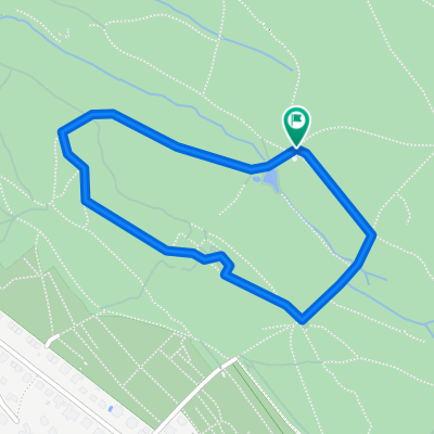 Bike-Parcour
- Distancia
- 1,4 km
- Ascenso
- 39 m
- Descenso
- 39 m
- Ubicación
- Zürich (Kreis 6) / Oberstrass, Zúrich, Suiza
 Ausfahrt durch Zürich
- Distancia
- 15,6 km
- Ascenso
- 283 m
- Descenso
- 311 m
- Ubicación
- Zürich (Kreis 6) / Oberstrass, Zúrich, Suiza
 tour - 00
- Distancia
- 38,1 km
- Ascenso
- 622 m
- Descenso
- 631 m
- Ubicación
- Zürich (Kreis 6) / Oberstrass, Zúrich, Suiza
 Runde über Lieli - Hedingen - Zürich
- Distancia
- 54 km
- Ascenso
- 647 m
- Descenso
- 644 m
- Ubicación
- Zürich (Kreis 6) / Oberstrass, Zúrich, Suiza
 ASVZ Donnerstagsrunde
- Distancia
- 45,9 km
- Ascenso
- 455 m
- Descenso
- 526 m
- Ubicación
- Zürich (Kreis 6) / Oberstrass, Zúrich, Suiza
 Greifenseerunde
- Distancia
- 45,6 km
- Ascenso
- 410 m
- Descenso
- 410 m
- Ubicación
- Zürich (Kreis 6) / Oberstrass, Zúrich, Suiza
 Day 1 - Zurich to Walenstadt
- Distancia
- 85,9 km
- Ascenso
- 194 m
- Descenso
- 226 m
- Ubicación
- Zürich (Kreis 6) / Oberstrass, Zúrich, Suiza
 Guillermos Sonntagsausfahrt
- Distancia
- 42,6 km
- Ascenso
- 517 m
- Descenso
- 513 m
- Ubicación
- Zürich (Kreis 6) / Oberstrass, Zúrich, Suiza
Ábrela en la app