
Malaga středa odpoledne
- 57,8 km
- 1175 m
- 1172 m
- Torremolinos, Andalucía, España
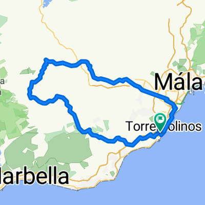
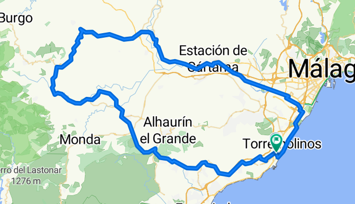
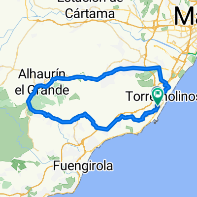
Una ruta en bici que comienza en Torremolinos, Andalucía, España.
Visión General
Nice and longer trip around valley called Hoya de Malaga. You will have adequate elevation and over 100 km including many possibilities to get refreshment.You start in city center following streets Marmoles / Martinez Maldonado / Avda. de Carlos Haya. When you see direction for University turn left and after 200 meters right. Follow street Navarro Ledesma leading out to Campanillas. In Campanillas take A-7054 to Estacion de Cartama. There you have to go over rail track to follow signs for Cartama / Coin, roads A-7057/A-7059 & A-355, later A-366. In Coin go through still following A-366 leading to Alozaina. You will get slow and sometimes invisible climb for any 20 km.Alozaina is located at the bottom of mountains Sierra Prieta and offers nice views and refreshment. Then keep on for Casarabonela / Zalea on road A 354. After 10 km turn right avoiding Casarabonela, directly to Zalea / Pizarra. You will descent to valley. Turn left over A-7077 and in front of Alora take ride for Pizarra. In Pizarra there are many rests to get food and drinks. Following road A-7054 through Aljaima and Estacion de Cartama you will come to Campanillas again. You can directly follow signs for Malaga or you can go back same way you started the trip. - Nice and longer trip around valley called Hoya de Malaga. You will have adequate elevation and over 100 km including many possibilities to get refreshment.You start in city center following streets Marmoles / Martinez Maldonado / Avda. de Carlos Haya. When you see direction for University turn left and after 200 meters right. Follow street Navarro Ledesma leading out to Campanillas. In Campanillas take A-7054 to Estacion de Cartama. There you have to go over rail track to follow signs for Cartama / Coin, roads A-7057/A-7059 & A-355, later A-366. In Coin go through still following A-366 leading to Alozaina. You will get slow and sometimes invisible climb for any 20 km.Alozaina is located at the bottom of mountains Sierra Prieta and offers nice views and refreshment. Then keep on for Casarabonela / Zalea on road A 354. After 10 km turn right avoiding Casarabonela, directly to Zalea / Pizarra. You will descent to valley. Turn left over A-7077 and in front of Alora take ride for Pizarra. In Pizarra there are many rests to get food and drinks. Following road A-7054 through Aljaima and Estacion de Cartama you will come to Campanillas again. You can directly follow signs for Malaga or you can go back same way you started the trip.
creado hace 4 meses
Calidad de la ruta
Carretera tranquila
25,2 km
(22 %)
Camino forestal
19,5 km
(17 %)
Pavimentado
42,4 km
(37 %)
Sin pavimentar
9,2 km
(8 %)
Asfalto
36,7 km
(32 %)
Pavimentado (sin definir)
5,7 km
(5 %)
Continuar con Bikemap
¿Te gustaría recorrer Malaga 1 o personalizarla para tu propio viaje? Esto es lo que puedes hacer con esta ruta de Bikemap:
Prueba gratuita de 3 días o pago único. Más información sobre Bikemap Premium.
Descubre más funciones Premium.
Consigue Bikemap PremiumDe nuestra comunidad
Ábrela en la app