
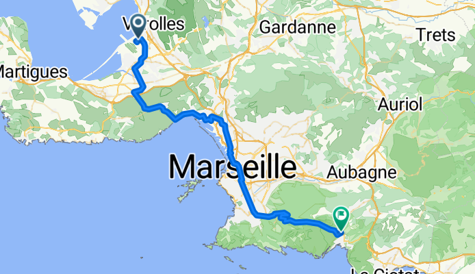
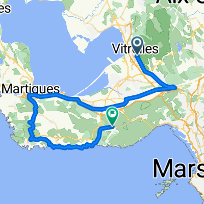
Flughafen Marseille - Cassis
Una ruta en bici que comienza en Vitrolles, Provenza-Alpes-Costa Azul, Francia.
Visión General
Sobre esta ruta
- Etapa de mi viaje a Francia '08
Aeropuerto
St. Victoret
Lauret
Le Rove
L'Estaque
Marseille
Valmante
Col de la Gineste
Cassis
- -:--
- Duración
- 53 km
- Distancia
- 616 m
- Ascenso
- 522 m
- Descenso
- ---
- Velocidad Media
- ---
- Altitud máxima

Continuar con Bikemap
Usa, edita o descarga esta ruta en bici
¿Te gustaría recorrer Flughafen Marseille - Cassis o personalizarla para tu propio viaje? Esto es lo que puedes hacer con esta ruta de Bikemap:
Funciones gratuitas
- Guarda esta ruta como favorita o en una colección
- Copia y planifica tu propia versión de esta ruta
- Sincroniza tu ruta con Garmin o Wahoo
Funciones Premium
Prueba gratuita de 3 días o pago único. Más información sobre Bikemap Premium.
- Navega esta ruta en iOS y Android
- Exporta un archivo GPX / KML de esta ruta
- Crea tu impresión personalizada (pruébala gratis)
- Descarga esta ruta para la navegación sin conexión
Descubre más funciones Premium.
Consigue Bikemap PremiumDe nuestra comunidad
Vitrolles: Otras rutas populares que empiezan aquí
 Etappe 27 Vitrolles - Giens
- Distancia
- 128,6 km
- Ascenso
- 1100 m
- Descenso
- 1105 m
- Ubicación
- Vitrolles, Provenza-Alpes-Costa Azul, Francia
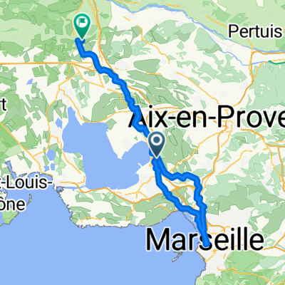 Vitrolles - Marseille 02
- Distancia
- 100,1 km
- Ascenso
- 1334 m
- Descenso
- 1347 m
- Ubicación
- Vitrolles, Provenza-Alpes-Costa Azul, Francia
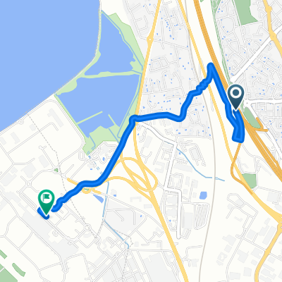 aeroport Marseille
- Distancia
- 3 km
- Ascenso
- 8 m
- Descenso
- 80 m
- Ubicación
- Vitrolles, Provenza-Alpes-Costa Azul, Francia
 Marseille to Romain
- Distancia
- 138,3 km
- Ascenso
- 1481 m
- Descenso
- 1267 m
- Ubicación
- Vitrolles, Provenza-Alpes-Costa Azul, Francia
 eyguiéres/lamanon
- Distancia
- 140,6 km
- Ascenso
- 661 m
- Descenso
- 648 m
- Ubicación
- Vitrolles, Provenza-Alpes-Costa Azul, Francia
 Mariagne-Niolon
- Distancia
- 57 km
- Ascenso
- 502 m
- Descenso
- 488 m
- Ubicación
- Vitrolles, Provenza-Alpes-Costa Azul, Francia
 210329_Vitroles_Redonne
- Distancia
- 58,6 km
- Ascenso
- 379 m
- Descenso
- 383 m
- Ubicación
- Vitrolles, Provenza-Alpes-Costa Azul, Francia
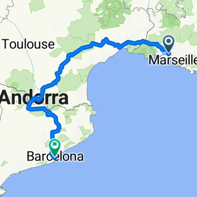 Marseille-Barcelona
- Distancia
- 809,4 km
- Ascenso
- 5469 m
- Descenso
- 5437 m
- Ubicación
- Vitrolles, Provenza-Alpes-Costa Azul, Francia
Ábrela en la app