

Roswell NM to Silver City NM
Una ruta en bici que comienza en Roswell, Nuevo México, Estados Unidos.
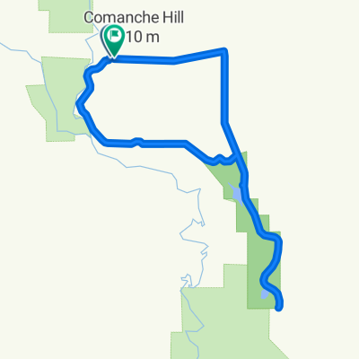
Visión General
Sobre esta ruta
Ruta de ciclismo de carretera y fuera de carretera desde Roswell hasta Silver City por una ruta más al norte. Siguiendo el río Grande lo más cerca posible del embalse Elephant Butte.
Esta ruta aún está en la fase de planificación, y estoy buscando comentarios sobre las condiciones del sendero. Especialmente en lo que respecta a la parte fuera de pavimento desde San Antonio NM hasta el lago Elephant Butte. Parece que el delta al norte del lago Elephant Butte puede ser difícil de navegar con la carga que llevo. Usando los picos montañosos circundantes como ayudas visuales, debería poder desviar hacia el oeste del río Grande. Apunta al pico Penasco a medida que la cordillera Fra Cristobel crece. Sigue los senderos que serpentean hacia el sur a través de los diversos arroyos antes de convertirse en cañones.- -:--
- Duración
- 546 km
- Distancia
- 3049 m
- Ascenso
- 2334 m
- Descenso
- ---
- Velocidad Media
- ---
- Altitud máxima
Destacados de la ruta
Puntos de interés a lo largo de la ruta
Punto de interés después de 318 km
Bridge to the East Side of Elmendorf Ditch
Continuar con Bikemap
Usa, edita o descarga esta ruta en bici
¿Te gustaría recorrer Roswell NM to Silver City NM o personalizarla para tu propio viaje? Esto es lo que puedes hacer con esta ruta de Bikemap:
Funciones gratuitas
- Guarda esta ruta como favorita o en una colección
- Copia y planifica tu propia versión de esta ruta
- Divídelo en etapas para crear una excursión de varios días
- Sincroniza tu ruta con Garmin o Wahoo
Funciones Premium
Prueba gratuita de 3 días o pago único. Más información sobre Bikemap Premium.
- Navega esta ruta en iOS y Android
- Exporta un archivo GPX / KML de esta ruta
- Crea tu impresión personalizada (pruébala gratis)
- Descarga esta ruta para la navegación sin conexión
Descubre más funciones Premium.
Consigue Bikemap PremiumDe nuestra comunidad
Roswell: Otras rutas populares que empiezan aquí
 Roswelll NM to Silver City NM
- Distancia
- 541,4 km
- Ascenso
- 2878 m
- Descenso
- 2163 m
- Ubicación
- Roswell, Nuevo México, Estados Unidos
 Highs and lows
- Distancia
- 19,1 km
- Ascenso
- 41 m
- Descenso
- 43 m
- Ubicación
- Roswell, Nuevo México, Estados Unidos
 Roswell NM to Silver City NM Onroad
- Distancia
- 538 km
- Ascenso
- 2938 m
- Descenso
- 2211 m
- Ubicación
- Roswell, Nuevo México, Estados Unidos
 Peaceful escapade
- Distancia
- 29,6 km
- Ascenso
- 81 m
- Descenso
- 78 m
- Ubicación
- Roswell, Nuevo México, Estados Unidos
 Bottomless loop 2
- Distancia
- 30,9 km
- Ascenso
- 192 m
- Descenso
- 188 m
- Ubicación
- Roswell, Nuevo México, Estados Unidos
 The bottomless route
- Distancia
- 64 km
- Ascenso
- 420 m
- Descenso
- 422 m
- Ubicación
- Roswell, Nuevo México, Estados Unidos
 Roswell circuit
- Distancia
- 44 km
- Ascenso
- 82 m
- Descenso
- 80 m
- Ubicación
- Roswell, Nuevo México, Estados Unidos
 Roswell NM to Silver City NM
- Distancia
- 546 km
- Ascenso
- 3049 m
- Descenso
- 2334 m
- Ubicación
- Roswell, Nuevo México, Estados Unidos
Ábrela en la app