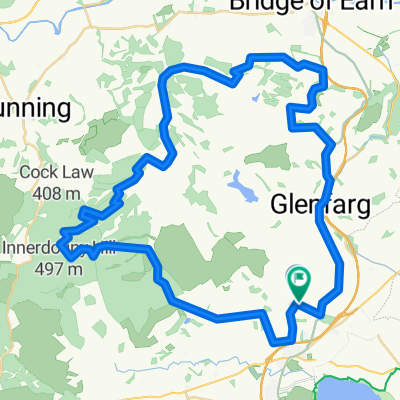
- 62,2 km
- 394 m
- 395 m
- Milnathort, Escocia, Reino Unido
The KCC Fixie Time Trial
Una ruta en bici que comienza en Milnathort, Escocia, Reino Unido.
Visión General
Sobre esta ruta
El inicio está a un par de cientos de yardas al oeste de la rotonda en el centro de Milnathort. Dirígete hacia el oeste por la A91 durante 7,4 millas. Gira a la derecha y nuevamente a la derecha alrededor de la 'isla de tráfico' (marshal) para volver hacia Milnathort por la A91. A 14,1 millas, gira bruscamente a la izquierda en la intersección justo después del puente pintado de blanco y negro (cartel Stronachie 4, marshal). Sube la corta colina y gira a la derecha nuevamente (cartel Stronachie, marshal). Continúa recto en el cruce (15,1 millas, marshal) y potencia la subida por Craigow Hill durante 2,4 millas más hasta la meta. Continúa doscientos yardas hasta el desvío del bosque para recuperar el aliento antes de volver a Milnathort.
- -:--
- Duración
- 28,1 km
- Distancia
- 307 m
- Ascenso
- 119 m
- Descenso
- ---
- Velocidad Media
- ---
- Altitud máxima
creado hace 10 años
Calidad de la ruta
Tipos de vía y superficies a lo largo de la ruta
Tipos de vía
Carretera
3,4 km
(12 %)
Carretera de acceso
2,3 km
(8 %)
Superficies
Pavimentado
9,6 km
(34 %)
Asfalto
9,6 km
(34 %)
Sin definir
18,6 km
(66 %)
Continuar con Bikemap
Usa, edita o descarga esta ruta en bici
¿Te gustaría recorrer The KCC Fixie Time Trial o personalizarla para tu propio viaje? Esto es lo que puedes hacer con esta ruta de Bikemap:
Funciones gratuitas
- Guarda esta ruta como favorita o en una colección
- Copia y planifica tu propia versión de esta ruta
- Sincroniza tu ruta con Garmin o Wahoo
Funciones Premium
Prueba gratuita de 3 días o pago único. Más información sobre Bikemap Premium.
- Navega esta ruta en iOS y Android
- Exporta un archivo GPX / KML de esta ruta
- Crea tu impresión personalizada (pruébala gratis)
- Descarga esta ruta para la navegación sin conexión
Descubre más funciones Premium.
Consigue Bikemap PremiumDe nuestra comunidad
Milnathort: Otras rutas populares que empiezan aquí
- Dunfermline down and up
- Water of May Dron Burn
- 48,3 km
- 864 m
- 868 m
- Milnathort, Escocia, Reino Unido
- Loch Leven Heritage Trail to New Skinner's Close 45
- 51,5 km
- 509 m
- 543 m
- Milnathort, Escocia, Reino Unido
- Reid Crescent 1, Milnathort to B919
- 15,4 km
- 58 m
- 51 m
- Milnathort, Escocia, Reino Unido
- The KCC Fixie Time Trial
- 28,1 km
- 307 m
- 119 m
- Milnathort, Escocia, Reino Unido
- Loch Leven Circuit (s.Leven Larder)
- 21,5 km
- 72 m
- 74 m
- Milnathort, Escocia, Reino Unido
- A911, Kinross to Muirs, Kinross
- 7,8 km
- 27 m
- 28 m
- Milnathort, Escocia, Reino Unido
- Milnathort to Gill
- 65,9 km
- 412 m
- 480 m
- Milnathort, Escocia, Reino Unido
Ábrela en la app


