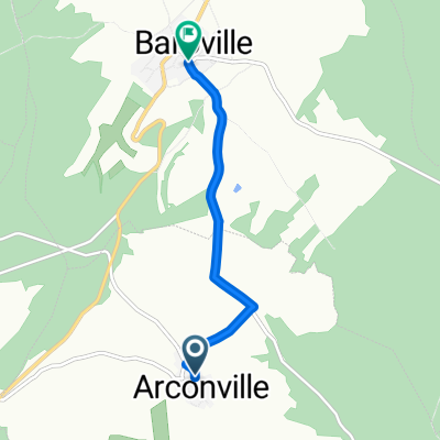
- 144,4 km
- 437 m
- 570 m
- Ville-sous-la-Ferté, Gran Este, Francia
Camino 2015 6b Clairvaux nach Les Riceys
Una ruta en bici que comienza en Ville-sous-la-Ferté, Gran Este, Francia.
Visión General
Sobre esta ruta
<table border="0" cellpadding="0" cellspacing="0" style="width:618px;" width="619"> <colgroup> <col /> <col /> <col /> <col /> <col span="4" /> <col /> </colgroup> <tbody> <tr height="22"> <td height="22" style="height:22px;width:34px;"> 3,0</td> <td style="width:34px;"> 3,0</td> <td colspan="3" style="width:162px;"> (D12) Anstieg 120 hm</td> <td style="width:64px;"> </td> <td style="width:64px;"> </td> <td style="width:64px;"> </td> <td style="width:194px;"> </td> </tr> <tr height="22"> <td height="22" style="height:22px;width:34px;"> 8,9</td> <td style="width:34px;"> 5,9</td> <td colspan="7"> (D12) bis Champignol-lez-Mondeville Zentrum --> D70 (links)</td> </tr> <tr height="22"> <td height="22" style="height:22px;width:34px;"> 9,2</td> <td style="width:34px;"> 0,3</td> <td colspan="7"> am Ortsausgang: abknickende Vorfahrt nach rechts (D70)</td> </tr> <tr height="22"> <td height="22" style="height:22px;width:34px;"> 15,7</td> <td style="width:34px;"> 6,5</td> <td colspan="4"> Saint--Usage (links halten D70)</td> <td> </td> <td> </td> <td> </td> </tr> <tr height="22"> <td height="22" style="height:22px;width:34px;"> 17,7</td> <td style="width:34px;"> 2,0</td> <td colspan="3"> Fontette (D70)</td> <td> </td> <td> </td> <td> </td> <td> </td> </tr> <tr height="22"> <td height="22" style="height:22px;width:34px;"> 22,0</td> <td style="width:34px;"> 4,3</td> <td colspan="6"> Abbiege-Option vor Essoye (guter Schotterweg)</td> <td> </td> </tr> <tr height="22"> <td height="22" style="height:22px;width:34px;"> 24,5</td> <td style="width:34px;"> 2,5</td> <td colspan="4"> Essoyes (D67--> Loches)</td> <td> </td> <td> </td> <td> </td> </tr> <tr height="22"> <td height="22" style="height:22px;width:34px;"> 27,5</td> <td style="width:34px;"> 3,0</td> <td colspan="4"> Loches-sur-Ource (D145-->D67)</td> <td> </td> <td> </td> <td> </td> </tr> <tr height="22"> <td height="22" style="height:22px;width:34px;"> 30,0</td> <td style="width:34px;"> 2,5</td> <td colspan="2"> Londreville</td> <td> </td> <td> </td> <td> </td> <td> </td> <td> </td> </tr> <tr height="22"> <td height="22" style="height:22px;width:34px;"> 35,1</td> <td style="width:34px;"> 5,1</td> <td colspan="4"> Celles-sur-Ource (Brücke)</td> <td> </td> <td> </td> <td> </td> </tr> <tr height="22"> <td height="22" style="height:22px;width:34px;"> 35,7</td> <td style="width:34px;"> 0,6</td> <td colspan="7"> Abzweig nach Süden (gegenüber der Post: Rue de l'Église)</td> </tr> <tr height="22"> <td height="22" style="height:22px;width:34px;"> 36,9</td> <td style="width:34px;"> 1,2</td> <td colspan="7"> geradeaus in die Rue de Puits de Tour/Rue de Craies-->D671</td> </tr> <tr height="22"> <td height="22" style="height:22px;width:34px;"> 37,2</td> <td style="width:34px;"> 0,3</td> <td colspan="6"> --> hinter der Bahn D452 nach links Ri Polisy</td> <td> </td> </tr> <tr height="22"> <td height="22" style="height:22px;width:34px;"> 42,0</td> <td style="width:34px;"> 4,8</td> <td colspan="3"> Balnot-sur-Laignes</td> <td> </td> <td> </td> <td> </td> <td> </td> </tr> <tr height="21"> <td height="21" style="height:21px;width:34px;"> 45,1</td> <td style="width:34px;"> 3,1</td> <td colspan="3"> Ricey-Bas</td> <td> </td> <td> </td> <td> </td> <td> </td> </tr> </tbody> </table>
Hotel Le Marius 2 Place De L'église<br /> 10340 Les Riceys Telefon +33325293165- -:--
- Duración
- 45,2 km
- Distancia
- 305 m
- Ascenso
- 314 m
- Descenso
- ---
- Velocidad Media
- ---
- Altitud máxima
creado hace 10 años
Calidad de la ruta
Tipos de vía y superficies a lo largo de la ruta
Tipos de vía
Carretera
9,9 km
(22 %)
Camino forestal
4,5 km
(10 %)
Superficies
Pavimentado
5 km
(11 %)
Sin pavimentar
1,8 km
(4 %)
Asfalto
4,5 km
(10 %)
Grava
1,8 km
(4 %)
Continuar con Bikemap
Usa, edita o descarga esta ruta en bici
¿Te gustaría recorrer Camino 2015 6b Clairvaux nach Les Riceys o personalizarla para tu propio viaje? Esto es lo que puedes hacer con esta ruta de Bikemap:
Funciones gratuitas
- Guarda esta ruta como favorita o en una colección
- Copia y planifica tu propia versión de esta ruta
- Sincroniza tu ruta con Garmin o Wahoo
Funciones Premium
Prueba gratuita de 3 días o pago único. Más información sobre Bikemap Premium.
- Navega esta ruta en iOS y Android
- Exporta un archivo GPX / KML de esta ruta
- Crea tu impresión personalizada (pruébala gratis)
- Descarga esta ruta para la navegación sin conexión
Descubre más funciones Premium.
Consigue Bikemap PremiumDe nuestra comunidad
Ville-sous-la-Ferté: Otras rutas populares que empiezan aquí
- 0017 Longchamp sur Aujon to Paris
- Jakobsweg_8: Clairvaux - Etourvy
- 66,3 km
- 846 m
- 829 m
- Ville-sous-la-Ferté, Gran Este, Francia
- 11 Ville-sous-la-Ferté - Étourvy Jakobsweg
- 64,9 km
- 673 m
- 673 m
- Ville-sous-la-Ferté, Gran Este, Francia
- De Rue de l'Abreuvoir à Baroville - Place Mairie
- 4,3 km
- 78 m
- 141 m
- Ville-sous-la-Ferté, Gran Este, Francia
- De Rue du Seilley 5, Ville-sous-la-Ferté à Rue de la Maison Commune 1, Charrey-sur-Seine
- 46,2 km
- 616 m
- 629 m
- Ville-sous-la-Ferté, Gran Este, Francia
- De la Ferté à Rue Pierre Marasi 1, Laferté-sur-Aube
- 66,1 km
- 662 m
- 655 m
- Ville-sous-la-Ferté, Gran Este, Francia
- champignol nach Renzwiller
- 281,6 km
- 2483 m
- 2441 m
- Ville-sous-la-Ferté, Gran Este, Francia
- De Route de Dijon 14, Ville-sous-la-Ferté à Rue du Moulin 3, Charrey-sur-Seine
- 31,6 km
- 160 m
- 169 m
- Ville-sous-la-Ferté, Gran Este, Francia
Ábrela en la app


