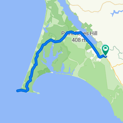
Leon Marshall Wall and Wilson Hill

Una ruta en bici que comienza en Inverness, California, United States of America.

Visión General

Sobre esta ruta

0

This is Leon Sun's ride

<span style="color: #000000; font-family: arial; font-size: 11px; line-height: 13px;">Will lead a ride on the 20th in <span id="lw_1252646841_0" class="yshortcuts" style="line-height: 1.2em; outline-style: none; outline-width: initial; outline-color: initial; cursor: pointer; background-image: initial; background-repeat: initial; background-attachment: initial; -webkit-background-clip: initial; -webkit-background-origin: initial; background-color: transparent; border-bottom-style: none; border-bottom-width: initial; border-bottom-color: initial; background-position: initial initial;">West Marin</span>. Toward the end of the ride, I want to stop at the G.R.O. Art Gallery in Pt Reyes Station where my friend Lucien Kubo has a solo show. Here are the details of the ride, if you don't mind posting it:<br style="line-height: 1.2em; outline-style: none; outline-width: initial; outline-color: initial;" /><br style="line-height: 1.2em; outline-style: none; outline-width: initial; outline-color: initial;" />Start: 9:00 a.m., <span id="lw_1252646841_1" class="yshortcuts" style="line-height: 1.2em; outline-style: none; outline-width: initial; outline-color: initial; border-bottom-style: dashed; border-bottom-width: 1px; border-bottom-color: #0066cc; cursor: pointer; background-image: initial; background-repeat: initial; background-attachment: initial; -webkit-background-clip: initial; -webkit-background-origin: initial; background-color: transparent; background-position: initial initial;">Bear Valley Visitor Center</span>, <span id="lw_1252646841_2" class="yshortcuts" style="line-height: 1.2em; outline-style: none; outline-width: initial; outline-color: initial; cursor: pointer; background-image: initial; background-repeat: initial; background-attachment: initial; -webkit-background-clip: initial; -webkit-background-origin: initial; background-color: transparent; border-bottom-style: none; border-bottom-width: initial; border-bottom-color: initial; background-position: initial initial;">Bear Valley Rd</span>, <span id="lw_1252646841_3" class="yshortcuts" style="line-height: 1.2em; outline-style: none; outline-width: initial; outline-color: initial; cursor: pointer; background-image: initial; background-repeat: initial; background-attachment: initial; -webkit-background-clip: initial; -webkit-background-origin: initial; background-color: transparent; border-bottom-style: none; border-bottom-width: initial; border-bottom-color: initial; background-position: initial initial;">Olema</span>. <br style="line-height: 1.2em; outline-style: none; outline-width: initial; outline-color: initial;" /><br style="line-height: 1.2em; outline-style: none; outline-width: initial; outline-color: initial;" />Route: Exiting Visitor Center, R onto Bear Valley Rd, L (North) onto Hwy 1, R onto Marshal-Petaluma Rd (Marshall Wall, about 1100' elev gain), L onto <span id="lw_1252646841_4" class="yshortcuts" style="line-height: 1.2em; outline-style: none; outline-width: initial; outline-color: initial;">Wilson Hill Rd</span>, L onto Chileno Valley Rd, L onto Tomales-Petaluma Rd, R onto Hwy 1 to <span id="lw_1252646841_5" class="yshortcuts" style="line-height: 1.2em; outline-style: none; outline-width: initial; outline-color: initial; cursor: pointer; background-image: initial; background-repeat: initial; background-attachment: initial; -webkit-background-clip: initial; -webkit-background-origin: initial; background-color: transparent; border-bottom-style: none; border-bottom-width: initial; border-bottom-color: initial; background-position: initial initial;">Tomales</span>, stop for lunch or snack, Return South on Hwy1 all the way to Bear Valley Rd, turn R, L into Visitor Center.<br style="line-height: 1.2em; outline-style: none; outline-width: initial; outline-color: initial;" /><br style="line-height: 1.2em; outline-style: none; outline-width: initial; outline-color: initial;" />Marshall Wall and Wilson Hill are the two major climbs, about 1500' el.gain combined. The rest are rollers. About 60 miles, total distance. Overlaps parts of Pilgrimage route. Stopping at gallery, of course, is optional.<br style="line-height: 1.2em; outline-style: none; outline-width: initial; outline-color: initial;" /></span>

-:--
Duración
98,3 km
Distancia
1271 m
Ascenso
1276 m
Descenso
---
Velocidad Media
220 m
Altitud máxima
berkeley_rinaldi

creado hace hace 15 años

Calidad de la ruta

Tipos de vía y superficies a lo largo de la ruta

Destacados de la ruta

Puntos de interés a lo largo de la ruta

  1. Punto de interés después de 20,3 km

    R Marshall-Petaluma Rod (Marshall Wall about 1100' elev gain)

  2. Punto de interés después de 42,4 km

    L Chileno Valley Rd

  3. Punto de interés después de 53,4 km

    R Chileno Valley Rd

  4. Punto de interés después de 58,1 km

    L Tomales Petaluma Rd.

  5. Punto de interés después de 67,1 km

  6. Punto de interés después de 67,8 km

    LUNCH IN TOMALES

  7. Punto de interés después de 68,4 km

    L Shoreline HWY1

Continuar con Bikemap

Usa, edita o descarga esta ruta en bici

¿Te gustaría recorrer Leon Marshall Wall and Wilson Hill o personalizarla para tu propio viaje? Esto es lo que puedes hacer con esta ruta de Bikemap:

Funciones gratuitas

Funciones Premium

Prueba gratuita de 3 días o pago único. Más información sobre Bikemap Premium.

  • Navega esta ruta en iOS y Android
  • Exporta un archivo GPX / KML de esta ruta
  • Crea tu impresión personalizada (pruébala gratis)
  • Descarga esta ruta para la navegación sin conexión

Descubre más funciones Premium.

Consigue Bikemap Premium

De nuestra comunidad

Inverness: Otras rutas populares que empiezan aquí

Ábrela en la app