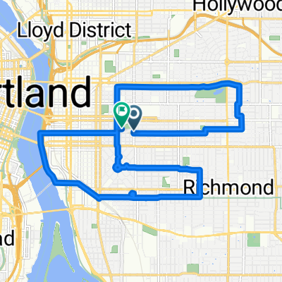
A Coffee + Architecture + Platting + Infrastructure + Beer Exploration
Una ruta en bici que comienza en Portland, Oregón, Estados Unidos.
Visión General
Sobre esta ruta
Cosas que veremos/haremos.
Pasaremos por el Steel Bridge - un puente de 104 años que transporta trenes ligeros, autobuses, peatones, bicicletas, ferrocarriles de carga, trenes de pasajeros y también camiones de remolque. ¡Es el caballo de batalla de Portland desde 1912!
Cup & Bar - uno de los tostadores más nuevos de la ciudad, entrega en bicicleta de carga, con un área abierta para relajarse/hacer hackers/ciclismo, etc. Está ubicado junto a dos de los nuevos locos y raros torres residenciales que están surgiendo.
Ladd's Addition, uno de los primeros barrios, un vecindario planeado de tranvías, de Portland, trazado y construido entre 1905 y 1930.
Apex Bar/Cervecería. Gran bar con música rockera, más aparcamientos para bicicletas de los que puedas imaginar (y probablemente aún cerraremos a los árboles) y una selección de cervezas locales extremadamente impresionante (docenas y docenas de ellas!).
El Tillikum Bridge es el nuevo puente de transporte, ciclismo y peatones de Portland. Nos dirigiremos a lo largo de algunos de los nuevos MUP (Sendero de Uso Mixto) hasta el puente, donde podrás ver la confluencia de tranvías, trenes ligeros y autobuses atravesando el puente, y probablemente ciclistas y peatones por todas partes. ¡Es un puente genial, que se inauguró el año pasado en septiembre!
Regresaremos por el extremo sur del MUP (Sendero de Uso Mixto) del frente marítimo.
- -:--
- Duración
- 9,9 km
- Distancia
- 122 m
- Ascenso
- 121 m
- Descenso
- ---
- Velocidad Media
- ---
- Altitud máxima
Calidad de la ruta
Tipos de vía y superficies a lo largo de la ruta
Tipos de vía
Carretera tranquila
3,6 km
(36 %)
Carril bici
2,7 km
(27 %)
Superficies
Pavimentado
8,6 km
(87 %)
Asfalto
3,9 km
(39 %)
Pavimentado (sin definir)
2,4 km
(24 %)
Continuar con Bikemap
Usa, edita o descarga esta ruta en bici
¿Te gustaría recorrer A Coffee + Architecture + Platting + Infrastructure + Beer Exploration o personalizarla para tu propio viaje? Esto es lo que puedes hacer con esta ruta de Bikemap:
Funciones gratuitas
- Guarda esta ruta como favorita o en una colección
- Copia y planifica tu propia versión de esta ruta
- Sincroniza tu ruta con Garmin o Wahoo
Funciones Premium
Prueba gratuita de 3 días o pago único. Más información sobre Bikemap Premium.
- Navega esta ruta en iOS y Android
- Exporta un archivo GPX / KML de esta ruta
- Crea tu impresión personalizada (pruébala gratis)
- Descarga esta ruta para la navegación sin conexión
Descubre más funciones Premium.
Consigue Bikemap PremiumDe nuestra comunidad
Portland: Otras rutas populares que empiezan aquí
 A Coffee + Architecture + Platting + Infrastructure + Beer Exploration
- Distancia
- 9,9 km
- Ascenso
- 122 m
- Descenso
- 121 m
- Ubicación
- Portland, Oregón, Estados Unidos
 I-5 to 205 Loop
- Distancia
- 38,7 km
- Ascenso
- 178 m
- Descenso
- 180 m
- Ubicación
- Portland, Oregón, Estados Unidos
 Ride to Rhody
- Distancia
- 89 km
- Ascenso
- 1095 m
- Descenso
- 444 m
- Ubicación
- Portland, Oregón, Estados Unidos
 august: a taylor swift ride v1
- Distancia
- 15,4 km
- Ascenso
- 98 m
- Descenso
- 103 m
- Ubicación
- Portland, Oregón, Estados Unidos
 august: a taylor swift ride v2
- Distancia
- 18,9 km
- Ascenso
- 116 m
- Descenso
- 121 m
- Ubicación
- Portland, Oregón, Estados Unidos
 8/2017 Century Plus Route 1
- Distancia
- 177,9 km
- Ascenso
- 995 m
- Descenso
- 993 m
- Ubicación
- Portland, Oregón, Estados Unidos
 Wednesday 9/24
- Distancia
- 37,7 km
- Ascenso
- 225 m
- Descenso
- 187 m
- Ubicación
- Portland, Oregón, Estados Unidos
 Modified Sellwood bridge route
- Distancia
- 18,5 km
- Ascenso
- 211 m
- Descenso
- 212 m
- Ubicación
- Portland, Oregón, Estados Unidos
Ábrela en la app


