

2016 Ride Day 107 - St-Sauveur-de-Montagut Circle to Le Cheylard
Una ruta en bici que comienza en Saint-Sauveur-de-Montagut, Auvernia-Ródano-Alpes, Francia.
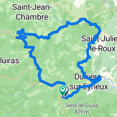
Visión General
Sobre esta ruta
Habíamos planeado una ruta mucho más larga, pero el calor era demasiado y abortamos el plan original en la empinada subida de la D204 desde Le Cheylard.
El camino para bicicletas sobre una antigua línea de ferrocarril fue excelente... siempre y cuando se tengan neumáticos relativamente anchos. Nuestros neumáticos 700Cx35 funcionaron bien. Esto no sería bueno para neumáticos estrechos de bicicleta de carreras.
Hermoso paisaje. Lo recomendamos mucho.
Tenga en cuenta que el perfil y los números de ganancia/pérdida de elevación no tienen sentido. Tanto el sendero ferroviario de subida como la D120 de bajada fueron bastante constantes y graduales. La ganancia de elevación no debería ser más de 350 o 400 como máximo.
- -:--
- Duración
- 51,1 km
- Distancia
- 680 m
- Ascenso
- 680 m
- Descenso
- ---
- Velocidad Media
- ---
- Altitud máxima

Fotos de la ruta


Calidad de la ruta
Tipos de vía y superficies a lo largo de la ruta
Tipos de vía
Carretera tranquila
8,7 km
(17 %)
Carril bici
7,7 km
(15 %)
Superficies
Pavimentado
15,8 km
(31 %)
Sin pavimentar
10,2 km
(20 %)
Asfalto
15,8 km
(31 %)
Grava
7,1 km
(14 %)
Continuar con Bikemap
Usa, edita o descarga esta ruta en bici
¿Te gustaría recorrer 2016 Ride Day 107 - St-Sauveur-de-Montagut Circle to Le Cheylard o personalizarla para tu propio viaje? Esto es lo que puedes hacer con esta ruta de Bikemap:
Funciones gratuitas
- Guarda esta ruta como favorita o en una colección
- Copia y planifica tu propia versión de esta ruta
- Sincroniza tu ruta con Garmin o Wahoo
Funciones Premium
Prueba gratuita de 3 días o pago único. Más información sobre Bikemap Premium.
- Navega esta ruta en iOS y Android
- Exporta un archivo GPX / KML de esta ruta
- Crea tu impresión personalizada (pruébala gratis)
- Descarga esta ruta para la navegación sin conexión
Descubre más funciones Premium.
Consigue Bikemap PremiumDe nuestra comunidad
Saint-Sauveur-de-Montagut: Otras rutas populares que empiezan aquí
 Saint-Sau->Saou Smooth Ride
- Distancia
- 69,1 km
- Ascenso
- 1502 m
- Descenso
- 1400 m
- Ubicación
- Saint-Sauveur-de-Montagut, Auvernia-Ródano-Alpes, Francia
 Dolce Via Les Ollières - La Voulte
- Distancia
- 19,7 km
- Ascenso
- 139 m
- Descenso
- 227 m
- Ubicación
- Saint-Sauveur-de-Montagut, Auvernia-Ródano-Alpes, Francia
 Saint-Pierreville - Ucel
- Distancia
- 58,1 km
- Ascenso
- 650 m
- Descenso
- 966 m
- Ubicación
- Saint-Sauveur-de-Montagut, Auvernia-Ródano-Alpes, Francia
 2016 Ride Day 107 - St-Sauveur-de-Montagut Circle to Le Cheylard
- Distancia
- 51,1 km
- Ascenso
- 680 m
- Descenso
- 680 m
- Ubicación
- Saint-Sauveur-de-Montagut, Auvernia-Ródano-Alpes, Francia
 les Ollières- les Vastres
- Distancia
- 62,4 km
- Ascenso
- 2360 m
- Descenso
- 1310 m
- Ubicación
- Saint-Sauveur-de-Montagut, Auvernia-Ródano-Alpes, Francia
 Saint-Sau - Saou - Max VeloRoute
- Distancia
- 70,6 km
- Ascenso
- 1495 m
- Descenso
- 1391 m
- Ubicación
- Saint-Sauveur-de-Montagut, Auvernia-Ródano-Alpes, Francia
 07 Route bei SF du Eyrieux
- Distancia
- 51,8 km
- Ascenso
- 2527 m
- Descenso
- 2533 m
- Ubicación
- Saint-Sauveur-de-Montagut, Auvernia-Ródano-Alpes, Francia
 2016 Ride Day 108 - St-Sauveur-de-Montagut to Largentière
- Distancia
- 69,2 km
- Ascenso
- 1053 m
- Descenso
- 1075 m
- Ubicación
- Saint-Sauveur-de-Montagut, Auvernia-Ródano-Alpes, Francia
Ábrela en la app