

Circuit du canal de Soulanges
Ruta ciclista
Resumen
Sobre esta ruta
- ENGLISH DESCRIPTION BELOW *
Le circuit du canal de Soulanges vous propose un tracé où l’eau est omniprésente. De Pointe-des-Cascades à la municipalité des Coteaux, en passant par Les Cèdres et Coteau-du-Lac, vous longerez un cours d’eau qui relie le lac Saint-Louis au lac Saint-François. Les gens du coin ont pris l’habitude d’appeler ce cours d’eau « le fleuve » bien qu’il ne s’agisse pas ici du fleuve Saint-Laurent à proprement parler. Les Amérindiens, avant qu’Hydro-Québec ne soit créée et qu’elle aménage nos cours d’eau, l’appelaient plutôt la rivière « Cataraqui » en raison des rapides qui la parsemaient.
De la municipalité des Coteaux, vous reviendrez par la piste cyclable Soulanges, un sentier hors route qui longe le canal de Soulanges sur près de 22 kilomètres. Ce canal, construit entre 1892 et 1899, a été abandonné en 1959 lorsque le gouvernement fédéral construisit le canal de Beauharnois. Depuis quelques années, plusieurs activités se déroulent autour du canal de Soulanges et ce, tout au long de l’année.
Pour les amateurs de longues distances, sachez que la piste cyclable du canal de Soulanges se rend jusqu’à Rivière-Beaudette pour poursuivre chez nos voisins ontariens sur la Waterfront Trail.
Ce circuit vous transportera au temps de la construction du premier canal en Amérique du Nord. Admirez les berges, les espaces verts et les bâtiments architecturaux. Découvrez des produits d’ici à l’effigie du canal de Soulanges au Bourg des Cèdres, vignoble de réputation, en bordure du fleuve Saint-Laurent.
The Circuit du canal de Soulanges route is characterized by the ubiquitous presence of water. This ride takes you along the waterway connecting Lake Saint-Louis and Lake Saint-François, from Pointe-des-Cascades to Les Coteaux, passing by Les Cèdres and Coteau-du-Lac. Before the establishment of Hydro-Québec and the redevelopment of the waterways in the area, this stretch of water—now known as “le fleuve” (as in the St. Lawrence River)—was referred to by the local indigenous population as “Cataraqui“ for its strong rapids.
From the municipality of Les Coteaux, you’ll head back via the Soulanges bike path, an off-road trail that runs along the Soulanges Canal for nearly 22 km. The canal was built between 1892-1899, but with the completion of the St. Lawrence Seaway in 1959, the Soulanges Canal fell into disuse. Scores of activities take place along the Soulanges Canal throughout the year.
Long-distance cyclists can follow the Soulanges Canal bike path all the way to Rivière-Beaudette, where it joins up with the Waterfront Trail in Ontario.
This excursion transports you back in time to the construction of the first canal in North America. Admire the banks, green spaces and architectural landmarks along the path. Discover local products inspired by the Soulanges Canal at the acclaimed Bourg des Cèdres vineyard, located on the banks of the St. Lawrence River.
- -:--
- Duración
- 43,7 km
- Distancia
- 34 m
- Ascenso
- 34 m
- Descenso
- ---
- Velocidad media
- ---
- Altitud máxima


tamarica, Adam Cimimo y Alexandre Loutfi han añadido esta ruta a marcadores.

creado hace 10 años
Calidad de la ruta
Tipos de vía y superficies a lo largo de la ruta
Tipos de vía
Carretera
21 km
48 %
Carril bici
20,1 km
46 %
Superficies
Pavimentado
42,8 km
(98 %)
Asfalto
38,8 km
89 %
Pavimentado (sin definir)
3,9 km
9 %
Sin definir
0,9 km
2 %
Destacados de la ruta
Puntos de interés a lo largo de la ruta
Punto de interés
a los 0 km
Stationnement

Punto de interés
a los 3,7 km
Le Bourg des Cèdres

Punto de interés
a los 18,7 km
Lieu historique national de Coteau-du-Lac

Punto de interés
a los 21,7 km
Parc Thomas-Monro
Agua potable
a los 25,4 km
Point d'eau
Punto de interés
a los 25,5 km
Stationnement
Punto de interés
a los 40,3 km
Stationnement
Punto de interés
a los 43,5 km
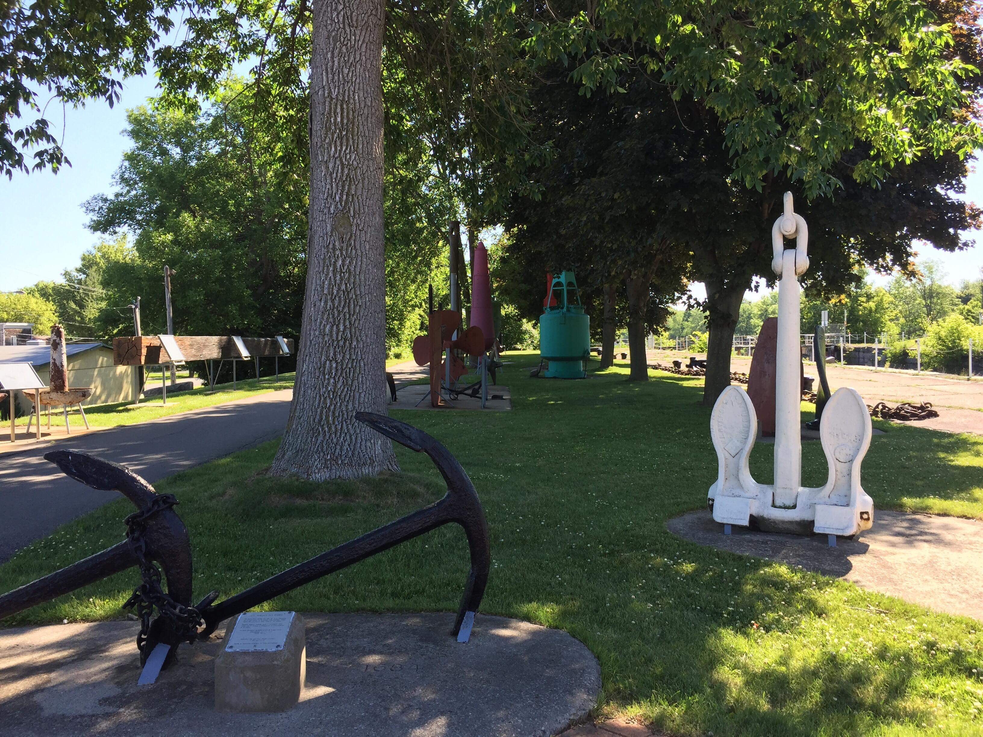
Parc des Ancres
Agua potable
a los 43,6 km
Point d'eau
Punto de interés
a los 43,6 km
Stationnement
Continuar con Bikemap
Usa, edita o descarga esta ruta en bici
¿Te gustaría recorrer Circuit du canal de Soulanges o personalizarla para tu propio viaje? Esto es lo que puedes hacer con esta ruta de Bikemap:
Funciones gratuitas
- Guarda esta ruta como favorita o en una colección
- Copia y planifica tu propia versión de esta ruta
- Sincroniza tu ruta con Garmin o Wahoo
Funciones Premium
Prueba gratuita de 3 días o pago único. Más información sobre Bikemap Premium.
- Navega esta ruta en iOS y Android
- Exporta un archivo GPX / KML de esta ruta
- Crea tu impresión personalizada (pruébala gratis)
- Descarga esta ruta para la navegación sin conexión
Descubre más funciones Premium.
Consigue Bikemap PremiumÁbrela en la app