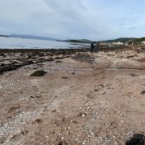
St Ninian's Way - Lochwinnoch to Paisley
Una ruta en bici que comienza en Lochwinnoch, Escocia, Reino Unido.
Visión General
Sobre esta ruta
Lochwinnoch a Paisley
Este 24º tramo del Camino de San Ninian sigue un sendero señalizado y la Ruta Nacional de Cicloturismo 7 hasta Paisley. El punto de inicio es el sendero junto al Castle Semple Loch que avanza hacia un puente sobre una autopista (6 km). Luego continúa hacia el norte a lo largo del Black Cart Water hasta otro puente (2 km). Cruza el puente y sigue por el camino hasta Elderslie (1.5 km), y luego hacia Sauce Hill, justo al sur de Paisley (3 km). Luego toma la Causeyside Road 200 m y gira a la derecha en Gordon Street durante 100 m y cruza el río Clyde, hacia Cotton Street y hacia la Abadía de Paisley (300 m). Una opción es continuar hacia Gauze Street y llegar a la encrucijada con la Catedral Católica de St Mirren.
Senda panorámica y señalizada
También parte del Whithorn Way - http://www.whithornway.org . Cortesía de la WWSG donde se encuentra disponible una descripción detallada de la ruta con referencias de cuadrícula.
Para una vista general del mapa de la Parte 1 y Parte 2 del Camino de San Ninian, por favor visite https://www.bikemap.net/en/route/3548129-st-ninians-way-carlisle-to-st-andrews-part-1-carlisle-to-whithorn/
El Camino de San Ninian es una de las grandes rutas de peregrinación en Escocia hacia St. Andrews - El Camino de San Andrés - Para otras rutas vea http://www.thewayofstandrews.com
- -:--
- Duración
- 15,9 km
- Distancia
- 65 m
- Ascenso
- 85 m
- Descenso
- ---
- Velocidad Media
- ---
- Altitud máxima
Calidad de la ruta
Tipos de vía y superficies a lo largo de la ruta
Tipos de vía
Carril bici
14,5 km
(91 %)
Carretera
0,2 km
(1 %)
Superficies
Pavimentado
14,8 km
(93 %)
Asfalto
14,8 km
(93 %)
Sin definir
1,1 km
(7 %)
Destacados de la ruta
Puntos de interés a lo largo de la ruta
Punto de interés después de 15,8 km
St Mirin's Cathedral
Punto de interés después de 15,8 km
Paisley Abbey
Continuar con Bikemap
Usa, edita o descarga esta ruta en bici
¿Te gustaría recorrer St Ninian's Way - Lochwinnoch to Paisley o personalizarla para tu propio viaje? Esto es lo que puedes hacer con esta ruta de Bikemap:
Funciones gratuitas
- Guarda esta ruta como favorita o en una colección
- Copia y planifica tu propia versión de esta ruta
- Sincroniza tu ruta con Garmin o Wahoo
Funciones Premium
Prueba gratuita de 3 días o pago único. Más información sobre Bikemap Premium.
- Navega esta ruta en iOS y Android
- Exporta un archivo GPX / KML de esta ruta
- Crea tu impresión personalizada (pruébala gratis)
- Descarga esta ruta para la navegación sin conexión
Descubre más funciones Premium.
Consigue Bikemap PremiumDe nuestra comunidad
Lochwinnoch: Otras rutas populares que empiezan aquí
 East Lochhead, Kilbirnie Road, Lochwinnoch to 5 Marine Ct, Largs
- Distancia
- 24,3 km
- Ascenso
- 425 m
- Descenso
- 470 m
- Ubicación
- Lochwinnoch, Escocia, Reino Unido
 Lochlip Road, Lochwinnoch to 78A South Beach, Troon
- Distancia
- 41,4 km
- Ascenso
- 196 m
- Descenso
- 226 m
- Ubicación
- Lochwinnoch, Escocia, Reino Unido
 Stewarton Circuit
- Distancia
- 58,7 km
- Ascenso
- 411 m
- Descenso
- 411 m
- Ubicación
- Lochwinnoch, Escocia, Reino Unido
 St Ninian's Way - Lochwinnoch to Paisley
- Distancia
- 15,9 km
- Ascenso
- 65 m
- Descenso
- 85 m
- Ubicación
- Lochwinnoch, Escocia, Reino Unido
 Barn Cottage, Kilbirnie Road, Lochwinnoch to Erskine Garden Centre, Bishopton
- Distancia
- 34,7 km
- Ascenso
- 119 m
- Descenso
- 140 m
- Ubicación
- Lochwinnoch, Escocia, Reino Unido
 Barn Cottage, Kilbirnie Road, Lochwinnoch to Fairlie House, Main Road, Largs
- Distancia
- 23,8 km
- Ascenso
- 435 m
- Descenso
- 484 m
- Ubicación
- Lochwinnoch, Escocia, Reino Unido
 Church Street 17 to Kilbirnie Road
- Distancia
- 3,9 km
- Ascenso
- 40 m
- Descenso
- 13 m
- Ubicación
- Lochwinnoch, Escocia, Reino Unido
 Route from East Lochhead, Kilbirnie Road, Lochwinnoch
- Distancia
- 29,9 km
- Ascenso
- 504 m
- Descenso
- 550 m
- Ubicación
- Lochwinnoch, Escocia, Reino Unido
Ábrela en la app


