

Gotthard Challenge
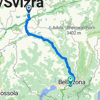
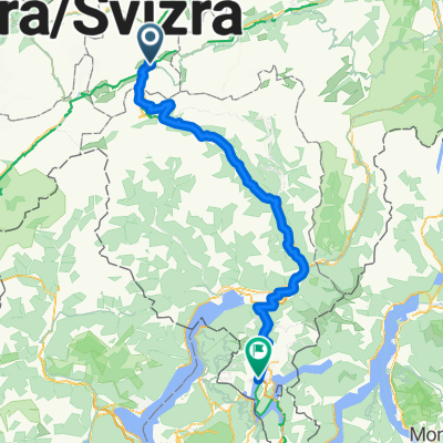
Una ruta en bici que comienza en Andermatt, Uri, Suiza.
Visión General
Sobre esta ruta
With three legendary passes that regularly feature in the Tour de Suisse, this loop ranks among the great alpine classics. Although just 106km in length, it should not be underestimated: with almost 40km of climbing, it presents a major challenge.
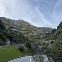
Starting in Andermatt in Canton Uri, the first pass is the Furka: 11km of climbing to reach the summit at alt. 2436m. You then enter Canton Valais for the long descent to Gletsch followed by Ulrichen in the Upper Rhone valley, known locally as the Goms. Time to think of taking food and drink on board, since you are about to make the ascent to the Nufenen pass (alt. 2478m) after 13km of climbing punctuated by long straights over 10% in gradient. Featuring Switzerland’s second-highest metalled pass road (only the Umbrail is higher), the Nufenen is a challenge in itself. The summit marks the gateway to another of Switzerland’s cantons: Ticino. There now follows a marvellous, extended descent towards Italian-speaking Airolo, where the day’s third and final ascent starts to the Gotthard at alt. 2091m. The world’s fourth-longest road tunnel swallows most of the north-south traffic; what is left takes the main pass road. Cyclists climb the ancient road, call the Tremola. Uniquely for the Alps, its 24 upper hairpin bends feature cobblestones. Enough to make you forget the 3000m-plus of difference in altitude you have been climbing today. Once at the top, Andermatt is no more than a few kilometres further on (and down!). Time for a well-earned rest in this quintessential village in the heart of the Swiss Alps.
- -:--
- Duración
- 105,9 km
- Distancia
- 3023 m
- Ascenso
- 3021 m
- Descenso
- ---
- Velocidad Media
- ---
- Altitud máxima

Calidad de la ruta
Tipos de vía y superficies a lo largo de la ruta
Tipos de vía
Carretera tranquila
4,2 km
(4 %)
Camino forestal
2,1 km
(2 %)
Superficies
Pavimentado
94,3 km
(89 %)
Asfalto
92,2 km
(87 %)
Pavimentado (sin definir)
1,1 km
(1 %)
Continuar con Bikemap
Usa, edita o descarga esta ruta en bici
¿Te gustaría recorrer Gotthard Challenge o personalizarla para tu propio viaje? Esto es lo que puedes hacer con esta ruta de Bikemap:
Funciones gratuitas
- Guarda esta ruta como favorita o en una colección
- Copia y planifica tu propia versión de esta ruta
- Divídelo en etapas para crear una excursión de varios días
- Sincroniza tu ruta con Garmin o Wahoo
Funciones Premium
Prueba gratuita de 3 días o pago único. Más información sobre Bikemap Premium.
- Navega esta ruta en iOS y Android
- Exporta un archivo GPX / KML de esta ruta
- Crea tu impresión personalizada (pruébala gratis)
- Descarga esta ruta para la navegación sin conexión
Descubre más funciones Premium.
Consigue Bikemap PremiumDe nuestra comunidad
Andermatt: Otras rutas populares que empiezan aquí
 Von Andermatt bis Locarno
- Distancia
- 115,9 km
- Ascenso
- 2182 m
- Descenso
- 3407 m
- Ubicación
- Andermatt, Uri, Suiza
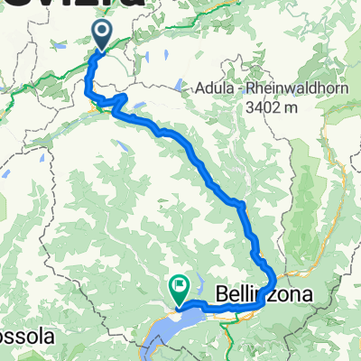
 Andermatt -Bellinzona Gotthardstrasse to Via San Gottardo
- Distancia
- 80,7 km
- Ascenso
- 708 m
- Descenso
- 1919 m
- Ubicación
- Andermatt, Uri, Suiza
 NL The Rhine Cycle Route
- Distancia
- 1352,1 km
- Ascenso
- 88 m
- Descenso
- 1523 m
- Ubicación
- Andermatt, Uri, Suiza
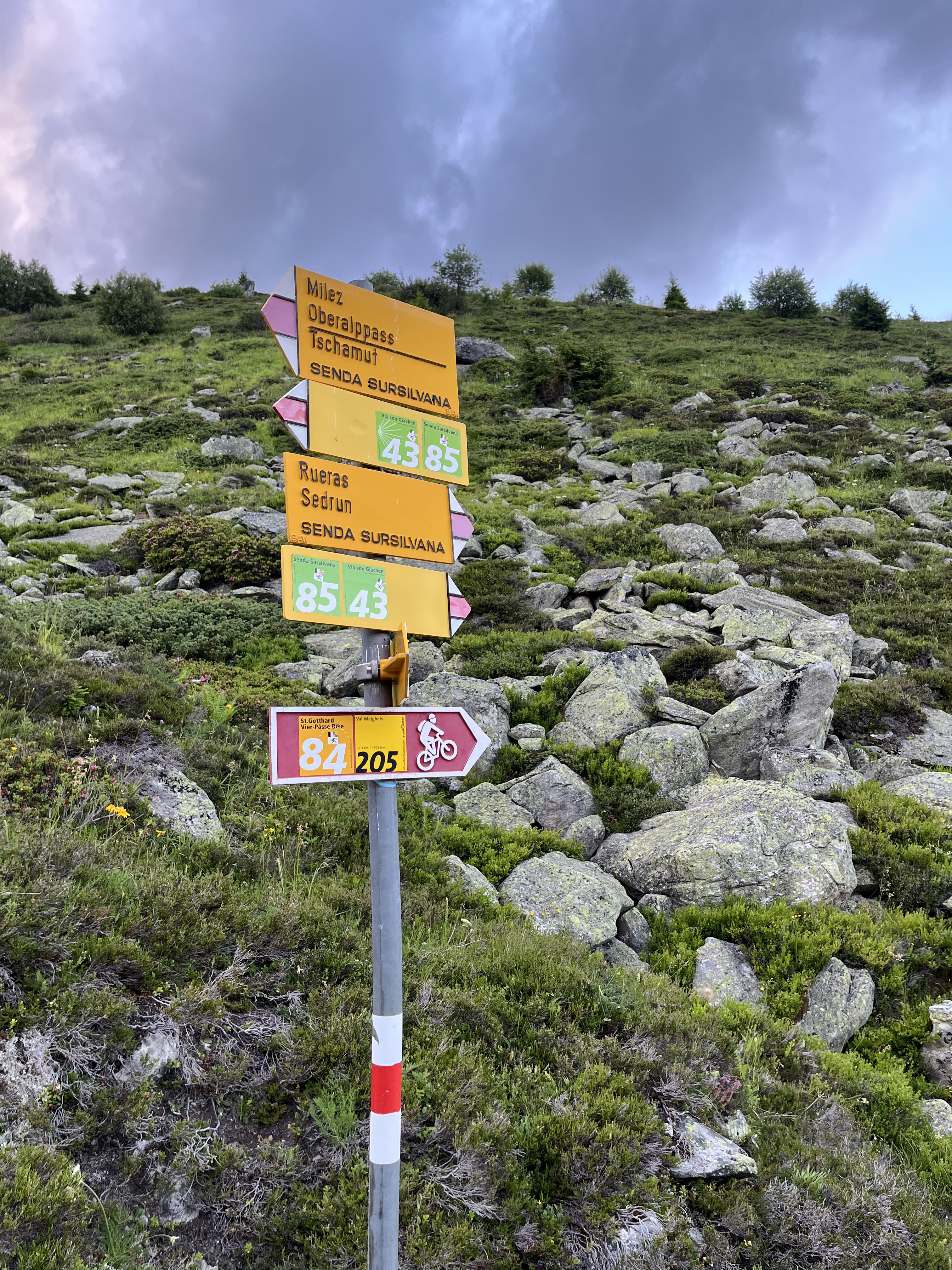 Oberalppass nach Sedrun,Oberalpbike Route 205/84
- Distancia
- 17,3 km
- Ascenso
- 593 m
- Descenso
- 1193 m
- Ubicación
- Andermatt, Uri, Suiza
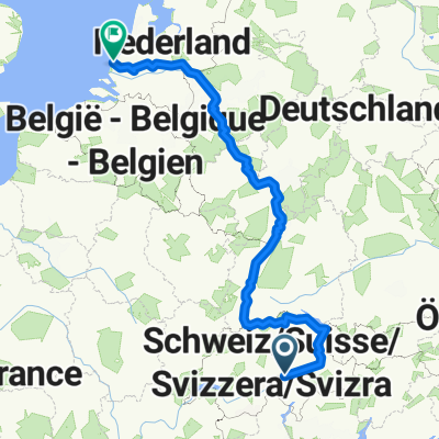
 rhein von oberalppass nach hoek van holland
- Distancia
- 1427,3 km
- Ascenso
- 146 m
- Descenso
- 2169 m
- Ubicación
- Andermatt, Uri, Suiza
 Furkastrasse, Realp nach Ritystrasse, Brigerbad
- Distancia
- 70,6 km
- Ascenso
- 558 m
- Descenso
- 2246 m
- Ubicación
- Andermatt, Uri, Suiza
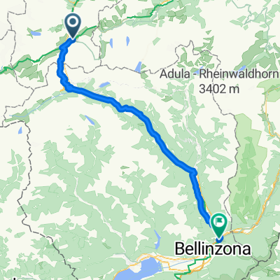
 Tag 3: Göschenen - Giubiasco (Bellinzona)
- Distancia
- 105,5 km
- Ascenso
- 1280 m
- Descenso
- 2197 m
- Ubicación
- Andermatt, Uri, Suiza
 Bellinzona - Vizzola Ticino
- Distancia
- 130,7 km
- Ascenso
- 2639 m
- Descenso
- 3799 m
- Ubicación
- Andermatt, Uri, Suiza
Ábrela en la app