
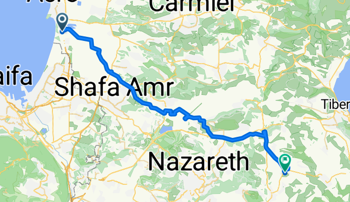
Acre To Kfar Kama 18
Una ruta en bici que comienza en Acre, Northern District, Israel.
Visión General
Sobre esta ruta
"Тятэжъмэ Яужыпкъыхэр" "In the Footsteps of the Forefathers": In memory of our ancestors
Cycling along the Circassians' route from Acre to Kfar Kama in 1878.
According to all opinions, Kfar Kama was settled in 1878. The settlers are part of the remains of the Circassian nation that survived the Russian Empire's attempt to annihilate the Circassian people..
In 1864 they were forced to abandon the Caucasus and settle in the Balkans. After 14 years in the Balkans, they were forced to leave again and reached the shores of Acre, where they stayed for a short period, and then settled in Kama.
Goals: 1. Feel and try to achieve the depth and extent of the difficulties experienced by our ancestors on their way to Kfar Kama 2. Appreciate the determination and efforts of our ancestors to ensure the continuity of the Circassian people 3. To strengthen the feeling and recognition of the commitment to this continuity
Designed for Experienced Circassian Cyclists For details: Monir Lavai - Community Center Manager 050-7235939
- -:--
- Duración
- 53,5 km
- Distancia
- 332 m
- Ascenso
- 143 m
- Descenso
- ---
- Velocidad Media
- ---
- Altitud máxima
Continuar con Bikemap
Usa, edita o descarga esta ruta en bici
¿Te gustaría recorrer Acre To Kfar Kama 18 o personalizarla para tu propio viaje? Esto es lo que puedes hacer con esta ruta de Bikemap:
Funciones gratuitas
- Guarda esta ruta como favorita o en una colección
- Copia y planifica tu propia versión de esta ruta
- Sincroniza tu ruta con Garmin o Wahoo
Funciones Premium
Prueba gratuita de 3 días o pago único. Más información sobre Bikemap Premium.
- Navega esta ruta en iOS y Android
- Exporta un archivo GPX / KML de esta ruta
- Crea tu impresión personalizada (pruébala gratis)
- Descarga esta ruta para la navegación sin conexión
Descubre más funciones Premium.
Consigue Bikemap PremiumDe nuestra comunidad
Acre: Otras rutas populares que empiezan aquí
 Unnamed Road to Yehuda Burla Street 6, Acre
- Distancia
- 5,5 km
- Ascenso
- 72 m
- Descenso
- 49 m
- Ubicación
- Acre, Northern District, Israel
 עין המפרץ 20ק"מ
- Distancia
- 20,4 km
- Ascenso
- 56 m
- Descenso
- 58 m
- Ubicación
- Acre, Northern District, Israel
 מסעף מוסד אחווה, עכו to הראשונים 1, מטולה
- Distancia
- 87,7 km
- Ascenso
- 4004 m
- Descenso
- 3503 m
- Ubicación
- Acre, Northern District, Israel
 רמח"ל 2, עכו to רמח"ל 2, עכו
- Distancia
- 7,8 km
- Ascenso
- 15 m
- Descenso
- 21 m
- Ubicación
- Acre, Northern District, Israel
 Ako to Roash hanikra
- Distancia
- 35,3 km
- Ascenso
- 89 m
- Descenso
- 84 m
- Ubicación
- Acre, Northern District, Israel
 Acre To Kfar Kama 18
- Distancia
- 53,5 km
- Ascenso
- 332 m
- Descenso
- 143 m
- Ubicación
- Acre, Northern District, Israel
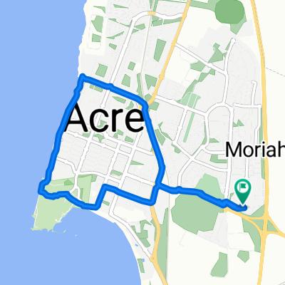
 acres
acres- Distancia
- 3,1 km
- Ascenso
- 13 m
- Descenso
- 20 m
- Ubicación
- Acre, Northern District, Israel
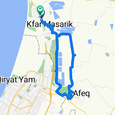
 מסעף עין המפרץ, עכו to Unnamed Road, Kfar Masaryk
- Distancia
- 1,7 km
- Ascenso
- 8 m
- Descenso
- 9 m
- Ubicación
- Acre, Northern District, Israel
Ábrela en la app