

2020 Ruta 40
Una ruta en bici que comienza en Valladolid, Comunidad Autónoma de Castilla y León, España.
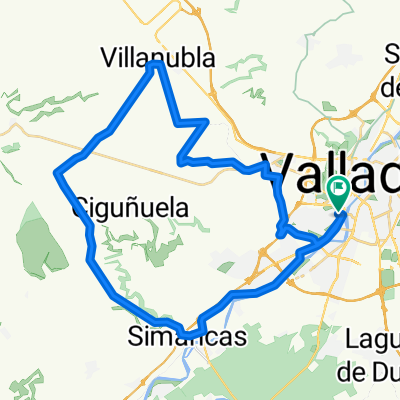
Visión General
Sobre esta ruta
Ronda-Ctra. Arca Real - Pte.Duero -Valdestillas-La Pedraja-Aldeamayor-(Tudela-exteri)-Villabañez-(direcci Olivares)-Villavaquerin -Villabañez-Renedo -Valladolid.
1º Subida: Páramo Rozas del Duero
Pendiente media 3,40% -
Distancia 3,6 Km.
2º Subida: Canteras (2)
Pendiente media 4,2 %
Distancia 2,6 Km.
- -:--
- Duración
- 94,8 km
- Distancia
- 383 m
- Ascenso
- 386 m
- Descenso
- ---
- Velocidad Media
- ---
- Altitud máxima

Calidad de la ruta
Tipos de vía y superficies a lo largo de la ruta
Tipos de vía
Carretera
64,5 km
(68 %)
Carril bici
8,5 km
(9 %)
Superficies
Pavimentado
82,5 km
(87 %)
Sin pavimentar
1,9 km
(2 %)
Asfalto
81,6 km
(86 %)
Grava
1,9 km
(2 %)
Destacados de la ruta
Puntos de interés a lo largo de la ruta
Punto de interés después de 57,7 km
Subida: Páramo Rozas del Duero Pendiente media 3,40% - Distancia 3,6 Km.
Punto de interés después de 80,2 km
Subida: Canteras (2) Pendiente media 4,2 % Distancia 2,6 Km.
Continuar con Bikemap
Usa, edita o descarga esta ruta en bici
¿Te gustaría recorrer 2020 Ruta 40 o personalizarla para tu propio viaje? Esto es lo que puedes hacer con esta ruta de Bikemap:
Funciones gratuitas
- Guarda esta ruta como favorita o en una colección
- Copia y planifica tu propia versión de esta ruta
- Divídelo en etapas para crear una excursión de varios días
- Sincroniza tu ruta con Garmin o Wahoo
Funciones Premium
Prueba gratuita de 3 días o pago único. Más información sobre Bikemap Premium.
- Navega esta ruta en iOS y Android
- Exporta un archivo GPX / KML de esta ruta
- Crea tu impresión personalizada (pruébala gratis)
- Descarga esta ruta para la navegación sin conexión
Descubre más funciones Premium.
Consigue Bikemap PremiumDe nuestra comunidad
Valladolid: Otras rutas populares que empiezan aquí
 Zaratán - Villanubla - Simancas
- Distancia
- 44,5 km
- Ascenso
- 254 m
- Descenso
- 255 m
- Ubicación
- Valladolid, Comunidad Autónoma de Castilla y León, España
 2021 - Ruta nº 51
- Distancia
- 84,5 km
- Ascenso
- 390 m
- Descenso
- 384 m
- Ubicación
- Valladolid, Comunidad Autónoma de Castilla y León, España
 Orilla Rio
- Distancia
- 40,3 km
- Ascenso
- 115 m
- Descenso
- 115 m
- Ubicación
- Valladolid, Comunidad Autónoma de Castilla y León, España
 Ciguñuela
- Distancia
- 16,3 km
- Ascenso
- 200 m
- Descenso
- 103 m
- Ubicación
- Valladolid, Comunidad Autónoma de Castilla y León, España
 2022 - Ruta nº 062
- Distancia
- 118,5 km
- Ascenso
- 683 m
- Descenso
- 686 m
- Ubicación
- Valladolid, Comunidad Autónoma de Castilla y León, España
 Circuito: (Parameño Valladolid)
- Distancia
- 37,2 km
- Ascenso
- 254 m
- Descenso
- 257 m
- Ubicación
- Valladolid, Comunidad Autónoma de Castilla y León, España
 vueltecilla mtb
- Distancia
- 21,9 km
- Ascenso
- 168 m
- Descenso
- 159 m
- Ubicación
- Valladolid, Comunidad Autónoma de Castilla y León, España
 2022 - Ruta nº 063
- Distancia
- 100,1 km
- Ascenso
- 201 m
- Descenso
- 199 m
- Ubicación
- Valladolid, Comunidad Autónoma de Castilla y León, España
Ábrela en la app