

B2B00382 55423 > 55407 via 12th, 15th, Bloomington
Una ruta en bici que comienza en Richfield, Minnesota, Estados Unidos.
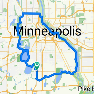
Visión General
Sobre esta ruta
Take 69th east to 12th Ave.
Left onto 12th Ave, and take 12th Ave north to 64th St.
Right onto 64th to Bloomington.
Left on Bloomington, and bike alongside the park heading north.
At the edge of the park, a bridge will appear to your left.
Take bridge over 62. Once over the bridge, hang a left onto 60th St.
Go right onto 12th Ave, and continue on 12th up to 47th.
Take a right onto 47th St and take that to 15th Ave.
Take a left onto 15th and take it to 32nd St.
Take a left onto 32nd, a quick right onto 14th Ave, and a left onto Powderhorn Terrace.
Powderhorn Terrace will curve to the right (curve north) and become 12th Ave.
Take that one block to 31st St, and take a left.
Take 31st St west to Park Ave. (note: on the way to Park, you'll cross Chicago where 1st juts slightly to the right, but keep heading west on 31st west).
Take a right onto Park and take the bikelane north to 28th.
Take a right on 28th and head a couple blocks to destination. (note, 28th St is one-way, and occasionally has a lot of traffic. An alternative is to walk the last 2 blocks on the sidewalk).
- -:--
- Duración
- 11,3 km
- Distancia
- 34 m
- Ascenso
- 28 m
- Descenso
- ---
- Velocidad Media
- 264 m
- Altitud máxima
Calidad de la ruta
Tipos de vía y superficies a lo largo de la ruta
Tipos de vía
Carretera tranquila
7,5 km
(67 %)
Carretera
2,3 km
(20 %)
Superficies
Pavimentado
1,9 km
(17 %)
Asfalto
1,9 km
(17 %)
Sin definir
9,3 km
(83 %)
Continuar con Bikemap
Usa, edita o descarga esta ruta en bici
¿Te gustaría recorrer B2B00382 55423 > 55407 via 12th, 15th, Bloomington o personalizarla para tu propio viaje? Esto es lo que puedes hacer con esta ruta de Bikemap:
Funciones gratuitas
- Guarda esta ruta como favorita o en una colección
- Copia y planifica tu propia versión de esta ruta
- Sincroniza tu ruta con Garmin o Wahoo
Funciones Premium
Prueba gratuita de 3 días o pago único. Más información sobre Bikemap Premium.
- Navega esta ruta en iOS y Android
- Exporta un archivo GPX / KML de esta ruta
- Crea tu impresión personalizada (pruébala gratis)
- Descarga esta ruta para la navegación sin conexión
Descubre más funciones Premium.
Consigue Bikemap PremiumDe nuestra comunidad
Richfield: Otras rutas populares que empiezan aquí
 30 miler
- Distancia
- 48,5 km
- Ascenso
- 308 m
- Descenso
- 310 m
- Ubicación
- Richfield, Minnesota, Estados Unidos
 31 Miles South to North, to Victory Memorial & Minnehaha
- Distancia
- 50,9 km
- Ascenso
- 124 m
- Descenso
- 124 m
- Ubicación
- Richfield, Minnesota, Estados Unidos
 the Bike & Bistro's premiere tour
- Distancia
- 6,7 km
- Ascenso
- 26 m
- Descenso
- 9 m
- Ubicación
- Richfield, Minnesota, Estados Unidos
 B2B00920 55407>55438 via Portland, Mnnha Pwy, Logan, Hylund Prk
- Distancia
- 23,7 km
- Ascenso
- 98 m
- Descenso
- 95 m
- Ubicación
- Richfield, Minnesota, Estados Unidos
 Perfect Circle Minneapolis Bike Route
- Distancia
- 36,4 km
- Ascenso
- 117 m
- Descenso
- 117 m
- Ubicación
- Richfield, Minnesota, Estados Unidos
 B2B00042 55419 > 55422 via Greenway, Cedar Lake, and Theo Wirth
- Distancia
- 13,3 km
- Ascenso
- 61 m
- Descenso
- 59 m
- Ubicación
- Richfield, Minnesota, Estados Unidos
 East 46th Street 180, Minneapolis to Union Depot, Saint Paul
- Distancia
- 22,2 km
- Ascenso
- 153 m
- Descenso
- 185 m
- Ubicación
- Richfield, Minnesota, Estados Unidos
 B2B00056 55407>55122 via Mnnhaha Pwy, Bg Rvrs Trl
- Distancia
- 17,7 km
- Ascenso
- 99 m
- Descenso
- 109 m
- Ubicación
- Richfield, Minnesota, Estados Unidos
Ábrela en la app