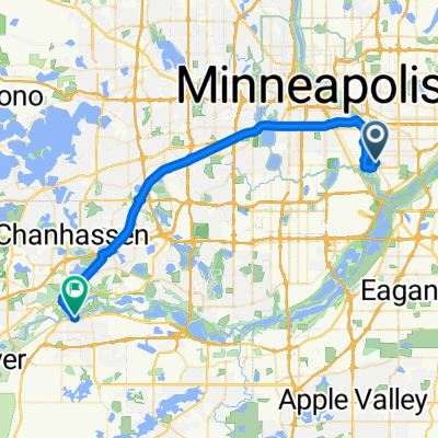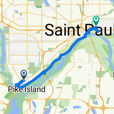
Wandering Leaf to Yoerg
- 15,4 km
- 134 m
- 129 m
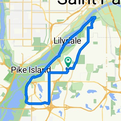
- Mendota Heights, Minnesota, Estados Unidos
Una ruta en bici que comienza en Mendota Heights, Minnesota, Estados Unidos.
Visión General
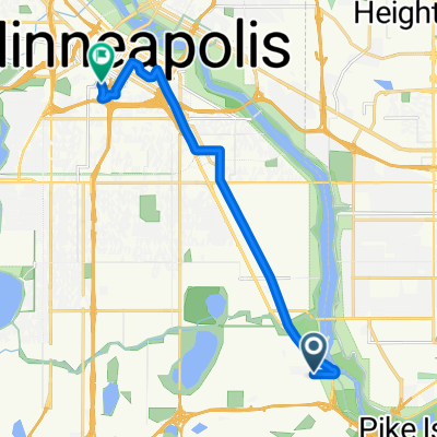
Toma Highland Parkway (justo al norte de Ford Parkway) hacia Mississippi River Blvd, y gira a la derecha. Toma Mississippi River Blvd hacia el norte hasta que llegues al puente Marshall/Lake. Continúa pedaleando bajo el puente, luego toma la primera derecha después del puente para regresar a Marhshall Ave. Gira a la derecha para ir hacia el oeste cruzando el puente. Una vez en el lado oeste del puente, gira a la derecha en W River Pkwy. Continúa por W River Pkwy hasta que llegues a 11th Avenue, donde giras a la izquierda y tomas el carril bici hacia 5th St (justo después del Metrodome). Gira a la derecha en 5th St, pasa por el Metrodome y avanza un par de cuadras hasta Portland Avenue (nota, 5th St no tiene un carril bici pero el tráfico es usualmente transitable). Gira a la derecha en 5th AVENUE hacia 4th street (1 bloque). Gira a la izquierda en 4th St y camina tu bloque final hasta tu destino.
creado hace 17 años
Calidad de la ruta
Carretera tranquila
5,7 km
(43 %)
Carretera
5,2 km
(39 %)
Pavimentado
10,9 km
(82 %)
Asfalto
10,1 km
(76 %)
Hormigón
0,7 km
(5 %)
Continuar con Bikemap
¿Te gustaría recorrer B2B00333 55116 > 55415 via West River Rd o personalizarla para tu propio viaje? Esto es lo que puedes hacer con esta ruta de Bikemap:
Prueba gratuita de 3 días o pago único. Más información sobre Bikemap Premium.
Descubre más funciones Premium.
Consigue Bikemap PremiumDe nuestra comunidad
Ábrela en la app