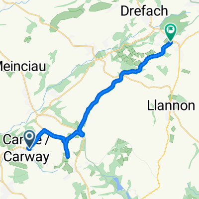
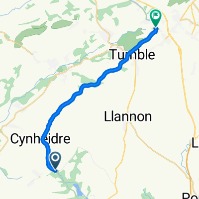
- 11,8 km
- 242 m
- 243 m
- Trimsaran, Gales, Reino Unido
Climb challenge
Una ruta en bici que comienza en Trimsaran, Gales, Reino Unido.
Visión General
Sobre esta ruta
Este es un desafío serio que involucra algunas carreteras principales, caminos rurales y vías ciclísticas. Hay ascensos empinados aquí, siendo la Herberdeg Road la más desafiante, en mi opinión. Las carreteras principales no están demasiado transitadas, pero algunos de los caminos rurales son estrechos y con superficies rugosas en algunas partes, prepárese para detenerse y permitir que el tráfico pase. Algunos de ustedes encontrarán que las subidas son demasiado severas, pero si logran completar este recorrido, entonces Alpe d'Huez será pan comido (¿quizás?). La última parte del recorrido de Cynheidre a Trimsaran es principalmente un camino ciclista y un paseo cómodo de regreso a Trimsaran. Comience en el centro de ocio de Trimsaran y termine aquí con una buena taza de té en el Café Becca. Cicla desde Trimsaran hacia Mynyddygarreg para tu sesión de calentamiento en la colina y luego, en su mayoría, baja hacia Pontyates. Realmente necesitas tener tus piernas de ciclista de montaña contigo para completar este recorrido. No es una carrera y por favor no lo trates como tal, ya que algunas de las carreteras no están diseñadas para ello, ¡pero qué expansión pulmonar! Nota: cuando ingreses a Trimsaran por segunda vez, algunos de ustedes pueden desear finalizar el desafío aquí. Además, en la última visita a Cynheidre, podrías tomar la ruta de la carretera principal más corta de vuelta a Trimsaran, con solo otra pequeña subida empinada al girar de Pontyates a Carway.
- -:--
- Duración
- 75 km
- Distancia
- 869 m
- Ascenso
- 869 m
- Descenso
- ---
- Velocidad Media
- ---
- Altitud máxima
creado hace 6 años
Calidad de la ruta
Tipos de vía y superficies a lo largo de la ruta
Tipos de vía
Carretera tranquila
36,8 km
(49 %)
Carril bici
16,5 km
(22 %)
Superficies
Pavimentado
27 km
(36 %)
Asfalto
27 km
(36 %)
Sin definir
48 km
(64 %)
Continuar con Bikemap
Usa, edita o descarga esta ruta en bici
¿Te gustaría recorrer Climb challenge o personalizarla para tu propio viaje? Esto es lo que puedes hacer con esta ruta de Bikemap:
Funciones gratuitas
- Guarda esta ruta como favorita o en una colección
- Copia y planifica tu propia versión de esta ruta
- Sincroniza tu ruta con Garmin o Wahoo
Funciones Premium
Prueba gratuita de 3 días o pago único. Más información sobre Bikemap Premium.
- Navega esta ruta en iOS y Android
- Exporta un archivo GPX / KML de esta ruta
- Crea tu impresión personalizada (pruébala gratis)
- Descarga esta ruta para la navegación sin conexión
Descubre más funciones Premium.
Consigue Bikemap PremiumDe nuestra comunidad
Trimsaran: Otras rutas populares que empiezan aquí
- Heol Y Meinciau 10, Pont-iets to Murray Street 46
- Trimsaran, Meincau, Trimsaran, Pen Y Mynydd, Pembrey, Llanelli
- 37,3 km
- 407 m
- 454 m
- Trimsaran, Gales, Reino Unido
- Heol Morlais-B4308-Monksford Street
- 66,5 km
- 537 m
- 515 m
- Trimsaran, Gales, Reino Unido
- Slow ride in Llanelli
- 21,2 km
- 104 m
- 150 m
- Trimsaran, Gales, Reino Unido
- 51.736, -4.223 to 51.786, -4.117
- 12,9 km
- 204 m
- 113 m
- Trimsaran, Gales, Reino Unido
- Capel Teilo Road, Kidwelly to Capel Teilo Road, Kidwelly
- 2,9 km
- 77 m
- 77 m
- Trimsaran, Gales, Reino Unido
- Heol Horeb, Five Roads, Llanelli to 60 Carmarthen Road, Llanelli
- 11,8 km
- 76 m
- 51 m
- Trimsaran, Gales, Reino Unido
- Moderate route in Llanelli
- 11,8 km
- 121 m
- 92 m
- Trimsaran, Gales, Reino Unido
Ábrela en la app


