- 7,8 km
- 72 m
- 95 m
- Forest Glen, Maryland, Estados Unidos
Fort Stevens Loop
Una ruta en bici que comienza en Forest Glen, Maryland, Estados Unidos.
Visión General
Sobre esta ruta
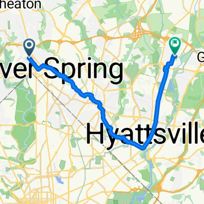
Una ruta corta que comienza en Woodside Park y que recorre los sitios históricos relacionados con la incursión de Jubal Early en Washington D.C. en el verano de 1864. El recorrido incluye el cementerio confederado, el cementerio de la unión y las fortificaciones en Fort Stevens y Fort DeRussy. La ruta termina con un corto viaje a través del Parque Rock Creek y regresa a Woodside.
- -:--
- Duración
- 20,3 km
- Distancia
- 157 m
- Ascenso
- 157 m
- Descenso
- ---
- Velocidad Media
- ---
- Altitud máxima
creado hace 6 años
Calidad de la ruta
Tipos de vía y superficies a lo largo de la ruta
Tipos de vía
Carretera
7,5 km
(37 %)
Carretera tranquila
5,1 km
(25 %)
Superficies
Pavimentado
16,2 km
(80 %)
Asfalto
15,4 km
(76 %)
Pavimentado (sin definir)
0,6 km
(3 %)
Destacados de la ruta
Puntos de interés a lo largo de la ruta
Punto de interés después de 1,6 km
9315 Greyrock Road. "Grey Rocks". At the time of Jubal Early's raid, this was the home of Doctor Henry Ford Condict. On July 11, 1864, the house was occupied by the Confederates and used as an observation post and a rendezvous point for cavalry searching for horses and provisions.
Punto de interés después de 2,6 km
Raymond W. Burche's home. Shells from Union artillery fell around this property. Now demolished.
Punto de interés después de 3,4 km
1504 Noyes Drive. When excavating the back yard of ths house for an addition, a ten-inch Union Parrott shell from the Civil War was discovered.
Punto de interés después de 3,4 km
8818 1st Avenue "Woodside" was Richard T. Wilson's Home at the time of the raid. This was a farmhouse with a driveway leading to Georgia Avenue. Wilson was a confederate sympathizer and this house was used as Confederate Major General John C. Breckinridge's headquarters. The Wilson Farm encompassed all of what is now Woodside and the western part of Woodside Park.
Punto de interés después de 3,6 km
John C. Wilson's home. John Wilson supported the Union. His brother Richard supported the Confederacy. The house is now demolished.
Punto de interés después de 4,4 km
"Sligo" was the name of Silver Spring during the Civil War. On 11-12 July 1864, the businesses here, including Lewis Graves' dry goods store, Rayney's store, and Barnes' Tavern farther south were looted by Confederate soldiers.
Punto de interés después de 4,4 km
The Eagle Inn.
Punto de interés después de 4,8 km
"Falkland", Montgomery Blair's mansion, stood here in 1864. It was burned by Confederate troops at the time of the raid. The ruin stood here until 1958, when it was burned down again to make way for Blair Plaza.
Punto de interés después de 5,3 km
Silver Cycles.
Punto de interés después de 5,4 km
Francis Preston Blair's "Silver Spring" mansion. This house was used by General Jubal Early as his headquarters. Now demolished.
Punto de interés después de 6,4 km
James Blair's "The Moorings". This is the only one of the Blair family's Silver Spring mansions still standing. From 1934 to 1957, the house served as the Silver Spring Public Library.
Punto de interés después de 8,5 km
Battleground National Cemetery. Here are buried the US soldiers who died defending Washington from Jubal Early's raid on 11-12 July 1864.
Punto de interés después de 9,5 km
Fort Stevens Battlefield Park There are a few gun emplacements remaining and a monument to the battle.
Punto de interés después de 12 km
Fort DeRussy. This fort is overgrown, but there is a marker and the banks that supported the gun emplacements can still be seen. There were no trees here in 1864.
Punto de interés después de 20,3 km
Confederate Cemetery. Ten years after the Civil War, soldiers of the Confederacy who had died during Jubal Early's raid on Washington, and who had been buried in nearby fields were exhumed and reburied together in Grace Church graveyard.
Continuar con Bikemap
Usa, edita o descarga esta ruta en bici
¿Te gustaría recorrer Fort Stevens Loop o personalizarla para tu propio viaje? Esto es lo que puedes hacer con esta ruta de Bikemap:
Funciones gratuitas
- Guarda esta ruta como favorita o en una colección
- Copia y planifica tu propia versión de esta ruta
- Sincroniza tu ruta con Garmin o Wahoo
Funciones Premium
Prueba gratuita de 3 días o pago único. Más información sobre Bikemap Premium.
- Navega esta ruta en iOS y Android
- Exporta un archivo GPX / KML de esta ruta
- Crea tu impresión personalizada (pruébala gratis)
- Descarga esta ruta para la navegación sin conexión
Descubre más funciones Premium.
Consigue Bikemap PremiumDe nuestra comunidad
Forest Glen: Otras rutas populares que empiezan aquí
- Bethesda Apple Store
- Forest Glen Road to Fenton Street
- 5,7 km
- 53 m
- 45 m
- Forest Glen, Maryland, Estados Unidos
- Hollow Glen Place 9910, Silver Spring to Hollow Glen Place 9910, Silver Spring
- 41,8 km
- 310 m
- 314 m
- Forest Glen, Maryland, Estados Unidos
- Route to Willard Ave & River Rd, Bethesda
- 11,8 km
- 195 m
- 176 m
- Forest Glen, Maryland, Estados Unidos
- Rosa Chevy Chase
- 9,9 km
- 107 m
- 129 m
- Forest Glen, Maryland, Estados Unidos
- Forest Glen Road to Rock Creek Trail
- 21,1 km
- 173 m
- 260 m
- Forest Glen, Maryland, Estados Unidos
- Fort Stevens Loop
- 20,3 km
- 157 m
- 157 m
- Forest Glen, Maryland, Estados Unidos
- Home to Noor
- 21,3 km
- 128 m
- 219 m
- Forest Glen, Maryland, Estados Unidos
Ábrela en la app


