

B2B00401 55106>55454 via WheelockPkwy/Como/IntercampusTrail/27SE/Franklin/Riverside
Una ruta en bici que comienza en Maplewood, Minnesota, Estados Unidos.
Visión General
Sobre esta ruta
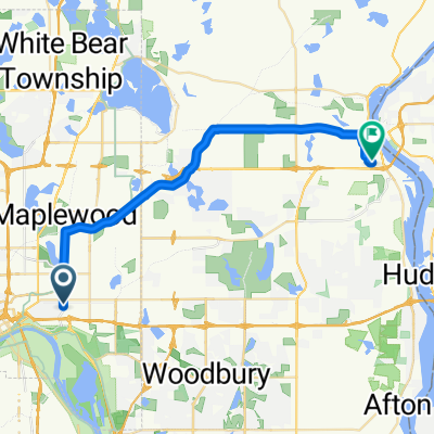
Toma Johnson Pkwy al norte hasta Lake Phalen, donde se convierte en Wheelock Pkwy. Sigue Wheelock Pkwy. a través de la 35E y Rice Street. Después de Rice Street hay una gran colina en curva hacia arriba. Sigue en Wheelock hasta que llegues al Lake Como. En Como, gira a la izquierda y continúa alrededor del lago hasta W. Horton Av. Sigue Horton hasta Lexington Pkwy. Sigue recto mientras la calle se convierte en Como Avenue en Hamiline. Sigue Como Avenue pasando por los terrenos de la Exposición Estatal hasta que llegues al Intercampus Trailway. Gira a la izquierda en el Trailway y continúa sobre el puente de la carretera. En Energy Park Drive puedes quedarte en la carretera o andar en el carril bici. Continua hasta que llegues a 29th AvSE. Gira a la izquierda y una cuadra a 4th St.SE. Gira a la derecha en 4th St. hasta 27th AvSE. Gira a la izquierda y continúa en 27th AvSE cruzando University Av. hasta el Franklin Bridge. Cruza el Franklin Bridge y sigue Franklin Av. hasta Riverside Av. Gira a la derecha en Riverside. Después de cruzar la I94, gira a la izquierda en Butler Pl. Sigue Butler Place hasta 23rd Av. S y gira a la derecha hacia Augsburg College.
- -:--
- Duración
- 19,1 km
- Distancia
- 69 m
- Ascenso
- 71 m
- Descenso
- ---
- Velocidad Media
- 286 m
- Altitud máxima
Calidad de la ruta
Tipos de vía y superficies a lo largo de la ruta
Tipos de vía
Carretera
11,8 km
(62 %)
Carril bici
4,8 km
(25 %)
Superficies
Pavimentado
12,6 km
(66 %)
Asfalto
11,5 km
(60 %)
Hormigón
0,8 km
(4 %)
Continuar con Bikemap
Usa, edita o descarga esta ruta en bici
¿Te gustaría recorrer B2B00401 55106>55454 via WheelockPkwy/Como/IntercampusTrail/27SE/Franklin/Riverside o personalizarla para tu propio viaje? Esto es lo que puedes hacer con esta ruta de Bikemap:
Funciones gratuitas
- Guarda esta ruta como favorita o en una colección
- Copia y planifica tu propia versión de esta ruta
- Sincroniza tu ruta con Garmin o Wahoo
Funciones Premium
Prueba gratuita de 3 días o pago único. Más información sobre Bikemap Premium.
- Navega esta ruta en iOS y Android
- Exporta un archivo GPX / KML de esta ruta
- Crea tu impresión personalizada (pruébala gratis)
- Descarga esta ruta para la navegación sin conexión
Descubre más funciones Premium.
Consigue Bikemap PremiumDe nuestra comunidad
Maplewood: Otras rutas populares que empiezan aquí
 Maplewood Cycling
- Distancia
- 14,1 km
- Ascenso
- 450 m
- Descenso
- 299 m
- Ubicación
- Maplewood, Minnesota, Estados Unidos
 B2B00401 55106>55454 via WheelockPkwy/Como/IntercampusTrail/27SE/Franklin/Riverside
- Distancia
- 19,1 km
- Ascenso
- 69 m
- Descenso
- 71 m
- Ubicación
- Maplewood, Minnesota, Estados Unidos
 Mississippi River Trail: Maplewood to Columbia Heights
- Distancia
- 35,3 km
- Ascenso
- 256 m
- Descenso
- 222 m
- Ubicación
- Maplewood, Minnesota, Estados Unidos
 B2B00497 55106>55082 via Bruce Vento Trl, Gateway Trl, Myrtle Av
- Distancia
- 28,4 km
- Ascenso
- 92 m
- Descenso
- 89 m
- Ubicación
- Maplewood, Minnesota, Estados Unidos
 B2B00784 55125>55164 via Up.Afton/Ruth/Mhaha/JohnsonPkwy/Wheelock/Edgerton/VadLake/Rice/Gramsie/Lex
- Distancia
- 27,1 km
- Ascenso
- 127 m
- Descenso
- 137 m
- Ubicación
- Maplewood, Minnesota, Estados Unidos
 WB CTY PARK
- Distancia
- 17,3 km
- Ascenso
- 59 m
- Descenso
- 71 m
- Ubicación
- Maplewood, Minnesota, Estados Unidos
 Handsome Cycles
- Distancia
- 38,6 km
- Ascenso
- 280 m
- Descenso
- 300 m
- Ubicación
- Maplewood, Minnesota, Estados Unidos
 B2B00956 55119>55401 via Case Av, Como Av, 4th St SE
- Distancia
- 24 km
- Ascenso
- 159 m
- Descenso
- 192 m
- Ubicación
- Maplewood, Minnesota, Estados Unidos
Ábrela en la app